Map of Mankato
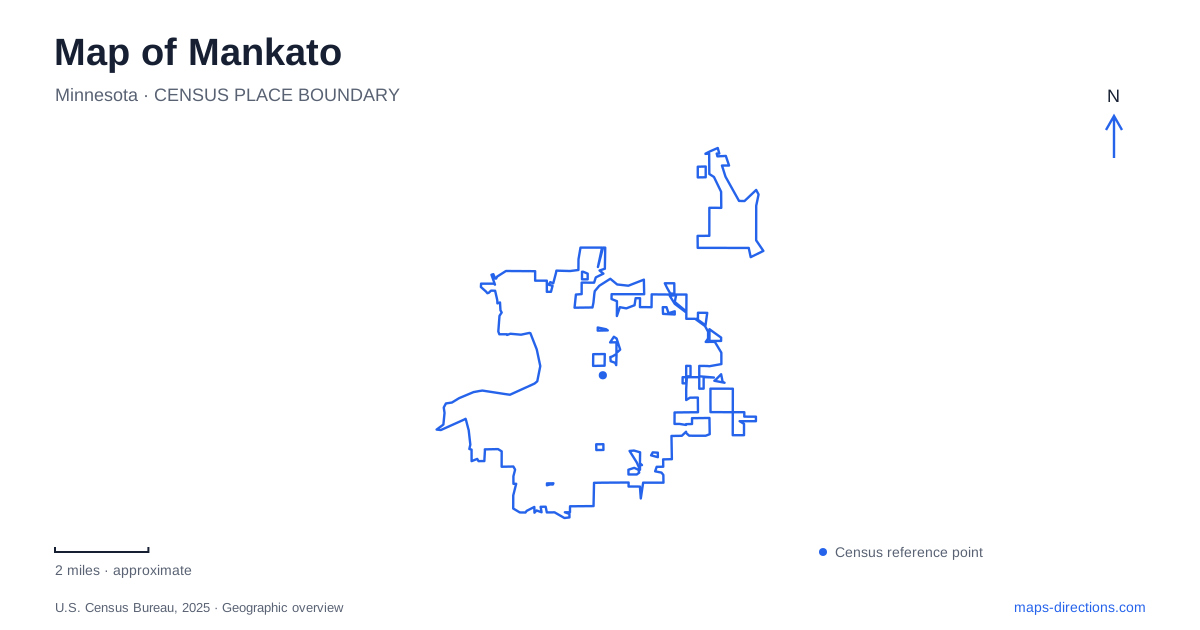
Street tiles load from OpenStreetMap when opened. The blue line shows the 2025 Census boundary.
- State
- Minnesota
- Population · July 2025
- 46,529
- Land area
- 20.2 sq mi
- Water area
- 0.4 sq mi
Mankato rewards a map reading that pays attention to rivers, changes in elevation, and the difference between an urban park and a regional trail. The Minnesota River supplies a major organizing line, while the Blue Earth River adds another waterway to the recreation landscape. Riverfront Park, Sibley Park, and Land of Memories Park offer different ways to encounter that setting. Farther west, Minneopa State Park introduces a waterfall gorge and a bison range that occupy separate sections of one destination.
The working riverfront became a public destination
Riverfront Park, at 309 West Rock Street, occupies land with a long industrial and commercial history. The city's account describes a riverbank where transportation, manufacturing, and distribution developed together. Railways and steamboats connected businesses to places beyond the immediate valley. Reading the park as a former working waterfront adds meaning to its present open space and river views.
Today its features include a canoe launch, an overlook, and a connection to the North Minnesota River Trail. The Vetter Stone Amphitheater supplies another function within the same park. These uses share a setting but operate at different scales: a trail carries people onward, the launch begins a water journey, and the amphitheater concentrates visitors at a particular venue.
For a map of Mankato, this makes West Rock Street a useful urban riverfront reference. It identifies a specific public destination rather than an unspecified point somewhere along the Minnesota River. The historical layer also explains why a recreational waterfront can sit within an established commercial part of town.
Sibley's mound changes the walking experience
Sibley Park is listed at 900 Mound Avenue. The address is especially memorable because a mound is part of the park's landscape, not just a word on the street sign. The city describes native plantings on the hilltop intended to restore an oak savanna setting. That higher ground gives the park an internal contrast with its gardens, pond, and more conventional recreation areas.
The walking network includes routes identified at different difficulty levels. A person planning a gentle garden visit and a person seeking a more demanding walk can therefore use the same park for different purposes. Simply measuring the distance between two points on a flat screen misses the significance of the mound and the route chosen over or around it.
Sibley Farm and the farm-themed playground add another distinct focus. This is not solely a trailhead or river overlook; it is a varied park whose features deserve to be located individually when planning how to spend time there.
Two rivers, several park settings
Land of Memories Park offers trails through woods and beside both the Blue Earth and Minnesota rivers. That combination distinguishes it from a visit organized around the amphitheater or gardens. A river label on a broad map can conceal the difference between these environments until the map is enlarged enough to show the park boundaries and individual waterways.
Around Mankato, it is useful to keep the Minnesota River corridor and the Blue Earth River in view together. The relationship explains why several recreation destinations cluster around water without being the same place. It also encourages an outing based on a chosen landscape, such as woodland trails, instead of treating every riverside park as a substitute for every other one.
A railway grade extends the trail map
The Sakatah Singing Hills State Trail begins at Lime Valley Road near Highway 14 and connects with the Minnesota River Trail. Its route continues toward Faribault, following an abandoned railway grade through a landscape between former prairie and Big Woods environments. The state identifies a 39-mile paved trail, so this is a regional connection rather than simply a circuit around a city park.
That railway origin helps explain its generally level character. It also gives the map a second transportation story: former rail infrastructure supports a journey at bicycle or walking speed, while the riverfront records an earlier relationship between freight transport and industry. A short local section can be enjoyed without undertaking the entire regional route.
Minneopa requires two destination choices
West of Mankato, Minneopa State Park has two separate sections. The waterfall and park office side is approached from County Highway 69; the campground, bison drive, and trails are on the Highway 68 side. The division is essential to understanding the map. Selecting the park name alone does not explain which experience a particular approach serves.
The double waterfall belongs to Minneopa Creek and its gorge. The bison range belongs to a prairie setting, with Seppmann Mill providing a historic landmark and an overlook. Visitors drive through the range in their own vehicles; walking routes are outside the enclosure. The two sections create a varied outing, but they should be planned as separate stops rather than one uninterrupted walk.
This wider view of Mankato connects an industrial riverfront, a landscaped mound, wooded river trails, a railway-based regional route, and two different state park landscapes. The value of the map is in keeping those distinctions visible, so the journey fits the place you actually want to explore.
Map and statistics: U.S. Census Bureau, 2025 Gazetteer, January 2025 generalized place boundaries and Vintage 2025 population estimates. Local references: City of Mankato; Minnesota Department of Natural Resources. Article prepared by Maps & Directions.