Map of Madera
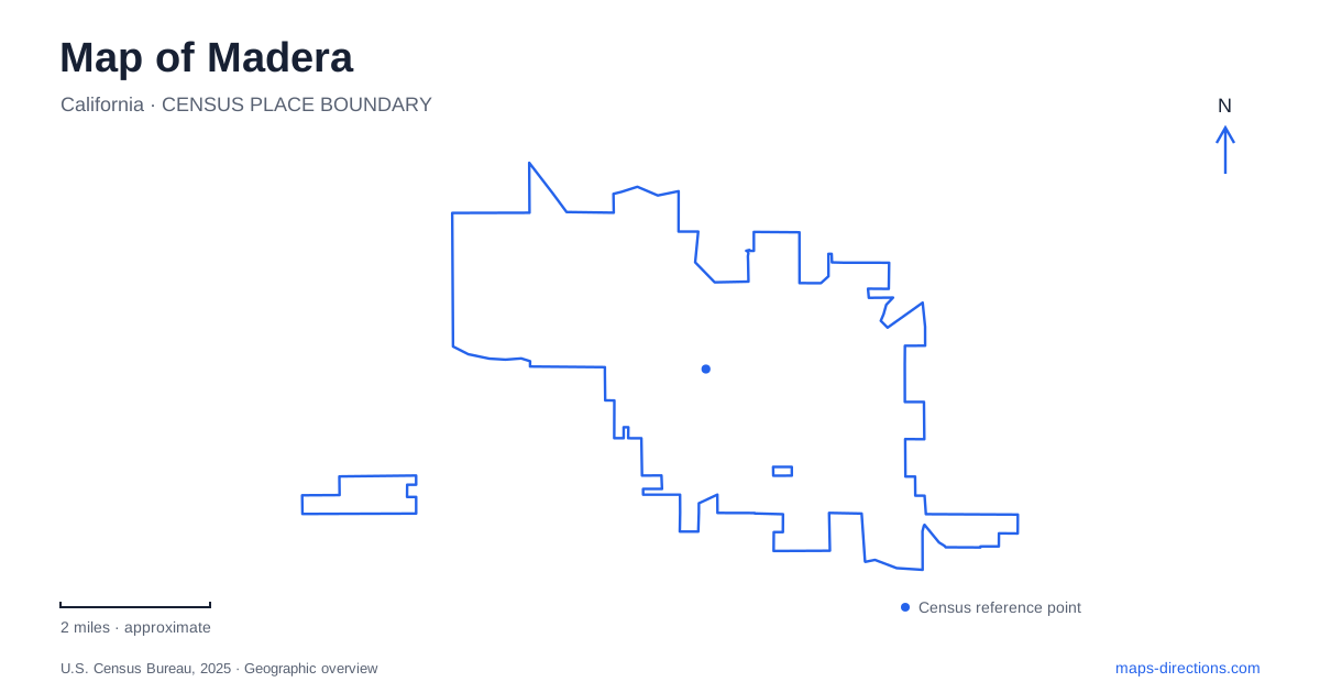
Street tiles load from OpenStreetMap when opened. The blue line shows the 2025 Census boundary.
- State
- California
- Population · July 2025
- 69,017
- Land area
- 20.1 sq mi
- Water area
- 0.0 sq mi
Madera's position in the San Joaquin Valley reflects an old connection to the Sierra Nevada as well as the agricultural land around it. A lumber flume helped establish the town, Yosemite Avenue developed into its commercial center, and the Fresno River now supplies a recognizable corridor for local recreation. The resulting map is more specific than a highway stop on the way to the mountains: it contains industrial origins, county institutions, and public landscapes within the city itself.
A town formed at a flume's end
The city's historical account places its beginning in 1876, when the California Lumber Company established a long flume from the Sierra Nevada to the valley. Town lots were auctioned that year at its lower end. The settlement's name means lumber in Spanish, giving the place-name a direct relationship to the industry that created it. The flume was dismantled in 1931, so it belongs to the historical geography rather than to an operating visitor attraction.
Lumber and cattle were followed by an increasingly agricultural economy. Irrigation enabled permanent fruit and nut plantings to replace much earlier grain production. These changes help explain why the city can be understood simultaneously as a former timber outlet and a center for valley farming. Madera's history links upland resources and lowland cultivation, two landscapes that meet economically even when they appear separate on a regional map.
Yosemite Avenue and the historical courthouse
The county museum occupies the old courthouse at 210 West Yosemite Avenue, within Courthouse Park. The museum's courtroom is one of its historical settings, and the city's visitor information identifies agricultural and pioneer history among the subjects interpreted there. This location makes a useful starting point for an exploration of the older civic center rather than a mountain-bound excursion suggested by the avenue's name.
The courthouse's National Register documentation dates the building to 1900 and identifies its importance as an early major county institution. It also records that the county's first library was established inside the courthouse. That combination places justice, administration, and public learning within the same historical building. The park around it supplies an open civic setting, helping the former courthouse remain visually distinct from the adjoining commercial streets.
The museum and the working court are separate
The modern superior court uses 200 South G Street. The state Judicial Council describes its site on West Sixth Street across from Courthouse Park and records occupancy in September 2015. Its ten-courtroom project consolidated functions previously spread between facilities. The relationship is geographically close but institutionally distinct: the old building interprets history, while the newer complex performs current court functions.
For a map of Madera, this is a useful example of civic continuity without identical use. Courthouse Park remains a shared reference point, yet different addresses correspond to different purposes. Someone studying local architecture can compare historical and contemporary public buildings in the same downtown setting. Someone attending a scheduled proceeding needs the current court's address and instructions, rather than the historic museum label.
Following the Fresno River through town
The Vernon McCullough Fresno River Trail runs from Tulare Street to Road 24, according to the municipal facilities directory. Its name describes a river within this city's landscape; it does not mean the trail is an urban path in neighboring Fresno. The two endpoints provide a much clearer picture of its local reach than the river name alone.
Other named trails follow shorter corridors. Laurel Trail runs from Riverview Drive to Sunset Avenue, while Wathen Berry Trail extends from Cleveland Avenue to Dutra Court. Together they show that pedestrian recreation is distributed among several named routes, not concentrated in one enormous park. Madera's street map becomes more informative when these local path segments are shown alongside their adjacent roads, particularly for someone comparing a river-oriented walk with a neighborhood outing.
Larger parks and smaller public spaces
Lions Town & Country Park is one of the larger community recreation properties. The city lists playground equipment, picnic space, shade structures, paths, horseshoe pits, volleyball, and softball among its amenities. Its roughly fifty-acre scale differs from the small neighborhood and linear parks elsewhere in the municipal system. A picnic gathering and a field activity can occupy different parts of the same substantial property.
The community garden at 623 East Fourth Street provides a much smaller, more focused destination. Its address also places cultivation within the urban street network, rather than only in the fields outside town. That is an appropriate final detail in a city whose history repeatedly connects land, water, and production. From the vanished flume to the courthouse grounds, trail corridors, and community garden, Madera can be read through the changing ways people have used and organized the valley landscape.
Map and statistics: U.S. Census Bureau, 2025 Gazetteer, January 2025 generalized place boundaries and Vintage 2025 population estimates. Local references: City of Madera; Madera County Museum; National Park Service; Superior Court of California County of Madera; Judicial Council of California. Article prepared by Maps & Directions.