Map of Mableton
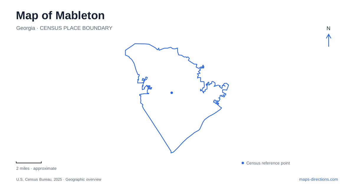
Street tiles load from OpenStreetMap when opened. The blue line shows the 2025 Census boundary.
- State
- Georgia
- Population · July 2025
- 78,820
- Land area
- 36.3 sq mi
- Water area
- 0.2 sq mi
Mableton has a much longer history than its modern municipal boundary suggests. The present city incorporated in November 2022, but older railroads, farm properties, creek industries, and Civil War defenses still organize important parts of its landscape. A useful map therefore has several centers: the historic railroad settlement, the cultural complex on Floyd Road, the Silver Comet corridor, and the wooded land beside the Chattahoochee. These places explain more about the area than treating it simply as an extension of metropolitan Atlanta.
A railroad settlement inside a newer city
The older core of Mableton developed around the Georgia Pacific Railroad during the late nineteenth century. A county historic-resource survey describes a compact arrangement of intersecting streets and records the offering of 61 lots north of the railroad in 1882. Passenger and freight service helped turn that subdivision into a commercial settlement. This is useful background when reading the comparatively small street blocks around the historic center against the larger road patterns beyond it.
The survey identifies such resources as the general store, Inman Lodge, Glore House, and the former guano-manufacturing plant later associated with Barnes Hardware. They represent different parts of the railroad economy: trade, housing, community institutions, and agricultural supplies. Rather than imagining a single monumental downtown, look for the relationship between the tracks and this collection of buildings. The historical pattern is a working settlement whose individual properties carried several everyday functions.
Floyd Road and the surviving farm landscape
The Mable House complex at 5239 Floyd Road provides another starting point for understanding Mableton. The ancestral home of the family behind the city's name dates to 1843. Cobb County preserves a roughly 16-acre remnant of a farm that once covered more than 400 acres. The house, outbuildings, and family cemetery make the property legible as a former agricultural landscape, rather than simply an old residence surrounded by lawn.
Its surviving features include a kitchen house, corncrib, sweet-potato house, storage barn, smokehouse, and well. Those buildings show how food preparation and storage once occupied separate spaces across the grounds. The house also served as a Civil War hospital. Today the historic property shares the broader complex with the Arts Center and Barnes Amphitheatre, placing nineteenth-century domestic history beside contemporary arts activity. On a local map, this cluster is especially useful because several cultural destinations can be understood together along Floyd Road.
Two kinds of trail near Nickajack Creek
The Silver Comet gives Mableton a connection to a much longer recreational corridor. Cobb County's portion runs 12.8 miles from Smyrna westward through the county's southern area. Its alignment follows a former railroad, and its name recalls the passenger train introduced by Seaboard Air Line in 1947. The Floyd Road trailhead at 4342 Floyd Road includes the Silver Comet Depot, making it a recognizable access point along the paved route.
Heritage Park offers a different experience at 60 Fontaine Road. Its 1.7-mile one-way soft-surface trail follows Nickajack Creek, crosses wet ground on boardwalks, and connects with the Silver Comet. The creek corridor contains the ruins of the Concord Woolen Mill, adding an industrial-history layer to the woodland walk. Fontaine Road and the Concord Road trailhead provide ways to approach this landscape.
The contrast between these routes matters when planning an outing. The rail trail offers an extended paved line shared by walkers, cyclists, and other users; the park trail turns attention toward creek banks, wetlands, and ruins. Their connection allows a map reader to understand them as complementary parts of the same area without assuming that pavement and trail conditions remain identical across the transition.
The Chattahoochee and surviving earthworks
Along the river, Discovery Park at the RiverLine occupies a distinct historical and natural setting. Its address is 6653 Discovery Boulevard, and the park includes more than a mile of Chattahoochee frontage. Wooded dirt trails pass preserved earthworks associated with the Confederate defensive line built in 1864, while a paved section belongs to the RiverLands Greenway. Interpretive signs, picnic facilities, and a playground add other reasons to explore the grounds.
The earthworks are evidence of a military landscape shaped around defending approaches to the river. Seeing them alongside the modern greenway makes the area's changing uses particularly clear: the same broad riverside terrain now supports conservation, interpretation, and recreation. This eastern river landscape, the Nickajack Creek corridor, and the Floyd Road cultural grounds give Mableton several distinct geographic stories. Keeping those stories visible on the map produces a more useful understanding of the city than reducing it to a single central marker.
Map and statistics: U.S. Census Bureau, 2025 Gazetteer, January 2025 generalized place boundaries and Vintage 2025 population estimates. Local references: City of Mableton; Cobb County. Article prepared by Maps & Directions.