Map of Lynwood
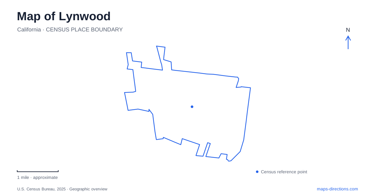
Street tiles load from OpenStreetMap when opened. The blue line shows the 2025 Census boundary.
- State
- California
- Population · July 2025
- 63,512
- Land area
- 4.8 sq mi
- Water area
- 0.0 sq mi
Lynwood's map reflects successive forms of movement through a compact urban area: early railways, a major boulevard, modern Metro service and a linear walking and cycling corridor. Long Beach Boulevard is a useful organizing reference, but its name can mislead readers into confusing a local street or former station name with the separate city of Long Beach. The nearby plazas and parks add another layer, giving the community gathering places with very different shapes and purposes.
Dairy land and electric rail shaped the boulevard
The city's history places a dairy and creamery established in 1902 near what is now Sanborn Avenue and Long Beach Boulevard. A railway siding took the dairy's name. The account then describes the Pacific Electric route built through the area in 1904–1905 between Los Angeles and Santa Ana. Rail service gave this land a relationship with the wider region before the boulevard became the familiar paved commercial street.
Lynwood's Pacific Electric depot was installed in 1929 at Long Beach Boulevard and Fernwood Avenue. That historical intersection helps locate the railway story within today's streets. It also makes clear that the depot's significance belongs to an earlier transit system. A preserved building or historical depot label is not evidence of a current passenger boarding point at the same site.
Residential subdivision followed the transport opportunities. The city records the opening of hundreds of acres for suburban homes in 1913, with water supply featured in the promotion. The local street landscape therefore emerged from a combination of land development, infrastructure and rail access rather than from one isolated commercial crossroads.
The Metro station's new name clarifies the geography
Metro approved a motion in January 2025 to rename the C Line's Long Beach Boulevard station. Its subsequent service information explained the change to Lynwood Station as a way of making the community served by the stop clearer. Older maps and descriptions can still contain the boulevard-based name, so both names may appear when comparing sources from different years.
The distinction is useful even for readers who are not taking a train. A station's former label named the road, not the distant municipality at the road's southern end. Recognizing that avoids a substantial geographic misunderstanding. It also separates the modern Metro stop from the Pacific Electric depot discussed in the city's history.
For an actual rail journey, consult the current Metro route and service information. A historical map can explain a name change, but it does not establish today's operating pattern or the status of a particular train. The durable local fact is the relationship among the community name, the boulevard and the station identity.
Plaza México combines commercial and cultural space
Plaza México's operator gives its address as 3100 East Imperial Highway and identifies entrances on Imperial Highway, Long Beach Boulevard and State Street. The property therefore has relationships with several surrounding streets, not just the single road in its postal address. This helps explain why map searches may emphasize different sides of the same complex.
Within Lynwood, the plaza provides a setting where shopping and cultural programming share a physical space. The operator describes architecture inspired by Mexican places and replicas of monuments including the Ángel de la Independencia and the Aztec Calendar. These are intentionally reproduced landmarks within a local commercial property, rather than original historic monuments transplanted from their source locations.
The distinction adds meaning to a site plan. Open gathering areas and architectural features are part of the experience alongside shops and restaurants. A broad retail category on a map does not fully communicate that combination of uses, while an individual monument marker does not describe the entire property.
Two park forms offer different experiences
The municipal park at 11301 Bullis Road occupies a substantial recreation site with sports fields, tennis and basketball courts, a skate park, playgrounds and a walking path. Its layout accommodates activities gathered within one broad property. The specific field or facility matters because the park name covers several distinct recreation spaces.
Senator Lara Linear Park, listed at 3850 Fernwood Avenue, has a different form. The city describes a walking trail spanning five blocks, community artwork, garden beds, playgrounds and separate dog areas. Those features are distributed along an extended corridor rather than arranged around one central playing field.
The city's Urban Bike Trail announcement further describes an east-west walking and cycling connection through the linear park between the Burke-Ham Park neighborhood and Long Beach Boulevard. That connection gives the park a transport role as well as a recreation role. Its elongated shape is therefore a practical part of how neighboring places relate to one another.
Read a map of Lynwood with these distinctions in mind: the boulevard and depot explain earlier growth, the Metro name identifies the modern community served, the plaza combines commerce with cultural space, and the parks provide both concentrated recreation and a connecting corridor. Each feature contributes a different piece of the city's physical character.
Map and statistics: U.S. Census Bureau, 2025 Gazetteer, January 2025 generalized place boundaries and Vintage 2025 population estimates. Local references: City of Lynwood; Los Angeles County Metropolitan Transportation Authority; Plaza México. Article prepared by Maps & Directions.