Map of Lynnwood
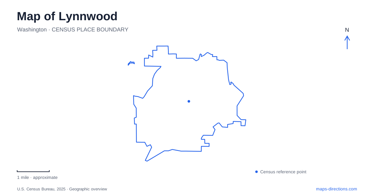
Street tiles load from OpenStreetMap when opened. The blue line shows the 2025 Census boundary.
- State
- Washington
- Population · July 2025
- 42,132
- Land area
- 7.9 sq mi
- Water area
- 0.0 sq mi
Lynnwood has several overlapping transportation landscapes. An early electric railway helped establish Alderwood Manor; Highway 99 encouraged roadside commerce; and modern light rail now anchors a major transit interchange. Wetlands and wooded ravines occupy another layer beneath the familiar road numbers. A useful map brings those layers together, showing why historic buildings, a regional trail, busy transfer platforms and a small urban lake appear within the same developed area.
Alderwood Manor survives at Heritage Park
Heritage Park stands at 19921 Poplar Way, east of Interstate 5 near Alderwood Manor Parkway. It interprets a rural community that developed along the Interurban Railway after surrounding forest had been logged. The Puget Mill Company marketed the cleared land for small farms, and poultry keeping became a defining activity. That agricultural background gives the preserved buildings a different meaning from a conventional collection of grand civic monuments.
The Wickers Building, Superintendent's Cottage, Humble House, water tower and Interurban Car No. 55 assemble domestic, commercial and transportation history in one setting. The city purchased the park property in 1999, and structures threatened during interchange construction were saved there. The grouping is therefore a deliberate preservation landscape. It should not be read as an untouched village whose buildings all remain precisely where their original uses began.
This part of Lynnwood makes the relationship between roads and history unusually visible. A historic trolley car and modest buildings sit near a major freeway, illustrating how successive transport systems changed the scale of the surrounding community. The park allows those earlier patterns to remain legible within a metropolitan setting.
A railway corridor becomes a regional trail
The Seattle–Everett Interurban operated from 1910 through 1939. Its right-of-way later became a power corridor, and portions were subsequently adapted for walking and cycling. The Interurban Trail thus follows a line established before the current pattern of shopping areas, residential development and major road interchanges.
The city's portion is approximately 3.8 miles long, extending from the Mountlake Terrace connection at 212th Street SW toward the area north of Alderwood's shopping district. Its diagonal course is easier to understand when treated as inherited infrastructure rather than as a path designed to follow the numbered street grid. The corridor connects with the transit-center area, giving it a practical role beyond recreation.
The wider trail also crosses municipal boundaries. County guidance notes that some sections use road shoulders rather than a completely separate path. Reading the route as a continuous regional idea does not mean every segment has an identical design. The old railway alignment provides continuity, while present streets and public ownership shape the details of the journey.
City Center as a transfer district
Lynnwood City Center Station is an elevated rail station at the established transit center. Sound Transit's station information lists rail platforms and multiple groups of bus bays, reflecting a place where local and regional trips meet. The station is a transportation destination in its own right, with pedestrian movement between modes forming an important part of its function.
This helps explain why a map centered on the station looks different from one centered on Heritage Park. The park preserves an earlier form of regional mobility through objects and buildings; the station concentrates current transfers. The Interurban corridor gives those two eras a broader geographic context, showing that the area has repeatedly served movement between communities rather than functioning only as a self-contained suburb.
Scriber Lake within the developed city
Scriber Lake Park, at 5322 198th Street SW, protects a lake and surrounding wetlands within an urban forest. The water supports wildlife habitat and also functions as a regulated stormwater holding facility. Its open-water shape therefore represents part of the city's drainage system as well as a place for outdoor recreation.
Road construction changed this landscape. Widening 196th Street SW in 1966 reduced the lake's size, and the city purchased 22 acres including the lake in 1982 to protect the natural area. The history of Scriber Lake helps explain how Lynnwood's transportation growth and conservation decisions have interacted. Boardwalk and trail work can affect access to different parts of the park, so the current municipal closure notice matters when planning a walk through the wetland setting.
A separate drainage toward Puget Sound
Lund's Gulch belongs to a different natural corridor. Its creek flows toward the northern end of Brown's Bay on Puget Sound, and protected land connects with county-owned Meadowdale Beach Park. That geography introduces a wooded ravine and coastal destination beyond the interior lake setting.
Reading these places together gives a map of Lynnwood greater depth. Heritage Park preserves the farming and railway community, the Interurban carries an older alignment into present use, City Center organizes transfers, and the lake and gulch reveal distinct drainage landscapes. The city's character emerges from their relationships rather than from any single shopping or freeway landmark.
Map and statistics: U.S. Census Bureau, 2025 Gazetteer, January 2025 generalized place boundaries and Vintage 2025 population estimates. Local references: City of Lynnwood; Lynnwood-Alderwood Manor Heritage Association; Snohomish County; Sound Transit. Article prepared by Maps & Directions.