Map of Lynchburg
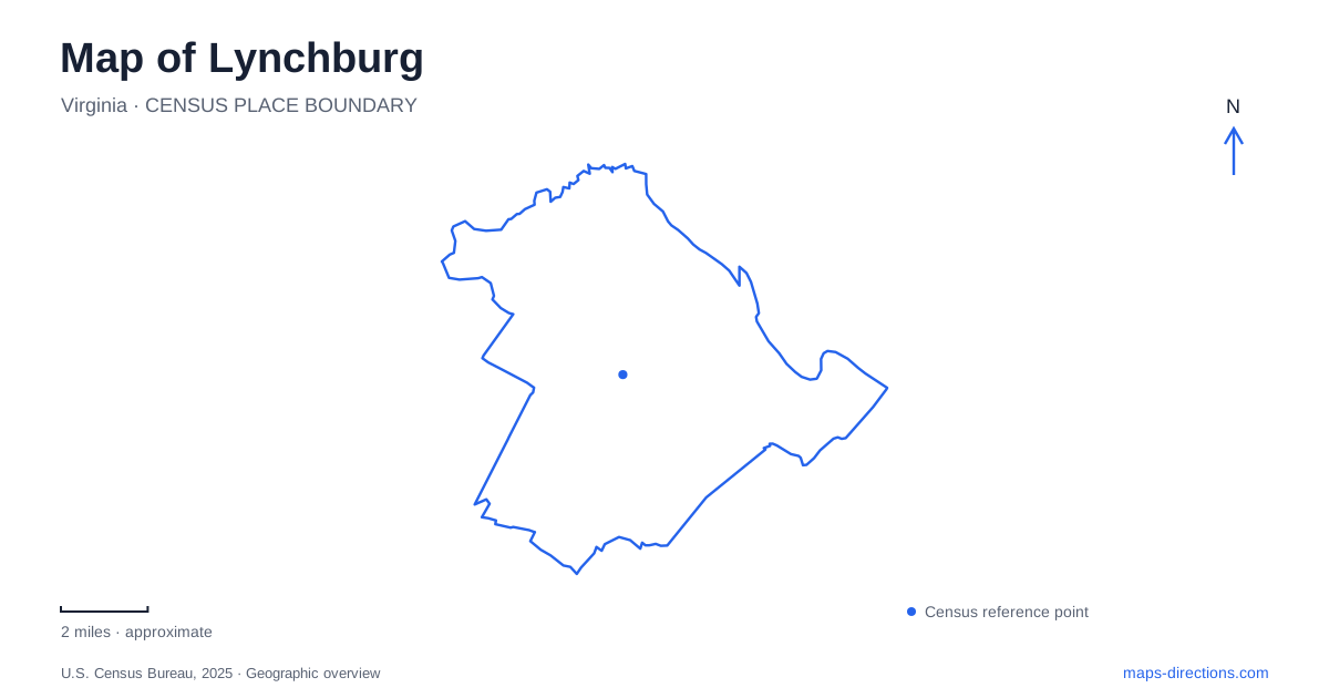
Street tiles load from OpenStreetMap when opened. The blue line shows the 2025 Census boundary.
- State
- Virginia
- Population · July 2025
- 81,347
- Land area
- 48.9 sq mi
- Water area
- 0.6 sq mi
Lynchburg's hills are part of its street plan, not merely a scenic background. Monument Terrace climbs between downtown streets, Daniel's Hill follows a ridge above two waterways, and former railway corridors provide gentler routes through the creek valley. The James River supplies another kind of connection, with RiverWalk crossing onto Percival's Island and continuing toward Amherst County. Understanding these changes in elevation and setting helps explain why nearby destinations may feel like different parts of the city.
Church Street below, Court Street above
Monument Terrace rises one city block from Church Street to Court Street. The museum system describes it as both a memorial landscape and a practical pedestrian connection. The Old Court House stands at the top, while the steps and landings make the slope visible in a way that a flat street diagram cannot.
The museum and visitor center occupy the courthouse at 901 Court Street. Their visitor information places accessible parking and an entrance ramp behind the building. This creates an important distinction between approaching the museum through its street-level arrival area and climbing the monumental staircase from below.
A Lynchburg walking map should preserve that vertical relationship. Church and Court streets are not interchangeable sides of a flat plaza; the terrace connects different elevations. Someone interested in the memorial sequence may choose the steps as part of the visit, while someone heading directly into the museum can identify the Court Street destination separately.
Cabell Street along Daniel's Hill
Daniel's Hill is a linear historic district organized around Cabell Street along the ridge. The city's description identifies steep terrain along its eastern and western edges, with Point of Honor marking the southern end of the district. The hill overlooks both the James River and Blackwater Creek, so its form is strongly tied to the waterways below.
Point of Honor's historic-house address is 112 Cabell Street. The museum foundation's tour information, however, directs participants to the Carriage House at 109 Norwood Street, with parking across from it. Those addresses describe different parts of the same historic property: the landmark house and the practical tour meeting location.
This is a useful example of local map interpretation in Lynchburg. Cabell Street explains the ridge and the house's position within the historic district; Norwood Street explains a particular visitor arrival. Retaining both names gives a fuller picture than choosing one address and discarding the other as contradictory.
A creek route built on a railway bed
The Blackwater Creek Trail follows an abandoned railway corridor through the creek's wooded setting. Parks and Recreation identifies the Ed Page entrance at 1720 Langhorne Road and another parking entrance at 340 East Randolph Place. These are distinct ways to reach the same trail system, allowing the starting point to be chosen according to the intended section.
The main paved trail connects with the Point of Honor and Kemper Station branches. The city's trail map also distinguishes earthen routes within the natural area. A creekside path and the paved railway-bed route therefore should not be assumed to offer the same surface or alignment, even when they follow the same broad valley.
For a map of Lynchburg, the railway reuse helps explain a contrast with the hilltop streets. The trail corridor follows its own course through the landscape, while the street network reaches institutions and neighborhoods above it. Their intersections are specific access points, rather than an assurance that every nearby street connects directly to the path.
RiverWalk and the island crossing
RiverWalk begins where the Blackwater Creek Trail reaches Jefferson Street, then follows the downtown riverfront before crossing onto Percival's Island. The wooded island once held industrial activity, including a train yard. Its present trail landscape therefore represents another conversion of transportation land into public recreation.
The route continues across the James toward Amherst County. Parks and Recreation identifies a city-side parking approach at Washington Street and Concord Turnpike and an Amherst-side approach at the end of Fertilizer Road. These are opposite approaches to a connected trail, not alternate street names for the same parking area.
The island's paved route and its smaller earthen paths offer different ways to experience the site. The through-route provides the river crossing, while the side paths remain within the island landscape. Keeping that distinction visible helps separate a short island exploration from a longer trip into the neighboring county.
A station outside the riverfront sequence
Kemper Street Station is at 825 Kemper Street. Amtrak's station information places local bus connections across the street at the transit company's transfer station. The Kemper Station Trail also links this area to the Blackwater network, giving the station a relationship to both regional transportation and local recreation.
Lynchburg is consequently more legible as a connected collection of hills, valleys, and crossings: the courthouse above Monument Terrace, Cabell Street on a ridge, the creek trail in a former railway corridor, and RiverWalk across the James. These relationships explain the city more usefully than a list of landmarks without their terrain and approaches.
Map and statistics: U.S. Census Bureau, 2025 Gazetteer, January 2025 generalized place boundaries and Vintage 2025 population estimates. Local references: Lynchburg Museum System; City of Lynchburg; Lynchburg Museum Foundation; Lynchburg Parks and Recreation; Amtrak Great American Stations. Article prepared by Maps & Directions.