Map of Long Beach
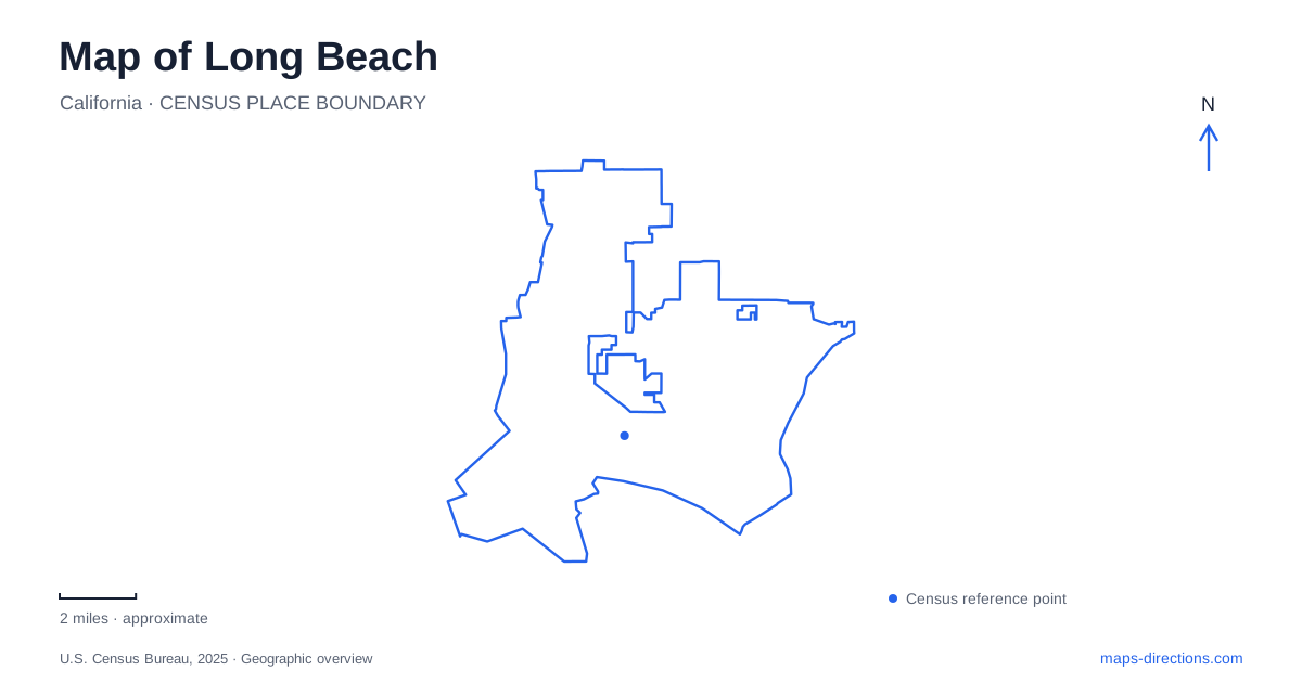
Street tiles load from OpenStreetMap when opened. The blue line shows the 2025 Census boundary.
- State
- California
- Population · July 2025
- 450,469
- Land area
- 50.7 sq mi
- Water area
- 27.2 sq mi
Long Beach has several waterfronts that look connected at a broad map scale but serve different purposes. Downtown combines marinas and visitor attractions, the main beach carries parallel walking and cycling paths, and Alamitos Bay contains neighborhoods shaped by canals and channels. Offshore islands add an industrial layer to the view. Reading these environments separately reveals much more than following a single line marked “coast.”
Downtown reaches south of Ocean Boulevard
The city's downtown shoreline planning area extends south of Ocean Boulevard between Golden Shore Drive and Alamitos Avenue. Those named edges help distinguish the waterfront from the larger downtown street network. The shoreline area includes open space, marinas, and destinations around Rainbow Harbor, with The Pike and Shoreline Village contributing different clusters of shops and restaurants.
The Aquarium of the Pacific stands at 100 Aquarium Way. Its parking structure is on the water side of Shoreline Drive between Chestnut Place and Aquarium Way. That relationship is useful because the waterfront's roads curve around larger sites; the straight grid seen farther inland is not the complete organizing pattern here.
Rainbow Harbor also supports sightseeing departures. The water itself is therefore both scenery and a transport setting, while the surrounding paths connect places that may appear separated by broad roads or large building footprints. For a downtown walk, the harbor shape and shoreline paths provide useful context alongside the street names.
Two paths along the main beach
The beach corridor gives Long Beach a clear recreational connection from the downtown side toward Belmont Shore. The city built a separate pedestrian path beside the existing bicycle route, with access extending from Shoreline Drive to 54th Place. The two lines may sit close together on a map, but they represent different uses of the same coastal corridor.
Belmont Veterans Memorial Pier provides a prominent intermediate landmark. The path project included ramps around the pier, illustrating how the route negotiates existing coastal structures rather than running as a perfectly uninterrupted strip. Cherry Beach and the Junipero area add further reference points between downtown and the pier.
This is a helpful place to compare map scales. At a citywide scale, the beach appears as one long edge. Closer in, access ramps, parking areas, the pier, and parallel paths explain how people actually enter and move along it. Ocean Boulevard and the beach route belong to the same landscape, but an address on the boulevard does not by itself describe the path's position below or beside it.
Second Street connects two neighborhood settings
Belmont Shore's business district occupies fourteen blocks along Second Street. Shops, restaurants, and neighborhood services concentrate there, while the beach and bay provide nearby recreational settings. The commercial street is a useful organizing line when exploring the neighborhood beyond the sand.
Farther along Second Street, Naples introduces canals, curved bridges, and waterfront homes. The name describes three islands rather than one uninterrupted landmass. Rivo Alto Canal separates the two larger islands, while Naples Canal separates the smaller Treasure Island from the others.
This canal pattern gives the eastern part of Long Beach a very different map texture from the downtown grid. Short stretches of water interrupt apparent connections between nearby streets, and bridges become central to understanding how the neighborhood fits together. Second Street supplies a larger connecting route, while the smaller streets and waterside walks reveal the residential pattern within it.
The Peninsula has water on both sides
The Peninsula lies immediately south of Naples, across the main channel of Alamitos Bay. Its western edge is at 54th Place, while its eastern end reaches toward the bay entrance channel. The ocean-facing shore borders San Pedro Bay, and the opposite side faces the protected bay waters.
These relationships explain why two nearby beach locations can have different orientations. One faces the broader ocean-side bay; the other looks across an interior channel toward Naples. On a Long Beach map, following the shoreline around the narrow landform clarifies the distinction more effectively than treating every nearby beach label as equivalent.
The bay's waterways also support boating, paddling, and marina activity. Their shapes are essential parts of the neighborhood layout, not empty spaces between roads. A water-based outing and a walk along the Peninsula may cover the same general area while following entirely different connections.
The landscaped islands offshore
The four THUMS islands—Grissom, White, Chaffee, and Freeman—are artificial oil-production islands. Their landscaped appearance can make them look like resort sites from shore, but their purpose belongs to the Wilmington Oil Field. The city has documented their role in offshore operations and the deliberate screening of industrial equipment.
Including those islands completes a more accurate reading of Long Beach. The waterfront contains visitor spaces, working infrastructure, residential canals, and recreational beaches at once. A map that distinguishes those roles makes the coast easier to understand without reducing it to a single beach destination.
Map and statistics: U.S. Census Bureau, 2025 Gazetteer, January 2025 generalized place boundaries and Vintage 2025 population estimates. Local references: City of Long Beach; Visit Long Beach; Aquarium of the Pacific; Belmont Shore Business Association. Article prepared by Maps & Directions.