Map of Little Rock
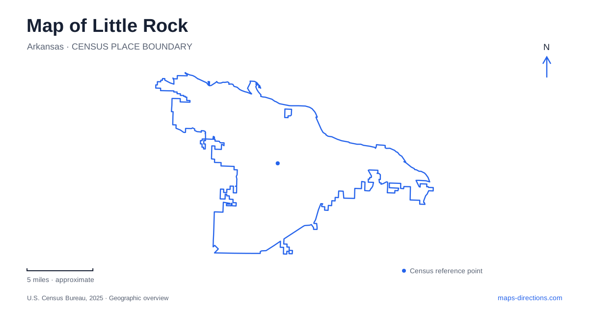
Street tiles load from OpenStreetMap when opened. The blue line shows the 2025 Census boundary.
- State
- Arkansas
- Population · July 2025
- 206,427
- Land area
- 121.2 sq mi
- Water area
- 3.0 sq mi
A map of Little Rock begins with the Arkansas River, but its most revealing details lie in the relationship between the water, the downtown street network and places farther inland. The city's namesake is a physical rock outcrop at the riverfront. Historic government buildings and presidential institutions occupy other parts of the central landscape, while the Central High School historic site takes the story into a neighborhood setting. To the west, mountain trails introduce a very different terrain from the downtown riverbank.
Finding the city's namesake
La Petite Roche stands near the north end of Rock Street in Riverfront Park, east of the Junction Bridge. The city exposed more of the formation and improved its viewing path as part of a project dedicated in 2010. This is the geographical feature behind the city name, rather than a commemorative sculpture created to represent it.
The location makes the riverfront a particularly informative starting place. A small surviving outcrop sits within a much larger engineered landscape of bridge approaches, park paths and downtown development. Its scale is modest compared with those surroundings, but its historical significance comes from its position along the river.
Riverfront Park's broader development also reflects a changing view of the waterfront. The city traces the idea of converting its industrial river edge into public parkland to a proposal by landscape architect John Nolen in 1913. Today's plazas, sculpture areas and recreation spaces belong to that longer shift in how the river is used.
Bridges as different kinds of crossings
Downtown Little Rock has several river crossings with distinct roles. The Junction Bridge is a pedestrian crossing; the Clinton Presidential Park Bridge accommodates pedestrians and bicycles. Road bridges such as Main Street and Interstate 30 belong to the same river panorama but serve a different transportation function.
That difference is important when tracing a riverfront outing. A walking connection shown across the water may use a bridge that cannot carry a car. Conversely, the presence of a highway crossing does not make its approaches equivalent to the park's paths. Reading the bridge labels alongside the travel mode explains how the two banks connect.
The presidential library and museum is at 1200 President Clinton Avenue, within the Clinton Presidential Center and Park. The associated park bridge gives this cultural destination a relationship with the trail network as well as the street system. It can be understood as one end of a riverfront sequence, rather than solely as an isolated museum address.
An earlier seat of state government
The Old State House illustrates another period of public life. Construction began in 1833, and legislators entered the still-unfinished building when Arkansas became a state in 1836. The original House Chamber later served as the Senate Chamber after an 1885 expansion created a larger space for representatives.
State government moved to the present Capitol in 1911. The older building subsequently housed several other institutions before taking its museum role. This history explains why the Old State House and the current State Capitol appear as separate civic landmarks: the distinction reflects a real relocation of government, not two names for one building.
The preserved chamber offers a way to understand the scale of early state politics. Its setting near the downtown riverfront also ties government history to the older urban core, whereas the later Capitol belongs to a different phase of the city's development.
Central High as a neighborhood historic site
Little Rock Central High School National Historic Site interprets the 1957 desegregation crisis and the experiences of the Little Rock Nine. The National Park Service visitor center is at 2120 West Daisy L. Gatson Bates Drive. Ranger-led programs begin there and cross streets toward the school grounds.
The historic setting extends beyond a single facade. Interpretive routes can include the Magnolia Mobil Station, Commemorative Garden and Elizabeth Eckford Bus Bench. These places locate the events within the surrounding neighborhood and show why sidewalks, corners and approaches matter to the history.
Current ranger programs require advance reservations and do not include entry inside the school. That is a concrete distinction between visiting the national historic site and entering the school building. A self-guided walking program with audio and transcripts provides another way to follow the outdoor story.
The western landscape at Pinnacle Mountain
Pinnacle Mountain State Park lies west of the city and includes the Big and Little Maumelle rivers, the Arkansas Arboretum and a varied trail system. The mountain's East and West Summit trails reach the same summit from separate approaches. The East Summit route crosses boulder fields, while the Base Trail circles the mountain and connects the two trailhead areas.
The park therefore calls for a trail map as well as a road map. Choosing a summit approach is a different task from finding the visitor center, arboretum or river access. Taken together, these places show the range within a Little Rock itinerary: a named river outcrop, civic and civil-rights landmarks, pedestrian bridges and a mountain landscape beyond downtown.
Map and statistics: U.S. Census Bureau, 2025 Gazetteer, January 2025 generalized place boundaries and Vintage 2025 population estimates. Local references: City of Little Rock; Little Rock Convention and Visitors Bureau; National Archives; Arkansas Heritage; National Park Service; Arkansas State Parks. Article prepared by Maps & Directions.