Map of Little Elm
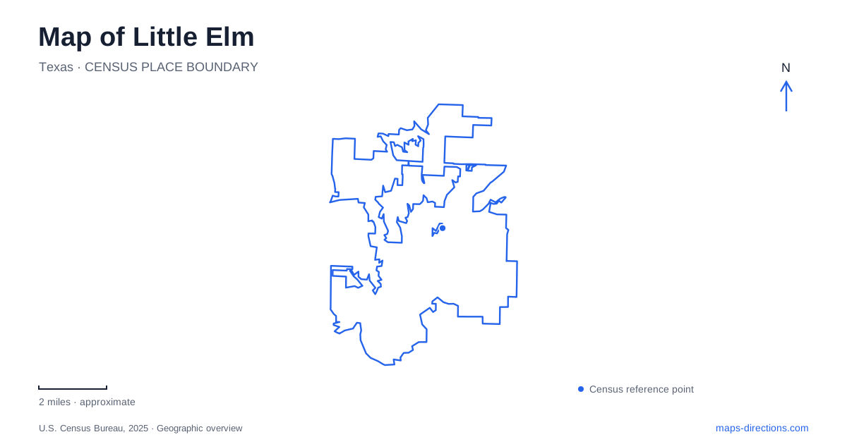
Street tiles load from OpenStreetMap when opened. The blue line shows the 2025 Census boundary.
- State
- Texas
- Population · July 2025
- 62,727
- Land area
- 18.5 sq mi
- Water area
- 4.1 sq mi
Little Elm wraps a set of waterfront and neighborhood destinations around part of Lewisville Lake. The water is the most obvious landmark, but a shoreline outline cannot tell you which park entrance, marina or trailhead serves a particular outing. Eldorado Parkway, Lobo Lane and FM 423 provide more practical arrival references. Farther from the immediate lakefront, the US 380 corridor introduces another cluster of development and recreation. Understanding those differences prevents a broad lakefront search from standing in for an actual destination.
The main beach park is a specific place
Little Elm Park is listed at 701 West Eldorado Parkway. The town identifies a swim beach, boat ramp, athletic fields, amphitheater and picnic areas among its facilities. This concentration of activities makes the park a useful anchor, but also means its name alone does not settle where a group should gather. A boat-launch trip and an amphitheater visit have different final requirements.
When comparing possible stops, distinguish a park entrance from a point placed on the lake. A shoreline destination should be selected by its official facility name, not by whichever stretch of blue is closest to the route line. Keep West in the street address as well: Eldorado Parkway also appears in the names and addresses of other recreation access points, so dropping the directional detail removes useful information.
The Lakefront Trail connects several arrival points
The town's destination district describes the Lakefront Trail as a crushed-granite route connecting the Hula Hut area with McCord Park. Its listed access points include Beard Park on East Eldorado Parkway, Harts Road and Eldorado Parkway, and McCord Park at 2050 FM 423. The eastern connection is associated with Veterans Memorial Bridge and the paved route through McCord Park.
This means a Little Elm trail outing can begin in different road corridors while using the same named recreational connection. Decide where to start and where to finish before choosing parking. Someone meeting another walker at McCord Park should not assume that a search for the overall trail will select that end. The route's surface also matters: a crushed-granite segment and a paved park connection should remain distinguishable when assessing an outing for the people involved.
Cottonwood has two named trailhead approaches
Cottonwood Park occupies the northeastern shore of the lake and is listed at 900 Lobo Lane. The municipal description places a sports complex adjacent to the park and Cottonwood Creek Marina next door. These neighboring facilities explain why several relevant map results can appear in the same small area. They are a cluster of destinations, not necessarily a single shared entrance.
The town identifies one Cottonwood Nature Trail access across from the sports complex and another at the end of Hardwicke Lane. That is more useful for a planned walk than a generic pin near the water. Keep the chosen trailhead in your directions and share that same point with companions. A route to the marina may be appropriate for a marina visit, while the named trail access solves a different arrival problem.
A lakefront district is broader than a park
The Lakefront District combines restaurants, retail and recreation. In Little Elm, it is therefore best understood as a destination area containing individual places, rather than a park with one gate. A meal, a beach visit and a trail walk may form a coherent outing, but each still needs its own point on the map. District branding can help identify the general area without providing the last turn.
Use Eldorado Parkway as a connecting reference and compare the selected destinations at street scale. This makes it possible to recognize when two activities are close enough to consider together without assuming that a path across a parcel is public or that every shoreline is accessible. Let the facility's published approach determine the final access, especially when moving between recreation space and a separate business.
US 380 belongs to another planning scale
The local economic development corporation identifies Union Park as the town's first major community park along University Drive, the US 380 corridor. That reference is useful because it separates a northern highway-oriented destination from the immediate lakeshore parks. An itinerary that includes both should show both road contexts rather than compressing everything beneath one lakefront label.
The most useful map of Little Elm preserves these distinctions: West Eldorado Parkway for the main beach park, the named Lakefront Trail entrances for a linear outing, Lobo Lane and Hardwicke Lane for Cottonwood access, and US 380 for a separate corridor. Choose among those anchors first. The resulting route will explain the town's geography and the purpose of the trip much more clearly than a city-center pin surrounded by water.
Map and statistics: U.S. Census Bureau, 2025 Gazetteer, January 2025 generalized place boundaries and Vintage 2025 population estimates. Local references: Town of Little Elm; Lakefront Little Elm; Little Elm Economic Development Corporation. Article prepared by Maps & Directions.