Map of Lincoln
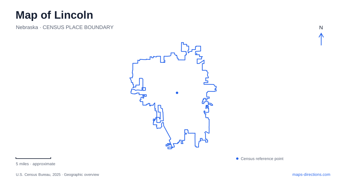
Street tiles load from OpenStreetMap when opened. The blue line shows the 2025 Census boundary.
- State
- Nebraska
- Population · July 2025
- 301,522
- Land area
- 102.5 sq mi
- Water area
- 1.4 sq mi
Lincoln combines a state-government center, a university city and a network of parks with quite different origins. Its central blocks are easy to organize around numbered and lettered streets, but those streets tell only part of the story. Rail-related buildings define the Haymarket, Antelope Creek helps organize a sequence of parks, and a separate university campus preserves the geography of an earlier farm. Looking at those features together explains why destinations with similar urban addresses can belong to very different landscapes.
The Capitol establishes a civic reference point
The Nebraska State Capitol occupies K Street between 14th and 16th streets, with an address of 1445 K Street. Architect Bertram Grosvenor Goodhue won the design competition in 1920, and construction proceeded from 1922 to 1932. The building's 400-foot tower rises above a broad lower structure, giving the government complex a distinctive form rather than the conventional domed profile of many state capitols.
Construction was phased so that government could continue working on the site. After portions of the perimeter structure were finished, offices moved into them while the previous building was removed and the remaining sections rose. That sequence helps explain the Capitol as an operating institution as well as an architectural landmark. Its position in Lincoln is useful for orienting the surrounding streets, but an interior visit should be planned separately from a walk around the grounds. Restoration work can affect tower access even when other parts of the building remain open.
The Haymarket records a commercial economy
The historic walking tour identifies a concentration of railroad and business landmarks around Seventh and Eighth streets. Bill Harris Iron Horse Park and locomotive 710 stand at Seventh and Q. The former Burlington depot occupies 201–225 North Seventh Street, while the Beatrice Creamery Building is at 701 P Street. The H. P. Lau Building and former ironworks and transfer buildings add further evidence of the district's commercial functions.
These addresses make the Haymarket readable as a working landscape inherited by later uses. A depot, a creamery building and an ironworks served different parts of an economy, even when they now appear together on a leisure walking route. Lincoln's South Haymarket adds another layer: rail connections after 1870 encouraged warehouses, branch offices and local industries south of the original core. The resulting industrial blocks developed alongside housing for workers. This relationship between freight movement, employment and nearby residences gives the district more historical depth than its current restaurants alone suggest.
Two campuses with different beginnings
The university's original campus occupied four city blocks between 10th and 12th streets. East Campus developed from a farm acquired northeast of the city. The former farm area is bounded by 33rd Street, Holdrege Street, 48th Street and Huntington Avenue, a much larger geographic frame than the original central campus.
That history matters when reading university destinations. City Campus and East Campus are distinct settings, each with its own internal organization. Their separation reflects the institution's development rather than an arbitrary division on a visitor map. A campus name is therefore a useful first piece of information when arranging an appointment, a tour or a walk. In Lincoln, the university occupies more than the blocks most closely associated with downtown, and its agricultural origins remain visible in the identity of the eastern campus.
Gardens follow a creek corridor
Antelope Park stretches from the vicinity of 23rd and N streets toward 33rd Street and Sheridan Boulevard. The Billy Wolff and Rock Island trails run through the park, which follows Antelope Creek. Its informal North, Triangle and South sections help organize a broad collection of gardens and recreation spaces.
Around 27th and A streets, the Triangle includes Sunken Gardens, Hamann Rose Garden, Rotary Strolling Garden and Cascade Fountain. Sunken Gardens has terraces, reflecting ponds, a waterfall and paved paths; the nearby strolling garden covers about three acres. Farther into the southern park are the Veterans Memorial Garden, bandshell and Auld Pavilion. The variety matters: this is a connected park landscape with several distinct garden and gathering spaces, rather than one formal garden enlarged to fill the whole corridor.
Prairie, woodland and park design
Pioneers Park was dedicated in 1930, with landscape architect Ernst Herminghaus shaping its plan and view corridors toward the Capitol. Pinewood Bowl, recreational paths and public art belong to that designed park setting. At its western end, the nature center introduces tallgrass prairie, woodland, wetlands and a tributary of Salt Creek.
The nature center began as a 40-acre sanctuary in 1963 and expanded substantially, adding interpretive facilities and trails through different habitats. Its live bison and non-releasable raptor exhibits support environmental education. This western landscape gives Lincoln another geographic identity alongside government, rail commerce and university life: a place where an urban park also provides access to the ecological communities of the central Great Plains.
Map and statistics: U.S. Census Bureau, 2025 Gazetteer, January 2025 generalized place boundaries and Vintage 2025 population estimates. Local references: Nebraska State Capitol; Nebraska Legislature; Downtown Lincoln Association; City of Lincoln; University of Nebraska–Lincoln; Visit Lincoln. Article prepared by Maps & Directions.