Map of Lexington
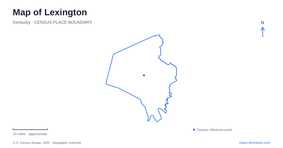
Street tiles load from OpenStreetMap when opened. The blue line shows the 2025 Census boundary.
- State
- Kentucky
- Population · July 2025
- 329,751
- Land area
- 283.9 sq mi
- Water area
- 1.7 sq mi
Lexington's geography connects an urban center with a surrounding Bluegrass landscape of springs, horse facilities, and river bluffs. Water is not always visible where it has influenced development: Town Branch runs beneath part of downtown, while the springs west of the center repeatedly disappear underground and return to the surface. Former industrial buildings provide another layer of orientation. These features make the map more informative when streets, trails, and landforms are read together rather than as separate systems.
Following a creek beneath downtown
Town Branch was the settlement's first water source, but part of its course now lies in a culvert beneath modern Vine Street. Town Branch Commons roughly follows that historic alignment through downtown. The park and trail corridor opened in October 2022, adding a continuous walking and cycling route through a setting where the original stream is largely concealed.
The corridor connects existing parks and public spaces, including Triangle Park and the area around Central Bank Center and Rupp Arena. It also links the Town Branch Trail and Legacy Trail. This gives the downtown route a larger purpose than circulating around a single attraction: it joins urban destinations with paths leading toward the surrounding landscape.
For a map of Lexington, the important distinction is between the watercourse and the public corridor that interprets it. They share a historical relationship but are not a continuously exposed streamside walk. The Commons makes an underlying feature legible through landscaping, paths, and connected public spaces, allowing the city's early geography to remain relevant within a modern business district.
Reused industrial districts retain different stories
The Distillery District developed around the old James E. Pepper distillery site. After a long period of disuse beginning in 1958, restoration efforts gathered momentum in 2008. Working distilleries, dining, and other businesses now occupy an area whose industrial identity remains central to its character. The reused buildings help explain why the district looks and functions differently from a conventional shopping center.
Other commercial areas have separate origins. Greyline Station occupies a 1928 building that served as the headquarters of Southeastern Greyhound Lines. The Warehouse Block around Walton and National avenues grew from industrial complexes dating to the 1930s. These places connect present-day restaurants and shops with transportation, storage, and manufacturing history. Grouping all three under a generic downtown label would miss the different activities that shaped their buildings and street settings.
Springs that reveal the limestone landscape
McConnell Springs lies south of Old Frankfort Pike and west of Forbes Road, inside New Circle Road. Archaeological research describes its water system as a karst window: underground drainage becomes visible at a series of surface openings. This gives the park a geological importance that is not obvious from its modest footprint on a street map.
Water emerges at the Blue Hole, flows a short distance above ground, and disappears again through a swallet. It later returns at the Boils, where pressure from the underground conduit can make the surface bubble. These are connected expressions of one drainage system, rather than unrelated ponds. The park also includes a constructed wetland intended to capture roadway runoff and improve water quality before that water enters the springs.
The spring landscape adds a useful counterpoint to downtown's buried creek. Both show that Lexington's water geography extends beneath the visible streets and lawns. A surface map records only the places where that system can be seen; the connections between them require an understanding of the underlying limestone.
Horse-country landmarks and their approaches
Keeneland stands at 4201 Versailles Road. Its grounds map identifies several separate approaches, including Keeneland Boulevard, Old Clubhouse Lane, and a gate associated with Rice Road toward Old Frankfort Pike. The map also places Blue Grass Airport across the Versailles Road area. These large neighboring properties create a recognizable western gateway landscape.
A racecourse, sales grounds, parking areas, and service facilities occupy different portions of the same property. The published grounds map is therefore more useful for a specific visit than the outline of the track alone. Keeneland's relationship to Versailles Road also provides a concrete reference when locating western destinations around Lexington, particularly when an itinerary combines equine attractions with the city center.
Raven Run and the river's historical landscape
Raven Run Nature Sanctuary borders the Kentucky River and contains about ten miles of trails through woodland, meadows, and streams. The protected landscape includes the river Palisades and remnants of early nineteenth-century settlement. Evans Mill, a former gristmill built along a rock ledge, and the Prather farmstead connect the natural setting with the area's agricultural history. Historic dry-stone fences add further evidence of earlier land use.
This river-edge terrain differs substantially from a paved downtown trail. Its paths are intended for hiking and nature observation, and the state identifies the sanctuary as a place where visitors remain on designated trails. Raven Run completes a broader picture of Lexington: the urban watercourse, industrial districts, underground springs, horse grounds, and river landscape each reveal a different relationship between people and the Bluegrass region.
Map and statistics: U.S. Census Bureau, 2025 Gazetteer, January 2025 generalized place boundaries and Vintage 2025 population estimates. Local references: City of Lexington; VisitLEX; University of Kentucky Archaeology / Friends of McConnell Springs; Friends of McConnell Springs; Keeneland; Kentucky Energy and Environment Cabinet. Article prepared by Maps & Directions.