Map of Lewisville
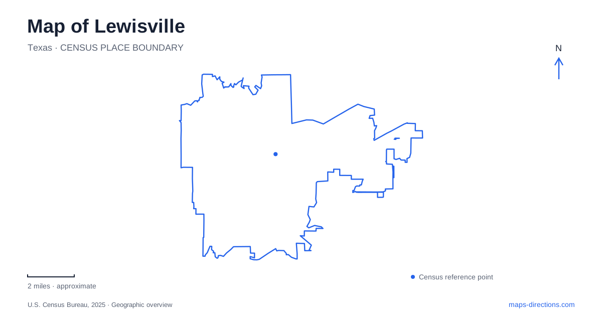
Street tiles load from OpenStreetMap when opened. The blue line shows the 2025 Census boundary.
- State
- Texas
- Population · July 2025
- 139,006
- Land area
- 40.7 sq mi
- Water area
- 6.2 sq mi
Lewisville's landscape has been shaped by both railway movement and water. The commercial center shifted toward the railroad, then buildings moved uphill in response to flooding. Today, Old Town preserves that history around Main and Mill streets, while the lake and the Elm Fork provide different settings for recreation and conservation. These connections give the map a coherent story: streets, rail infrastructure and green spaces occupy positions influenced by earlier decisions about trade, settlement and the river.
Old Town moved before it became historic
The municipal timeline identifies an important change in 1881, when railway extension drew the community toward the area now called Old Town. Some early buildings stood close to the tracks, but flooding on the Elm Fork of the Trinity River encouraged establishments to move west and uphill toward Mill and Main streets. The historical center therefore emerged through more than one relocation.
Main Street's older buildings recall a farming community supported by trade and services. The city's historical interpretation identifies a livery stable, hotels, hardware businesses, a bank and a lumber company among the earlier enterprises. These functions made the commercial district part of the surrounding agricultural economy, rather than an isolated collection of storefronts.
An 1885 building associated with the community theater and the former feed mill site are among the timeline's specific references. Together, the buildings show how commercial uses changed while the street remained an organizing feature. The history of Lewisville is visible not only in surviving architecture but in the shift from a flood-prone railway edge to the more durable center that followed.
A contemporary plaza beside older streets
Wayne Ferguson Plaza adds a modern public gathering space to Old Town. It sits beside the historic Main Street district and across from City Hall and the Grand Theater. The arrangement places performance, civic activity and outdoor gathering within a compact group of neighboring blocks.
The theater includes a main auditorium, gallery, dance-recital space and black-box theater. That mixture supports different arts activities rather than a single kind of performance. The plaza's outdoor setting extends the district's cultural use beyond the building walls.
The result is an area where newer public facilities occupy the same broader street framework as the older commercial properties. This does not make the plaza a historical reconstruction. Instead, it shows how an established town center can take on new community functions while retaining the streets and buildings that explain its earlier role.
Passenger rail remains part of the local geography
Old Town Station is at 617 East Main Street. DCTA's A-train connects it with other stations along the Denton–Carrollton corridor, where Trinity Mills provides a connection to DART's Green Line. The railway's current passenger role is different from the nineteenth-century transport story, but the corridor continues to shape how people reach the city.
DCTA also identifies Old Town as an access point for the A-train Rail Trail. That creates a second use of the corridor for walking and cycling. On a map of Lewisville, the station and trail belong to a transport landscape extending beyond the small Main Street commercial district. They connect a local center with a wider regional route.
Lake Park occupies the reservoir shore
Lake Park lies along the reservoir shoreline east of Mill Street, with its principal listing at 600 Sandy Beach Road. The city operates it on land leased from the U.S. Army Corps of Engineers. Golf, athletic facilities, day-use grounds and a marina form separate parts of this large recreation area.
The shoreline supports boat ramps, docks, beaches and picnic facilities. Those uses explain the park's regional appeal and its different scale from the downtown plaza. A lakeside outing may remain within one recreation area for much of the day, moving between water access and nearby facilities.
This reservoir setting is an important part of Lewisville, but it is not the same landscape as the wooded river corridor at LLELA. The distinction reflects actual habitats and land uses, not simply different park names.
River habitats and a relocated log house
At LLELA, the Cicada Trail follows a historical Elm Fork channel through hardwood forest. Bittern Marsh Trail passes through bottomland woodland and marsh, while Blackjack Trail includes grassland openings. The preserve's trail system therefore reveals several environments within the river landscape. Water levels can alter access to low ground, a practical consequence of the habitat rather than an unusual exception to it.
The Minor-Porter Log House adds a human-history layer. Originally built on land in what became Highland Village, the structure was later concealed within an enlarged house. After its rediscovery, it was moved to the preserve in 2005 and restored. Its present position is an interpretive relocation, not the original farm site.
Taken together, these places make a map of Lewisville a record of adaptation: commerce moved, a house was preserved elsewhere, railway use evolved, and water continues to shape both recreation and conservation.
Map and statistics: U.S. Census Bureau, 2025 Gazetteer, January 2025 generalized place boundaries and Vintage 2025 population estimates. Local references: City of Lewisville; Denton County Transportation Authority; City of Lewisville Parks and Recreation; LLELA. Article prepared by Maps & Directions.