Map of Lehi
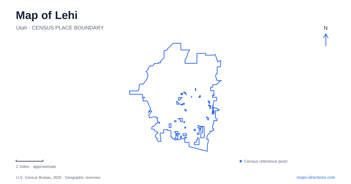
Street tiles load from OpenStreetMap when opened. The blue line shows the 2025 Census boundary.
- State
- Utah
- Population · July 2025
- 95,313
- Land area
- 30.3 sq mi
- Water area
- 0.4 sq mi
Lehi’s destinations spread across several recognizable street systems. Main Street and Center Street organize the older civic area, Thanksgiving Way and Garden Drive identify different parts of Thanksgiving Point, and numbered western addresses lead toward the Jordan River parks. These are more useful starting points than assuming every major attraction belongs to one central district. The city’s map combines an established town center with large educational campuses and a river corridor, each with its own pattern of movement.
Center Street’s civic collection
The Hutchings Museum occupies 55 North Center Street, in the Memorial Building. Dedicated in 1926 to honor First World War veterans, the structure has housed a library, jail, city hall, and fire station. The museum has occupied it since 1996. Those successive uses make the building a compact record of municipal life, rather than simply a container for exhibits.
John and Eunice Hutchings donated their collections in 1956 to be held in trust for the community. The museum’s natural and cultural history material includes subjects such as fossils, geology, western settlement, and Native American culture. Its position near Main Street connects that interpretation with the older town, where the street grid is easily followed through individual blocks.
Other civic addresses reinforce Center Street’s role. The library is at 120 North Center and the Legacy Center at 123 North Center, while the justice court is farther along at 154 North Center. A Lehi map centered on this short corridor therefore shows several public functions close together. The numerals identify a local sequence of destinations, not the much larger museum campuses farther north.
A working mill on East Main
At 833 East Main Street, Lehi Mills preserves a direct connection with food production. The company dates its opening to 1906 and continues operating as a hard-wheat mill. It sources wheat within a 300-mile radius, linking the building’s local address with a wider agricultural region.
This is an operating business rather than a general-access industrial museum. The company specifically says that public mill tours are unavailable. Its Main Street location can still serve as a recognizable point along the older commercial corridor, but a visit to the retail business and a tour of the production machinery are different expectations. The distinction also illustrates how historic buildings can retain their original purpose while nearby civic buildings take on new ones.
Thanksgiving Point is organized into campuses
Thanksgiving Point divides its attractions between the Water Tower Campus and Gardens Campus. The Mountain America Museum of Ancient Life is at 2929 North Thanksgiving Way, and the Butterfly Biosphere is at 3003 North Thanksgiving Way. Curiosity Farms uses a Wildflower Lane address within the Water Tower Campus. These facilities form one cluster within a larger institution.
Garden Drive identifies another cluster. The Museum of Natural Curiosity is at 3605 North Garden Drive, the carousel at 3653, and Ashton Gardens at 3900. Comparing those addresses on a Lehi map reveals why the institution’s umbrella name alone provides an incomplete location. A dinosaur-museum visit and a garden visit belong to different parts of the campus system.
The learning environments differ as well. Natural Curiosity includes Water Works, Kidopolis, and Rainforest exhibits, while Ashton Gardens includes designed outdoor spaces and sculpture. The Tree of Life garden contains Angela Johnson’s bronze figures, and her Light of the World garden occupies a separate 2.5-acre sculpture setting. Garden paths thus connect planted landscapes with figurative art, rather than serving merely as routes between buildings.
The rail station has an Ashton Boulevard address
FrontRunner serves the city at 3101 North Ashton Boulevard. Its street name is distinct from both Thanksgiving Way and Garden Drive, despite belonging to the same broader northern part of the map. The station is one point on the regional commuter-rail network, while the attraction campuses occupy their own local road and path systems.
Using those three named streets makes the northern area easier to understand. Ashton Boulevard establishes the rail arrival point; Thanksgiving Way locates the ancient-life museum cluster; Garden Drive organizes the gardens and interactive museum. The addresses provide a geographic framework without assuming that one arrival point supplies every attraction’s front door.
The Jordan River as a recreation corridor
On the western side of Lehi, Olympic Park at 2700 West 1600 North has a walking path connecting to the Jordan River Trail. Soccer fields and pickleball courts give it a neighborhood recreation role alongside that regional connection.
Willow Park, at 2998 West 300 North, occupies space between the river and its trail. It adds a nonmotorized boat launch, playgrounds, and overnight camping. Campsites are dry, with no RV hookups or dump station, and a dog park stands beside the campground. The river, path, and camping area therefore run together as related but separate features. This quieter corridor extends the local map beyond buildings and campuses into a landscape shaped by water.
Map and statistics: U.S. Census Bureau, 2025 Gazetteer, January 2025 generalized place boundaries and Vintage 2025 population estimates. Local references: Lehi Historical Society; Explore Utah Valley; Hutchings Museum; Lehi City; Lehi Mills; Thanksgiving Point; Utah Transit Authority. Article prepared by Maps & Directions.