Map of Lee's Summit
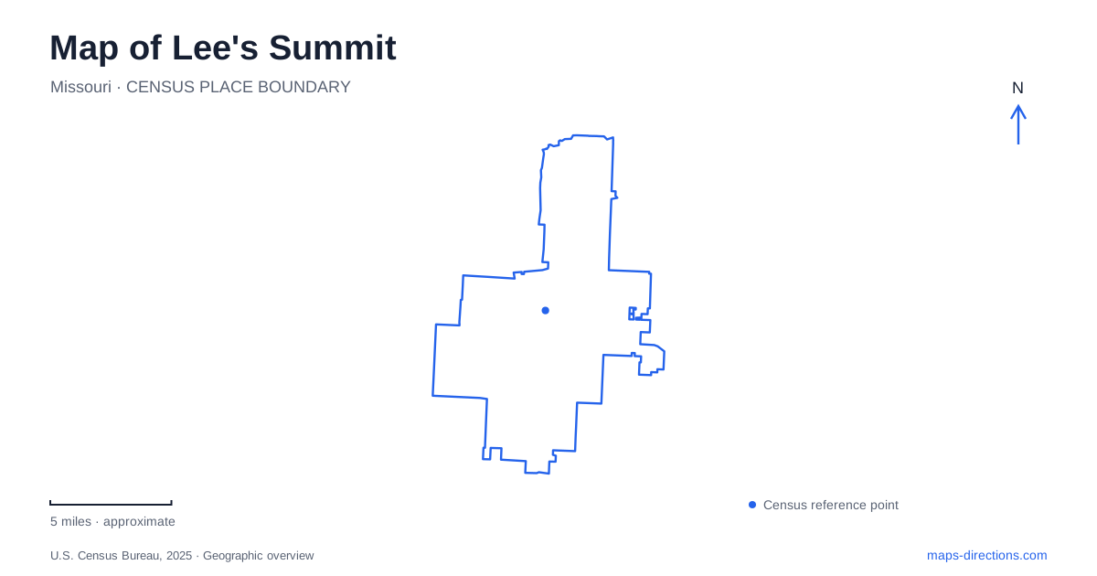
Street tiles load from OpenStreetMap when opened. The blue line shows the 2025 Census boundary.
- State
- Missouri
- Population · July 2025
- 107,514
- Land area
- 63.9 sq mi
- Water area
- 2.0 sq mi
Lee's Summit has a downtown whose railway setting remains visible, a newer civic gathering place on Green Street, and substantial recreational landscapes beyond the central blocks. Main Street, Green Street, and the numbered cross streets provide the first layer of orientation. Legacy Park Drive and Bluestem Drive organize a different cluster to the northeast, while Ranson Road leads south of US 50 toward a state wildlife area. Reading these places at their appropriate scales reveals how a compact historic center relates to much larger parks and conservation land.
Main Street and the railway presence
The passenger station at 217 Southwest Main Street places rail travel within downtown Lee's Summit rather than at a remote suburban terminal. Amtrak's station-history resource distinguishes the present passenger stop from the nearby historic Missouri Pacific depot. That relationship is important: the old railroad building is a historic landmark, while the station address identifies the passenger facility. Their proximity reflects a continuing railway corridor through the center.
A downtown street map labels Southwest Main and Southeast Main alongside Market, Douglas, and Green streets. Second, Third, and Fourth streets help divide the district into smaller blocks. The directional prefixes are part of this geography, especially where similarly named streets appear on different sides of the central rail corridor. Keeping those prefixes with an address is more informative than shortening everything to Main Street.
The compact arrangement makes it possible to compare the depot area, commercial blocks, and municipal buildings on one neighborhood map. It also explains why rail history appears throughout accounts of the center: the tracks are a physical organizing feature, not simply a historical theme applied to newer development.
Green Street's civic and market cluster
City Hall uses 220 Southeast Green Street. The Green Street Market building stands at 209 Southeast Green, giving the public gathering area a separate address along the same corridor. The downtown organization identifies the market building as the farmers market's current home. These places form a civic and community cluster that is easy to locate through Green and the nearby numbered streets.
This part of Lee's Summit also illustrates why older event maps can become misleading. The current market location belongs to the Green Street development, so a historical farmers-market reference should not be assumed to identify today's venue. The useful geographic relationship is between the market building, City Hall, and the surrounding downtown blocks. They share a central setting while retaining their own entrances, addresses, and functions.
The downtown map is therefore readable as several connected pieces: the railway and depot on Main, the commercial street grid, and the Green Street civic gathering space. That structure is more useful than choosing an arbitrary downtown pin and expecting it to explain every event location.
Legacy Park is a landscape of separate venues
Legacy Park covers approximately 692 acres, according to the municipal parks department. Its listed address range is 1201–1501 Northeast Legacy Park Drive. Within the grounds are sports fields, Lovell Community Center, a lake, disc golf, trails, and an amphitheater. The Joseph A. Dyke playground provides an inclusive play destination within this larger recreational landscape.
The amphitheater uses its own address at 897 Northeast Bluestem Drive. Official directions describe approaches using Colbern Road and Legacy Park Drive from one direction, and the Tudor/Scruggs corridor from another. Those road names show that the venue sits within a substantial park network rather than directly on the downtown street grid. A ballfield assignment, community-center program, and concert may all mention Legacy Park while pointing to different parts of the grounds.
For Lee's Summit, the park supplies a major recreational center whose internal map deserves attention. The city lists a 4.7-mile trail and a shoreline fishing dock and overlook, adding quieter landscape uses alongside organized sports. Its scale and variety make it different from a small neighborhood green or a single-purpose stadium complex.
South of US 50: managed wildlife land
The James A. Reed Memorial Wildlife Area lies south of US 50, reached from Southeast Ranson Road, also designated Route RA. Missouri's conservation department describes more than 3,000 acres with woodlands, native grass plantings, crop fields, ponds, and multiple lakes. The area began with a land donation from Nell Reed in 1952 and expanded through later acquisitions.
That managed mosaic gives the map a different meaning from Legacy Park's sports and civic facilities. Individual lakes and habitat areas serve conservation and outdoor recreation across a broad property, rather than gathering all activity around one central lawn. Together, the downtown railway blocks, Green Street, Legacy's venues, and the Reed landscape show Lee's Summit through several distinct kinds of public space connected by identifiable local roads.
Map and statistics: U.S. Census Bureau, 2025 Gazetteer, January 2025 generalized place boundaries and Vintage 2025 population estimates. Local references: Amtrak Great American Stations; Downtown Lees Summit Main Street; City of Lees Summit; Missouri Department of Conservation. Article prepared by Maps & Directions.