Map of League City
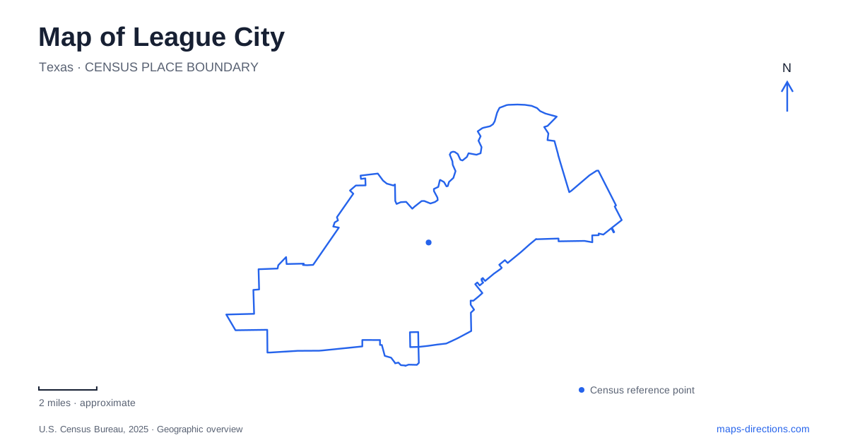
Street tiles load from OpenStreetMap when opened. The blue line shows the 2025 Census boundary.
- State
- Texas
- Population · July 2025
- 119,905
- Land area
- 51.4 sq mi
- Water area
- 1.8 sq mi
League City has an older village landscape around Main Street and a creek landscape along its northern edge. Railroad history, cattle ranching, live oaks, and wetlands all help explain the places marked on the map. The historic district concentrates small streets and individual landmarks, while Clear Creek ties together parks and paddling access farther along the water. These two patterns offer a useful introduction to a city whose identity extends beyond the larger roads used to reach it.
Main Street and the railroad settlement
The historic overlay district combines homes, shops, offices, parks, and open space within a village-like street grid. The city identifies oak trees and landscaping as important elements of that character. This is a living mixed-use district rather than a collection of detached museum sites, so the ordinary streets and small properties contribute to its appearance as much as the best known landmarks.
League Park contains the former railroad Section House, once home to the station master of the Galveston, Houston and Henderson line. The railway connected Galveston with the mainland, giving the settlement a transportation role well before today's regional road network. The old house's position beside the railway makes that history visible in the park setting.
Nearby, Butler's Courtyard at 122 North Michigan Avenue preserves part of the town's first brick building, constructed in 1909. Its original uses included commercial services downstairs and professional offices above. The surviving first story is now an event venue. Helen's Garden, at East Main Street and South Kansas Avenue, occupies the location associated with George Washington Butler's former home. Together, these sites place the Butler family's commercial and residential history on different corners of the district.
For a League City historical walk, those street relationships offer a natural structure: the railroad and park, the Michigan Avenue building, and the garden at Kansas. The district's scale allows the story to remain attached to particular places rather than becoming an abstract account of early settlement.
Clear Creek links three established landing places
Clear Creek runs along the city's northern border and supplies a second line of orientation. The municipal paddle trail was developed through cooperation with Galveston County, linking city and county park access. Its established route identifies Countryside Park at 100 Alderwood, Walter Hall Park at 807 Highway 3 North, and Heritage Park at 1220 Coryell Street.
Those three locations explain how a water route relates to the road network. Alderwood, Highway 3, and Coryell approach the creek from different settings, while the paddling route connects them along the water. The city describes the original trail as extending six and a half miles from Countryside to Heritage. That is a water itinerary, not a measurement of a road journey between the same parks.
Heritage Park adds picnic areas, a pond, playground space, and the Butler Longhorn Museum setting to its creek access. Walter Hall's county management provides a different administrative context within the same river recreation system. On a League City map, the creek can therefore be read as a shared landscape crossing facility boundaries rather than as a single park with one entrance.
Wetlands at the Egret Bay crossing
The Dr. Ned and Fay Dudney Nature Center occupies land on the south shore of Clear Creek at Egret Bay Boulevard. Formerly called the Davis tract, it preserves a substantial wetland landscape with a pond, observation areas, and birding trails. The city describes wetland habitat used by wading birds and other wildlife, with nursery habitat for fish.
Its first public phase opened in 2008 and included an improved observation trail, bird blinds, and picnic facilities. The landscape provides a different experience from the historic district's shaded streets: open water, wet ground, and vegetated margins organize the view. A map of League City that includes both settings reveals how close the settlement history is to coastal habitat.
The nature center's name can suggest a single indoor building, but the documented visitor experience centers heavily on the outdoor preserve and observation route. Egret Bay Boulevard and Clear Creek provide the larger geographic frame, while the trail and viewing areas provide the scale for exploring the grounds.
A neighborhood park demonstrates water conservation
Ghirardi Family WaterSmart Park on Louisiana Avenue brings environmental interpretation into a smaller neighborhood space. A state estuary-program report describes rain gardens, a rainwater cistern for irrigation, a green roof pavilion, and water-conscious landscaping. The park also contains a century-old Compton oak moved there in 2012.
These features connect the city's celebrated trees with practical stormwater design. The oak is a preserved living landmark, while the gardens and cistern demonstrate how a developed site can handle water. Alongside the historic district and creek wetlands, the park adds another useful layer to League City: conservation is visible both in large habitat areas and in the design of an everyday neighborhood gathering place.
Map and statistics: U.S. Census Bureau, 2025 Gazetteer, January 2025 generalized place boundaries and Vintage 2025 population estimates. Local references: City of League City; Visit League City; League City Nature; Galveston Bay Estuary Program. Article prepared by Maps & Directions.