Map of Lauderhill
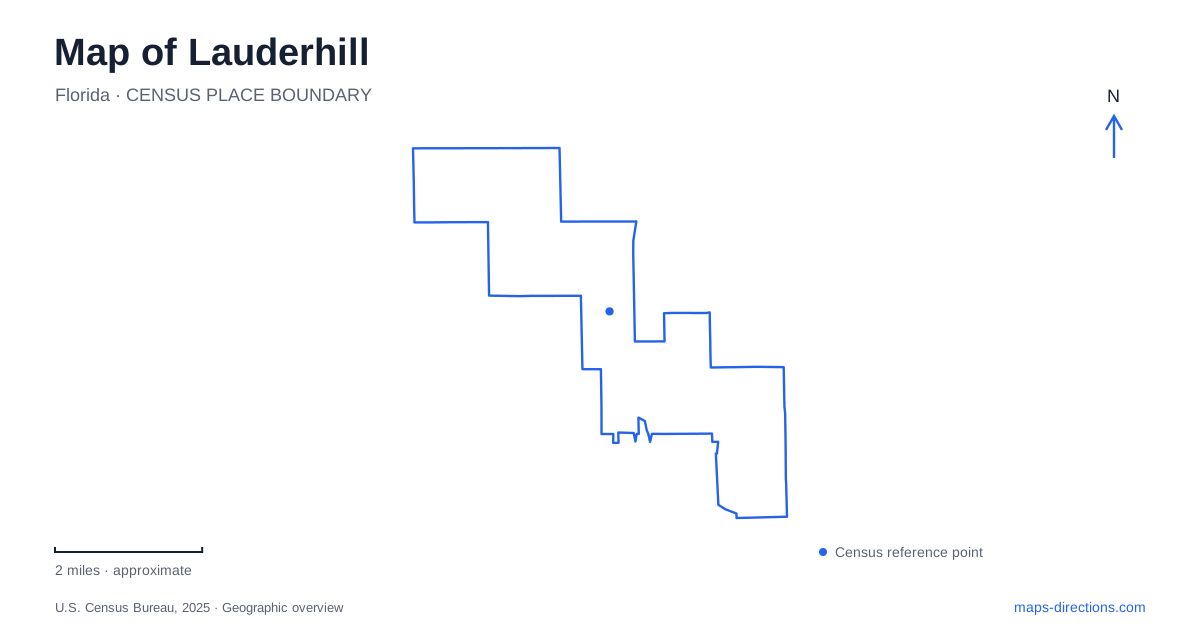
Street tiles load from OpenStreetMap when opened. The blue line shows the 2025 Census boundary.
- State
- Florida
- Population · July 2025
- 75,668
- Land area
- 8.5 sq mi
- Water area
- 0.1 sq mi
Lauderhill is a place where a map can reveal several different kinds of transformation. Former pasture became residential development, a municipal landfill became a regional sports park, and the footprint of the first city hall became a setting for a cultural museum. Its destinations are distributed among numbered streets and named corridors, so understanding the history of each cluster is more useful than assuming that every major public facility belongs to one continuous downtown district.
A regional park with an international sporting role
Central Broward Park and Broward County Stadium occupy a large recreation campus at 3700 Northwest 11th Place. The county's park overview describes the 110-acre site as a former municipal landfill redeveloped for recreation. Development began in phases in 2007, with the stadium completed in 2008. The venue became the country's first International Cricket Council-certified cricket facility, giving a local park an unusually prominent role in an international sport.
The wider park includes multipurpose fields, cricket practice cages, courts, walking routes, a natural trail, and a protected natural area. Public artwork adds another layer to the site. The result is not simply a stadium surrounded by parking: the property supports large events and everyday recreation within the same boundary. On the map, the stadium is the dominant landmark, but the surrounding fields and public spaces explain why people may be visiting entirely different parts of the park.
Performance beside the playing fields
The Lauderhill Performing Arts Center uses the neighboring address of 3800 Northwest 11th Place and is located within the regional park setting. It opened in January 2016 and accommodates music, theater, dance, cinema, and visual arts. The LEED Silver building was funded through a combination of city and county bond support, reflecting the site's role as a shared cultural investment.
The proximity of the arts center and stadium produces a distinctive destination cluster. An indoor performance, a cricket match, and a walk through park grounds can all appear in searches for this same stretch of Northwest 11th Place, although their spaces and purposes differ considerably. Keeping the two street numbers visible is helpful when comparing event information. The park address identifies the regional recreation property; the arts center address identifies the performance building within that larger setting.
Inverrary's garden-scale spaces
Inverrary adds a different chapter to the Lauderhill landscape. Municipal planning history describes the country club and golf development opening in 1970, with Jackie Gleason helping promote the area to northern visitors and prospective residents. That history explains why the Inverrary name has a strong identity within the broader city. It is a development-era place name with cultural associations, not merely another numbered street designation.
Along Inverrary Boulevard, Ilene Lieberman Botanical Gardens occupies just over three acres at 3831. The municipal listing identifies an amphitheater, public art, a walking path, a pavilion, a dock or pier, and a playground designed for younger children. These amenities give the site a garden and gathering-space character, markedly smaller in scale than Central Broward's athletic campus.
Meditation Park, at 3310 on the same boulevard, is another separate green space. Its roughly two-acre grounds have benches, a nature trail, and passive open area. Comparing the two places shows that a boulevard can connect several kinds of outdoor destination: one arranged for community gatherings and garden activity, the other emphasizing a quieter, less programmed setting. Neither needs to be mistaken for the much larger historical golf landscape associated with the district's name.
Remembering the first civic center
The cultural museum preserves a tangible point of origin for Lauderhill government. At 1080 Northwest 47th Avenue, it stands in Walter M. “Wally” Elfers Park on the footprint of the first city hall. Photographs, artifacts, and other historical objects occupy the center of the building, while flexible rooms also accommodate community uses. The site combines interpretation of the past with continuing neighborhood activity.
The surrounding landscape uses brick paving and planting selected to require little irrigation. This compact museum-and-park setting is quite different from today's city hall address on West Oakland Park Boulevard. Together, the two locations illustrate how civic functions moved as the community developed. The museum preserves the memory of an earlier administrative center without serving as the current municipal headquarters.
For a Lauderhill itinerary, these clusters offer a practical organizing principle: Northwest 11th Place for major sports and performance, Inverrary Boulevard for smaller garden spaces, and Northwest 47th Avenue for local history. The relationships are rooted in actual land uses and successive stages of development, giving the numbered street map a more recognizable human geography.
Map and statistics: U.S. Census Bureau, 2025 Gazetteer, January 2025 generalized place boundaries and Vintage 2025 population estimates. Local references: Broward County; City of Lauderhill; Lauderhill Performing Arts Center. Article prepared by Maps & Directions.