Map of Lathrop
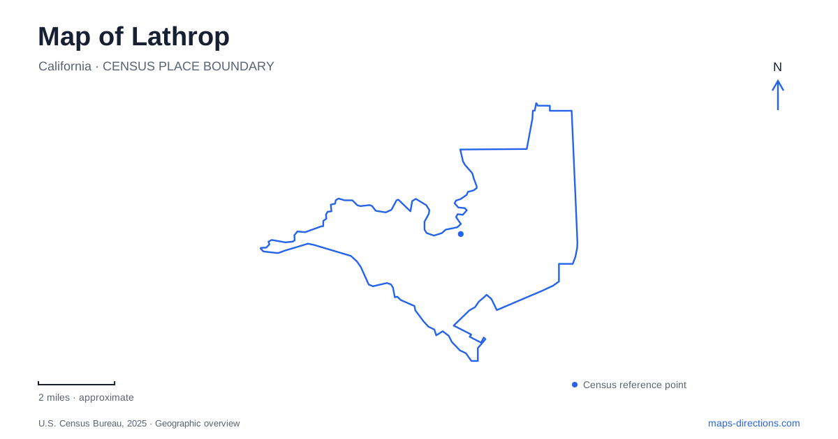
Street tiles load from OpenStreetMap when opened. The blue line shows the 2025 Census boundary.
- State
- California
- Population · July 2025
- 42,783
- Land area
- 19.8 sq mi
- Water area
- 1.2 sq mi
Lathrop developed around crossings: ferries and railways first, followed by highways and the streets of newer residential districts. The San Joaquin River and Interstate 5 remain the strongest features for understanding its layout. Mossdale's neighborhoods occupy land near the river, while River Islands introduces a large planned community in a Delta setting. Public boat launches, neighborhood parks, and the Generations Center provide useful destinations for seeing how transportation history and modern growth occupy the same landscape.
Mossdale before the subdivisions
The Mossdale name comes from steamboat captain William Simms Moss, whose landholdings and ferry crossing became important in the area's development. City planning histories describe the nearby settlement as Wilson's Station before its later name. The railroad then made this river crossing part of a much larger transportation system. The first train crossed the San Joaquin bridge in September 1869, establishing a connection associated with the westward completion of transcontinental rail travel.
This history gives the Mossdale area a significance that is easy to overlook among newer streets. A ferry landing depended on the river as an obstacle and transport route; a railway bridge allowed traffic to continue across it. The modern map retains both patterns, with roads running along the water and bridges carrying movement over it. The historical crossing belongs to a regional story, while the surrounding neighborhoods reflect subsequent changes from agricultural land to housing.
Reading the western development areas
West of Interstate 5, Mossdale Landing West extends toward the San Joaquin River. The city describes its planning area as land historically used for agriculture. That placement helps distinguish the district from the River Islands development, whose island setting forms another major part of Lathrop's growth. The two names refer to different planned areas, even though both use waterfront imagery and appear close together on a regional map.
River Islands has a phased development history. Its city planning page describes a long-term mixed-use vision incorporating homes, schools, commercial space, lakes, and parks. Buildout figures describe that vision, rather than a count of facilities available to visitors. A useful map reading separates established streets and destinations from development diagrams. This is especially relevant where a drawing combines a proposed school or commercial district with residential streets that already have addresses.
Two county parks on the river
Mossdale Crossing Regional Park, at 19091 South Manthey Road, provides a two-lane boat ramp and floating dock. The county identifies it as an access point for the San Joaquin, Middle, and Old rivers. Picnic tables and restrooms make it useful for a shorter shore visit as well. Its primary identity is a public river-launch facility, connecting the road network with the wider Delta waterways.
Dos Reis Regional Park offers a different arrangement at 890 West Dos Reis Road. In addition to boat launching and day-use picnic facilities, it has RV campsites with hookups and shower facilities. Its riverbank setting therefore supports an overnight stay as well as a daytime outing. For a visit to Lathrop, the distinction between these parks is practical: Mossdale Crossing emphasizes launch access, while Dos Reis combines that function with camping. Neither name should be substituted for the other when arranging a campsite or meeting boat passengers.
A civic campus on Spartan Way
The Generations Center at 450 Spartan Way brings the map back to community life away from the boat ramps. Completed in 2014, the complex combines a public library with youth and teen space. Its outdoor site includes a skate park, parkour course, and performance space. The design places several activities together, so the building and adjoining recreation areas function as a campus rather than an isolated public office.
The city also lists Leland and Jane Stanford Park at the Spartan Way address. Elsewhere, Valverde Park and the Community Center use 15557 Fifth Street. These locations show how public facilities serve more than one part of Lathrop. The newer campus complements an established civic-recreation address rather than replacing every community activity with one central destination.
Distinguishing the Mossdale park names
Several smaller places carry the Mossdale name. The municipal park list places Mossdale Commons at 740 Green Plaza and Mossdale Landing Community Park at 700 Towne Center Drive. The county's Mossdale Crossing boat launch is on South Manthey Road. These are three separate destinations with different settings and purposes.
Recognizing that pattern makes Lathrop easier to explore. The river crossing supplies the historical reference, the county parks offer water access, and the neighborhood parks serve residential districts. Combined with Interstate 5 and the Spartan Way campus, those features provide a concrete framework for reading a city whose older transportation landscape continues to shape substantial new development.
Map and statistics: U.S. Census Bureau, 2025 Gazetteer, January 2025 generalized place boundaries and Vintage 2025 population estimates. Local references: City of Lathrop; San Joaquin County Parks. Article prepared by Maps & Directions.