Map of Las Vegas
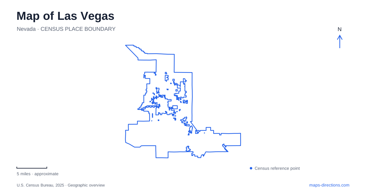
Street tiles load from OpenStreetMap when opened. The blue line shows the 2025 Census boundary.
- State
- Nevada
- Population · July 2025
- 679,817
- Land area
- 141.9 sq mi
- Water area
- 0.1 sq mi
Las Vegas presents an important map-reading trap: the city, the wider valley and the Strip are not interchangeable labels. A municipal boundary overview includes downtown, while much of the famous resort corridor lies in unincorporated Clark County. Visitors can use the same familiar city name for destinations in different jurisdictions and very different travel settings. Before arranging a journey, identify whether the actual stop is downtown, on the Strip or elsewhere in the valley. That first distinction is more useful than choosing a central pin and assuming every recognizable attraction lies around it.
Separate the resort corridor from the municipal outline
Clark County's planning material places much of the Strip in the Winchester and Paradise area. The county also identifies the airport and the university within that broader setting. A municipal map therefore cannot stand in for a complete visitor map of the metropolitan area. A hotel can be part of the familiar resort destination without being inside the city boundary shown on this page.
For a Las Vegas trip, keep the full property address rather than relying on the city field in a booking confirmation. That field is useful for identifying the region, but it does not settle the property's relationship to downtown or the appropriate arrival approach. A boundary view and a resort-corridor view answer separate questions. Use the former for municipal geography and the latter when comparing specific properties, intersections and transport stops along the Strip.
Fremont Street contains more than one arrival setting
Downtown's Fremont Street Experience is a pedestrian-oriented destination, while Fremont East is a neighboring entertainment district with its own street context. The city's visitor information treats them as distinct parts of downtown. A meeting beneath the canopy, a restaurant farther east and a nearby hotel should each retain their own entrance or cross street. The shared Fremont name is not enough to identify the final arrival point.
This matters when switching between a walking plan and a vehicle plan. A pedestrian destination can be approached from a surrounding garage or drop-off area without making the interior of that pedestrian space a driving route. Place the arrival point first, then identify the remaining walk. For several downtown stops, use the individual blocks and entrances to establish their order rather than drawing a straight line through a general entertainment-district label.
Main Street and Symphony Park form different clusters
The Arts District is organized around a different downtown setting from the Fremont canopy. The city's information highlights Main Street and the area's galleries, dining and shopping. A visit centered on those blocks deserves its own map view; the district name should not be used as a synonym for every downtown attraction. Select a particular venue or meeting point before deciding where the trip should begin and end.
Symphony Park provides another useful reference, with the Smith Center for the Performing Arts identifying a cultural destination west of the main Fremont area. Combining a performance with an Arts District or Fremont visit means connecting separate destination clusters. A useful downtown Las Vegas map preserves those distinctions, especially when the final approach depends on a venue's garage, entrance or designated pickup location rather than the center of the surrounding district.
The Downtown Loop and the monorail are separate systems
The city-operated Downtown Loop serves downtown stops including the Bonneville Transit Center, Symphony Park, Fremont destinations and the Arts District. Its route is useful for understanding how those clusters relate to one another. Consult the current stop list and operating information before treating a mapped line as a service available at the exact time of a visit. A route illustration establishes coverage, not a guaranteed departure.
The monorail follows a different corridor. Its operator's map shows a line between MGM Grand and SAHARA, with intermediate stations associated with resort properties and the convention-center area. Fremont Street is not one of the listed stations. A journey from the Strip to downtown consequently needs a separate plan; simply following the monorail north does not deliver a passenger to the Fremont canopy. Station access within or beside a large property also deserves a closer look than a citywide transport diagram can provide.
Choose a specific regional destination before leaving the center
The valley includes neighboring communities and destinations beyond the downtown and resort corridors. Clark County's regional road framework identifies I-15 beside the resort area and Highway 215 across the southern portion of Paradise. These routes help orient a wider journey, but a highway visible near a destination is not itself the final access instruction. The actual interchange and local approach still determine how the trip connects to the property.
A map of Las Vegas is most useful when it retains three separate layers of understanding: the municipal boundary, the individual downtown districts, and the wider resort and regional transport network. Start with the one that matches the visit, then add the others only when the itinerary crosses between them. Keeping Fremont Street, Main Street, Symphony Park and the Strip distinct avoids the common mistake of turning an entire visitor region into one apparently compact downtown. That distinction makes Las Vegas easier to interpret without inventing journey times or assuming that every named attraction shares the same transport connection.
Map and statistics: U.S. Census Bureau, 2025 Gazetteer, January 2025 generalized place boundaries and Vintage 2025 population estimates. Local references: Clark County; City of Las Vegas; Las Vegas Monorail. Article prepared by Maps & Directions.