Map of Las Cruces
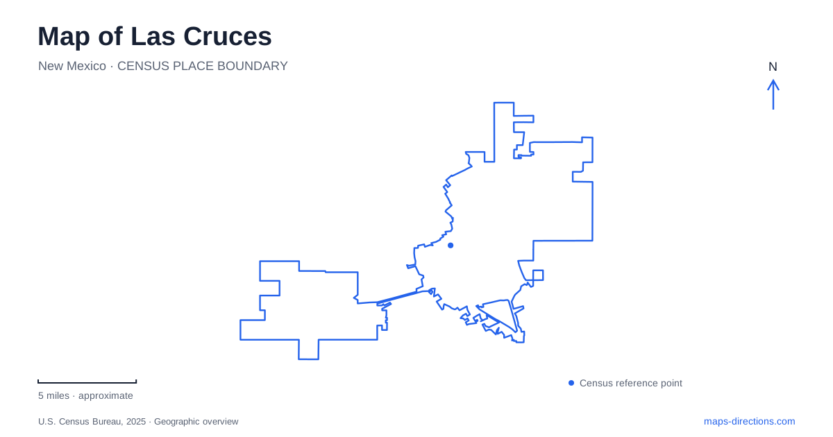
Street tiles load from OpenStreetMap when opened. The blue line shows the 2025 Census boundary.
- State
- New Mexico
- Population · July 2025
- 116,978
- Land area
- 76.9 sq mi
- Water area
- 0.1 sq mi
Las Cruces occupies a landscape where a valley town, a university campus, and a mountain approach fit within the same regional view. The city was founded in 1849 in the Mesilla Valley, but its map reflects several later transformations. Railway connections influenced residential architecture, cultural institutions gathered around downtown, and New Mexico State University developed a substantial campus near the interstate junction. To understand the layout, start with Main Street and the historic depot, then follow University Avenue toward either the campus or the Organ Mountains.
Two museum addresses reveal the older city
The Branigan Cultural Center stands at 501 North Main Street, in a building listed on the state and national historic registers. Its changing exhibitions explore cultural subjects rather than presenting one unchanging account of the region. The center identifies parking at 500 North Water Street, beside the Museum of Art. These neighboring streets establish the museum cluster at the north end of downtown Main Street and provide a useful starting point for exploring the central blocks.
The Railroad Museum occupies the historic Santa Fe depot at 351 North Mesilla Street. Its setting gives the railway story a physical location beyond an exhibit label. The museum interprets how rail transportation affected southern New Mexico, and its neighborhood walking programs examine houses and the people associated with them. A Las Cruces history itinerary can therefore move between a Main Street cultural setting and a depot district where the surrounding architecture forms part of the evidence.
The distinction is especially useful for readers comparing street names. North Mesilla Street is the depot's address; the historic district is Alameda-Depot. Neither name describes the Main Street museum cluster. Keeping the two areas visible together makes a more coherent historical route than searching for a single downtown museum point and expecting every institution to surround it.
Railway growth changed the residential landscape
The city's historical account describes new building materials arriving with the railway and making different styles of houses possible. Hip roofs and broad lawns contrasted with the one-story adobe and territorial buildings of the original town. Alameda-Depot preserves this architectural variety. The contrast helps explain why nearby residential streets can feel different even when a modern map shows them as similar blocks.
Historic preservation in Las Cruces identifies three principal districts: Mesquite, Alameda-Depot, and Mesilla Park. They offer a more specific vocabulary for reading older neighborhoods than the general word downtown. Mesquite and Alameda-Depot belong in a discussion of the central city's historic connections, while Mesilla Park adds another named district to the broader urban story. Treating these names as historical areas also helps distinguish neighborhood exploration from a visit to a particular public museum.
Architecture supplies a useful subject for a slower outing. Compare building form and the relationship between houses and streets, rather than trying to turn every historic property into an attraction. The museums provide interpretation, while the district names help organize what can be observed from public streets. This approach ties the map to the material changes brought by the railway without suggesting that every building is open for tours.
University Avenue links education with the eastern landscape
New Mexico State University's main campus covers roughly 900 acres near the meeting of I-10 and I-25. University Avenue and Espina Street are useful approach references, with Espina leading into the campus from University. The university map identifies buildings, parking, public art, memorials, and hydration stations. Those layers are particularly helpful because a campus visit may involve several short walks between facilities after the regional drive is complete.
For Las Cruces visitors heading into the foothills, University Avenue has a second role. The Bureau of Land Management directs travelers from I-25 Exit 1 east along University Avenue and Dripping Springs Road to the natural area at the road's end. Dripping Springs lies on the western side of the Organ Mountains, about ten miles east of the city. The road connection turns the mountain backdrop into a specific, reachable destination.
The natural area combines desert vegetation, woodland habitats, trails, and a visitor center with mountain interpretation. Its landscape also contains the remains of the Van Patten Mountain Camp and the Boyd health resort, adding a historical dimension to the foothills. A Las Cruces itinerary can consequently connect three distinct settings: downtown cultural buildings, the university, and a mountain landscape once used for lodging and health retreats. The common thread is how people adapted routes and buildings to the valley and its eastern edge.
Map and statistics: U.S. Census Bureau, 2025 Gazetteer, January 2025 generalized place boundaries and Vintage 2025 population estimates. Local references: City of Las Cruces; New Mexico State University; Bureau of Land Management. Article prepared by Maps & Directions.