Map of Lancaster
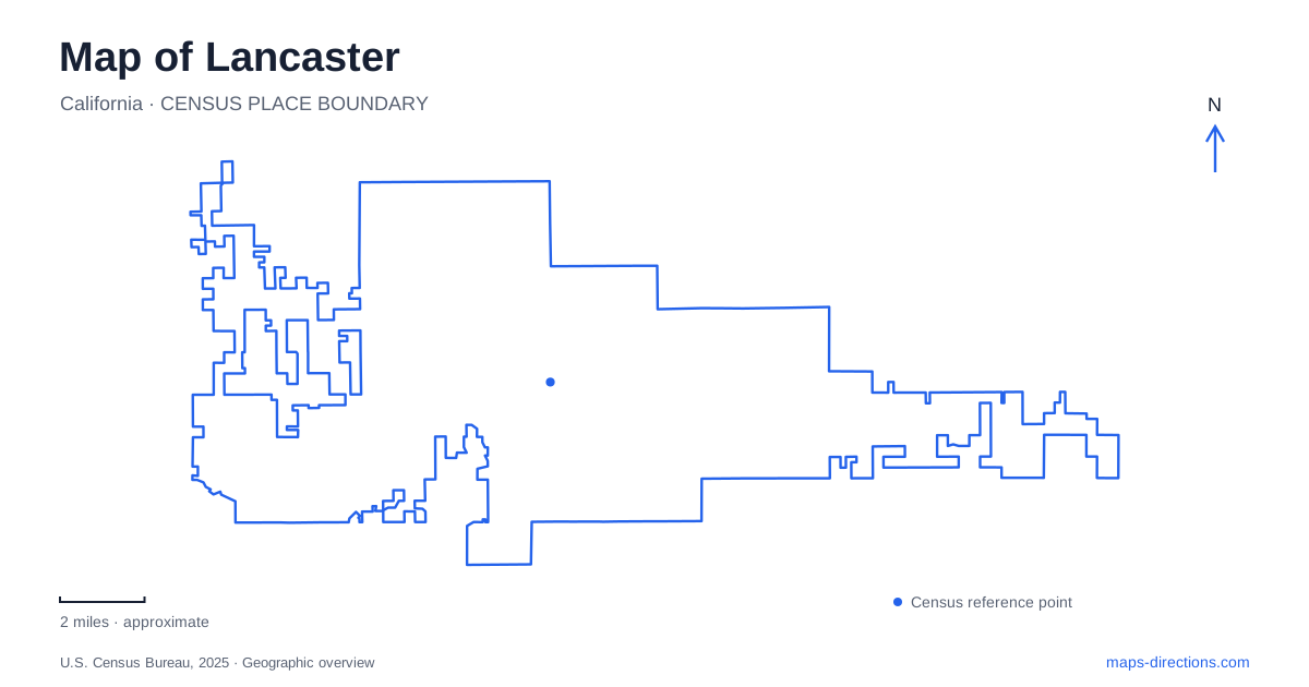
Street tiles load from OpenStreetMap when opened. The blue line shows the 2025 Census boundary.
- State
- California
- Population · July 2025
- 170,084
- Land area
- 94.3 sq mi
- Water area
- 0.3 sq mi
Lancaster combines a deliberately redesigned downtown with public landscapes that reveal very different aspects of the Antelope Valley. An old hotel records an era of travelers and aqueduct workers, a woodland preserve protects desert habitat inside the urban area, and a county park uses artificial lakes as its central feature. Farther west, the state poppy reserve protects rolling grassland. A useful map distinguishes these settings instead of treating every open space as the same desert excursion or assuming that the best-known regional flower display lies within downtown.
A boulevard reshaped for public life
The BLVD transformation was completed in November 2010 along the downtown segment between Tenth Street West and Sierra Highway. The project changed the streetscape into a more pedestrian-oriented gathering place, with shopping, dining, and entertainment forming part of a wider downtown strategy. Its boundaries provide a practical way to locate the district: the branded BLVD refers to a particular central segment, not every mile of the longer road.
The redesign added a contemporary layer to an older commercial setting. It did not create local history from nothing. The Western Hotel Museum, at 557 West Lancaster Boulevard, preserves a building that had already witnessed very different uses of the same downtown area.
Built in 1888, the hotel changed names and owners over time. In the early twentieth century, workers involved in constructing the Los Angeles–Owens River Aqueduct stayed there. That connection places the building within a regional infrastructure story as well as a local hospitality history. After deterioration threatened its survival, community preservation efforts helped it reopen as a museum in 1988.
A preserved desert inside the street grid
Prime Desert Woodland Preserve occupies roughly 120 acres at Avenue K-8 and Thirty-fifth Street West. First proposed in 1985, it resulted from local efforts to protect and interpret a natural landscape within the developed city. Its trails and interpretive center focus attention on plants, animals, geology, and human history.
An acquisition of approximately 20 acres in 2017 expanded protection for Joshua trees, California junipers, and wildlife habitat. This makes the preserve a useful place to understand what survives among surrounding roads and neighborhoods. Its purpose is conservation and education rather than a collection of sports fields.
For Lancaster, the preserve offers a close view of the region's environment without requiring a trip to distant desert land. The marked trails are central to that experience. Bicycles and dogs are not permitted on them, reflecting management for habitat and walking rather than general multiuse recreation.
Three lakes and an aviation reference
Apollo Community Regional Park lies near Fox Field, east of the airport between Avenues F and G. Dedicated in 1972, it was named in honor of the Apollo 11 astronauts. Its three interconnected artificial lakes carry the names of Neil Armstrong, Buzz Aldrin, and Michael Collins.
The park's water-centered design contrasts with the woodland preserve. Here the lakes and surrounding recreation areas are the principal features, while the nearby airfield and the park's name connect the setting with aviation and spaceflight associations. The lakes are constructed features, not evidence that this portion of the valley naturally resembled a chain of freshwater ponds.
A map of Lancaster should consequently distinguish this county-managed park from the municipal desert preserve. Both provide outdoor destinations, but their landscapes, origins, and management differ. The airport location is a useful geographical reference for Apollo Park and keeps it separate from the central boulevard district.
Wildflower country farther west
The Antelope Valley California Poppy Reserve is a state natural reserve west of Highway 14. It protects Mojave Desert grassland known for native wildflowers, especially the California poppy. The intensity and duration of flowering vary from year to year, so its name should not be read as a guarantee of a dense bloom on any chosen visit.
The reserve's trails cross rolling hills, with named loops and viewpoints helping visitors understand the terrain. The Tehachapi Vista Point Trail provides a concrete-surfaced accessible loop beginning near the visitor center. Other trails explore a broader landscape of slopes and open grassland.
This destination belongs to the wider landscape around Lancaster rather than the compact downtown walking area. Its value extends beyond the seasonal flowers: the reserve protects habitat where burrowing animals, birds, and other desert wildlife live throughout the year. Staying on designated paths protects both plants and the ground beneath them.
Together the hotel, redesigned boulevard, woodland preserve, Apollo lakes, and poppy reserve offer distinct ways to read the area. They connect travel and infrastructure history with urban investment and environmental preservation, giving each destination a clear place within the valley's geography.
Map and statistics: U.S. Census Bureau, 2025 Gazetteer, January 2025 generalized place boundaries and Vintage 2025 population estimates. Local references: City of Lancaster; Museum of Art and History; Los Angeles County Parks; California State Parks. Article prepared by Maps & Directions.