Map of Lakeland
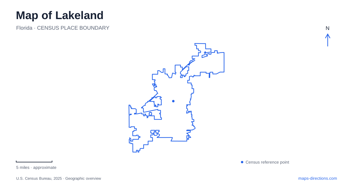
Street tiles load from OpenStreetMap when opened. The blue line shows the 2025 Census boundary.
- State
- Florida
- Population · July 2025
- 125,520
- Land area
- 66.6 sq mi
- Water area
- 8.8 sq mi
Lakeland is not organized around one central lake. Mirror, Morton, Hollingsworth, Bonny, Parker, and other named waters belong to different parts of the city and support different kinds of destinations. The municipal lakes department identifies both natural lakes and lakes created through phosphate mining. That variety matters when reading the map: the water shapes the street network and provides familiar local names, but each shore has its own surroundings and purpose.
Lake Mirror and a group of civic spaces
Lake Mirror provides a compact downtown reference with several named spaces around it. The city's Lake Mirror Complex includes the Frances Langford Promenade, an amphitheater, the Loggia, Railroad Pavilion, Kryger Park, and Hollis Garden. These names describe parts of a shared civic landscape, rather than a collection of unrelated parks scattered across the city.
South Lake Avenue helps locate the indoor facilities associated with that landscape. The auditorium is at 121 South Lake Avenue, while the Peggy Brown Center is at 215 South Lake Avenue. The Magnolia Building is on East Orange Street. This arrangement explains why the complex can appear under different addresses: its name covers several buildings and outdoor spaces, not a single front door.
Hollis Garden adds a formal planted setting within historic Lake Mirror Park. The city describes a 1.2-acre garden with patterned beds, public art, and ornamental fountains in a neoclassical architectural environment. For a map of Lakeland, the important relationship is the garden's place within the larger lake park. A visit can focus on that designed garden, the promenade, or a building event while remaining in the same general landscape.
Munn Park and the downtown street reference
Munn Park is a separate downtown outdoor venue at 201 East Main Street. Keeping it distinct from Lake Mirror is useful when interpreting meeting instructions or event descriptions. Both are central public spaces, but they have different names and locations. An event identified with Munn Park should not be relocated mentally to the lake simply because both appear in a downtown search.
Main Street, Orange Street, and South Lake Avenue form practical references for these civic destinations. The streets make it possible to understand a collection of nearby places without reducing them to a single downtown marker. They also explain why a central-area walk may move between a street-oriented park, lakefront paths, and indoor facilities.
This gives downtown Lakeland a geography based on connected but distinct public spaces. The useful question is which space an activity uses: the park on Main Street, the garden within the lake park, or one of the buildings on South Lake Avenue. Knowing that relationship makes the central map more informative than an undifferentiated list of attractions.
Lake Morton and the surrounding historic districts
Lake Morton is especially associated with the city's swans. Municipal accessibility information identifies viewing areas on Lake Morton Drive at East Walnut Street and at Kentucky Avenue. Those cross streets provide specific shore references for an outing focused on the birds. They also distinguish this lake from Lake Mirror's formal garden and event complex.
The surrounding East and South Lake Morton Historic Districts contain residential streets with early twentieth-century buildings. The regional heritage guide identifies Craftsman, bungalow, and Frame Vernacular architecture among the South district's characteristics. This makes the setting more than a water-view stop: the shore and the neighboring residential blocks form a broader historic landscape.
The Lake Morton names are therefore useful at two levels on a map of Lakeland. The lake itself is a natural feature and a wildlife-viewing destination; the district names identify surrounding areas of historic development. A walk around the shore and an exploration of nearby architecture may overlap, but they are not identical activities. Retaining both the lake and district labels helps preserve that distinction.
Campus architecture and the wider lake pattern
Florida Southern College is another major architectural destination, known for its concentrated collection of Frank Lloyd Wright-designed buildings. The city highlights that collection as part of its architectural heritage. Unlike a single freestanding monument, it is a campus setting with multiple structures. The campus name should therefore remain attached to searches for the architecture, so the buildings are understood as a group within an educational landscape.
Elsewhere, Lake Bonny provides another example of how water and neighborhood history connect. The municipal boat ramp is at 1515 East Main Street in Shore Acres, a residential district platted in 1924 north of the lake. The ramp's location, the lake, and the neighborhood describe three related features rather than three competing names for one place.
The wider Lakeland map also includes natural lakes such as Parker and Hollingsworth, alongside former mining lakes such as Bentley and John. Their different origins remind a reader that the pattern of water is part natural geography and part land-use history. Following the individual lake names, then identifying the streets and institutions around each one, offers a coherent way to understand a city whose destinations are repeatedly organized by its shores.
Map and statistics: U.S. Census Bureau, 2025 Gazetteer, January 2025 generalized place boundaries and Vintage 2025 population estimates. Local references: City of Lakeland; Visit Central Florida. Article prepared by Maps & Directions.