Map of Lake Worth Beach
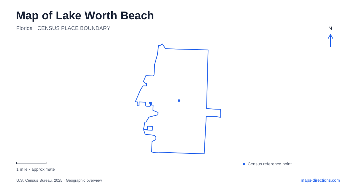
Street tiles load from OpenStreetMap when opened. The blue line shows the 2025 Census boundary.
- State
- Florida
- Population · July 2025
- 43,970
- Land area
- 5.9 sq mi
- Water area
- 0.9 sq mi
Lake Worth Beach has two distinct waterfront settings: the lagoon beside downtown and the Atlantic shore beyond it. Between them, a bridge connects a compact commercial center with the municipal beach complex. That arrangement gives the city an eastward sequence of streets, estuary, crossing, and ocean. Reading each layer separately makes the map much more informative than treating every waterfront symbol as part of one continuous beach.
Lake and Lucerne organize the historic center
Lake and Lucerne Avenues are the principal east–west streets through the historic downtown. The city's preservation information identifies Old Town as the commercial district, with Northeast Lucerne and Southeast Lucerne on opposite sides of that core. These names describe a pattern of business frontage and surrounding residential streets rather than unrelated attractions scattered across town.
The Lucerne name also preserves an earlier chapter. The Palm Beach Farms Company used it when developing the settlement in 1912, but a conflicting Florida post-office name led to the adoption of Lake Worth. Incorporation followed in 1913. On a modern map of Lake Worth Beach, the continued use of Lucerne therefore connects street geography with the town's first development scheme.
Farther north, College Park reflects another period of outward growth. Municipal records identify important building phases in the late 1920s and again after the Second World War. This helps explain why a historic-city map needs more than the central shopping blocks: residential development contributed its own distinct districts.
A theater that became an arts address
At 601 Lake Avenue, the Robert M. Montgomery, Jr. Building provides a specific downtown cultural landmark. Before serving as headquarters of the Cultural Council for Palm Beach County, it housed the Lake Theatre, which operated from 1940 into the 1970s. Later uses included art institutions, among them the Palm Beach Institute of Contemporary Art, which opened in 2000.
This succession adds depth to a walk through the commercial core. An entertainment building did not disappear when its original movie-theater function ended; its large interior supported new kinds of public cultural use. The address anchors that continuity on the street map. Its location also places cultural activity within the everyday downtown grid, rather than in a separate campus reached only by leaving the center.
The lagoon edge has been rebuilt for habitat
Snook Islands offers a particularly revealing view of Lake Worth Beach. Palm Beach County describes a 118-acre wetland restoration project that established mangrove and oyster habitat along the urban lagoon shoreline. The county reused sand from Peanut Island to fill a degraded dredged area near the bridge, transforming underwater ground as well as the visible edge.
The islands should consequently be understood as restored habitat, not simply untouched remnants surrounded by development. Mangroves, oyster areas, and shallow-water habitat are elements of an environmental project carried out within a busy urban estuary. A satellite view can show their forms, while a closer site map explains the public boardwalk and launch facilities.
The public-use address is 100 North Golfview Road. Only a few designated parking spaces serve that location directly; the county directs additional parking and restroom needs toward Bryant Park. That relationship makes the park and natural area useful to read together while preserving their different functions. One provides familiar urban waterfront facilities, while the other interprets and gives access to a restored lagoon landscape.
Across the water to the Atlantic
The oceanfront Casino and Beach Complex is another defining destination in Lake Worth Beach. The city states that the present building and renovated complex opened in 2013, with architecture recalling the original 1920s building. “Casino” is a retained historical name, and there is no gambling operation in the building.
That distinction matters because the label can suggest an entirely different kind of destination. Here it refers to a civic beachfront complex with dining, shops, and an upstairs ballroom with ocean views. The nearby William O. Lockhart Pier projects into the Atlantic, giving the ocean side a form quite unlike the mangrove islands and boardwalk on the lagoon side.
The bridge is the connection between those experiences. Downtown streets and Bryant Park sit on the lagoon approach; the beach facilities occupy the oceanfront beyond the crossing. An outing combining both waterfronts therefore involves a real change of shoreline and setting.
The railway approach comes from the west
The Tri-Rail station serving Lake Worth Beach is at 1703 Lake Worth Road near Interstate 95. The operator's driving directions approach through Sixth Avenue or Tenth Avenue and A Street, then use the traffic circle and Lake Worth Road. The station is not on the oceanfront or within the central cultural block.
Locating it first gives rail visitors a clear starting point for the rest of the city. From that western transport corridor, the map extends toward the downtown avenues, restored lagoon edge, and Atlantic beachfront. These linked but distinct places explain the city's geography through actual destinations, with each adding a different historical or environmental layer.
Map and statistics: U.S. Census Bureau, 2025 Gazetteer, January 2025 generalized place boundaries and Vintage 2025 population estimates. Local references: City of Lake Worth Beach; Cultural Council for Palm Beach County; Palm Beach County Environmental Resources Management; South Florida Regional Transportation Authority; Palm Beach County. Article prepared by Maps & Directions.