Map of Lake Charles
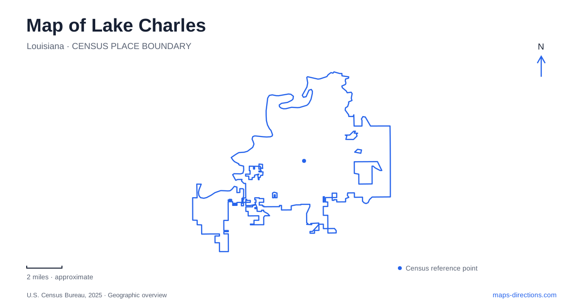
Street tiles load from OpenStreetMap when opened. The blue line shows the 2025 Census boundary.
- State
- Louisiana
- Population · July 2025
- 82,676
- Land area
- 47.5 sq mi
- Water area
- 2.9 sq mi
Lake Charles is both a city name and a waterbody name, which makes shoreline references especially important when reading a local map. Downtown's promenade follows the lake beside Bord du Lac Drive, while Prien Lake offers a different waterfront setting near Interstate 210. Farther afield, forested river parks and the Creole Nature Trail belong to a wider regional itinerary. These landscapes share a tourism region without being interchangeable destinations.
Bord du Lac Drive gives the downtown shore a clear edge
The city describes the Lakefront Promenade as occupying the space between Bord du Lac Drive and the shore, extending from the marina to the PPG Fountain area. It connects with the seawall across from the civic-event complex. Its landings contain different artworks and features, including the September 11 memorial, which help distinguish locations along an otherwise continuous waterfront path.
For a Lake Charles walking map, the promenade is a linear public space rather than a single attraction point. The marina and fountain area provide broad endpoints, while the named landings give finer orientation. Someone planning to meet along the waterfront should use a recognizable feature rather than assuming that the promenade's general address identifies one particular gathering place.
The shoreline also separates two kinds of movement. Bord du Lac Drive provides the road reference, while the promenade provides the pedestrian route beside it. A trip to an event building and a walk along the water can share the same general district but have different final destinations. The close-scale map should show both the road and the waterfront path.
Ryan Street connects cultural and university destinations
Historic City Hall Arts and Cultural Center is at 1001 Ryan Street. The city identifies it as a public art and history gallery with three floors of exhibition space, a clock tower and a landscaped plaza. Its historic civic name describes the building's past, while its current arts-center role explains why people visit it today.
McNeese State University's campus map gives the university's main address as 4205 Ryan Street. These two addresses provide a useful comparison within Lake Charles: the same street name can lead to an arts destination or a much larger university setting. The street establishes a broad connection; the building number and institution identify the intended part of it.
A campus visit requires another level of detail after reaching the university area. The campus map identifies individual buildings and internal routes that the main postal address cannot describe. By contrast, the cultural center is a particular building with a recognizable clock tower and plaza. Reading the two at the same map scale would conceal the difference between locating one venue and navigating an institution.
Prien Lake Park belongs to another waterfront
Calcasieu Parish lists Prien Lake Park at 3700 West Prien Lake Road. Its facility description places the park above Indian Bay on the eastern shore of Prien Lake, with views toward the Interstate 210 bridge. The grounds include walking paths, boat and kayak launches, pavilions and an amphitheater.
A Lake Charles outing that includes this park is therefore different from a stroll along the downtown promenade. Prien Lake Road and the Interstate 210 bridge give the correct geographical references. The presence of a shoreline path at both places does not mean they are two entrances to the same public space. Keep the waterbody's name attached to the park when comparing plans.
The park's launch facilities also give it a different role from a simple viewing area. A pedestrian visit can remain within the landscaped grounds, while a paddling or boating outing uses an access point to the water. The same map should be interpreted differently depending on which of those activities is intended.
Sutherland Road reaches a forest-and-river setting
Sam Houston Jones State Park is at 107 Sutherland Road. Louisiana State Parks describes tree-filled lagoons, mixed pine and hardwood forest, and boat launches on the West Fork of the Calcasieu River. These features create a setting distinct from both the downtown seawall and the landscaped Prien Lake grounds.
The river fork is the useful geographical distinction. A reference to the Calcasieu system can encompass several waterways and destinations, so the named park and its Sutherland Road address narrow the intended place. A regional water map explains how the waterways relate, while the park map explains its trails and visitor facilities.
The nature-trail gateway is in Sulphur
Creole Nature Trail Adventure Point is at 2740 Ruth Street in Sulphur. The city's visitor information places it south of Interstate 10's Exit 20 and describes the western trail journey toward Holly Beach through farmland and marsh landscapes. It is a regional starting point, not a downtown lakefront attraction.
A useful Lake Charles itinerary makes that distinction visible before combining stops. The urban promenade, Ryan Street institutions, Prien Lake shore, river-fork state park and Sulphur gateway each represent a different geographical setting. Their addresses and waterbody names explain the relationships more clearly than a broad regional attraction list, and they help keep a local walk separate from a longer journey into coastal Louisiana.
Map and statistics: U.S. Census Bureau, 2025 Gazetteer, January 2025 generalized place boundaries and Vintage 2025 population estimates. Local references: City of Lake Charles; McNeese State University; Calcasieu Parish Police Jury; Louisiana State Parks; City of Sulphur. Article prepared by Maps & Directions.