Map of Lacey
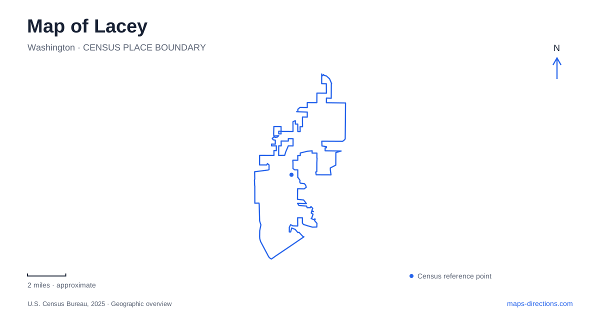
Street tiles load from OpenStreetMap when opened. The blue line shows the 2025 Census boundary.
- State
- Washington
- Population · July 2025
- 58,833
- Land area
- 19.0 sq mi
- Water area
- 0.5 sq mi
Lacey's lakes are not isolated blue shapes scattered among suburban streets. Hicks Lake, Pattison Lake and Long Lake form a connected water system, and Woodland Creek carries water onward toward Lake Lois and Henderson Inlet. That natural sequence provides one way to understand the landscape. Pacific Avenue, the Karen Fraser Woodland Trail and the Saint Martin's University campus provide another, more urban set of references through the center of the community.
Follow the water before choosing a park
The city's stormwater plan traces the lake sequence from Hicks to Pattison and then to Long Lake. Woodland Creek leaves the north end of Long Lake, passes through Woodland Creek Community Park near Longs Pond and continues toward Lake Lois. Farther downstream, it crosses the Martin Way and Interstate 5 corridors on its way toward Henderson Inlet.
This arrangement makes several nearby names more meaningful. Long Lake and Longs Pond are different water bodies, despite the similarity. Lake Lois belongs farther along the creek sequence, while the other two lakes lie within the connected headwater landscape. A map of Lacey should preserve those distinctions rather than allowing a general search for a lake to select the wrong destination.
The hydrological connection also does not mean there is a continuous public shoreline route around every water body. The value of the larger view is to explain how the landscape fits together. Individual parks and trails then determine where a visitor can experience particular parts of it.
Woodland Creek Community Park and the rail trail
Woodland Creek Community Park is at 6729 Pacific Avenue Southeast. Longs Pond forms a central feature, with play equipment, picnic shelters, paths and community facilities around the grounds. The park also contains disc golf facilities. Its pedestrian bridge connects parts of the park and the trail network, reinforcing the relationship between a local recreation destination and a route extending beyond it.
The Karen Fraser Woodland Trail runs parallel to Pacific Avenue for about 2.2 miles. At the eastern end it connects with the community park; to the west it meets the Chehalis-Western and Olympia Woodland trails. The corridor follows former railroad property, which helps explain its relatively direct alignment through a developed area.
The depot and its train-themed playground provide a central stop along the trail. This gives a walk or bicycle ride a useful intermediate landmark, rather than making the route only about its endpoints. Within Lacey, the trail can therefore serve both as a neighborhood recreation route and as part of a longer regional outing. The choice of starting point depends on whether the purpose is the park, the depot area or an onward connection.
Carpenter Road reaches a different lake experience
Long Lake Park is at 2790 Carpenter Road Southeast, adjacent to the Thurston County Fairgrounds. The park combines a swimming beach with wooded uplands, picnic tables and a natural trail. The transition from trees to an open shoreline is one of its defining features, quite different from the pond-centered community park on Pacific Avenue.
The nearby boat launch is a separate facility for which the city directs visitors to the state Department of Fish and Wildlife. A swimming-beach visit and a boat-launch trip should therefore retain different destination details. The lake name alone does not tell the full story of access around its shore.
The contrast between the two parks is useful for planning. Woodland Creek Community Park emphasizes paths, gathering spaces, play and the trail connection. Long Lake Park emphasizes a beach and its wooded setting beside Carpenter Road. Both involve water, but the activities and layout differ substantially.
The university has upper and lower approaches
Saint Martin's University lists 5000 Abbey Way Southeast as its principal campus address. Its directions distinguish the upper campus, including Old Main, academic buildings and Abbey Church, from the lower campus around the Hal and Inge Marcus Pavilion. For the latter, the university supplies 5300 Pacific Avenue Southeast as the useful address.
College Street and Abbey Way help orient the upper-campus approach, while Pacific Avenue and Lacey Boulevard appear in directions to the lower area. This is a meaningful geographic distinction within one institution. A visitor attending a pavilion event should not assume that the general university address identifies the most useful arrival point.
The campus, trail and water system together make a map of Lacey much more informative. Abbey Way explains one institutional cluster, Pacific Avenue locates the central trail corridor, Carpenter Road reaches the beach park, and the creek-and-lake sequence reveals the natural structure beneath the street network. Choosing the relevant layer first helps turn a broad map view into a purposeful local visit.
Map and statistics: U.S. Census Bureau, 2025 Gazetteer, January 2025 generalized place boundaries and Vintage 2025 population estimates. Local references: City of Lacey; City of Lacey Parks; Saint Martins University. Article prepared by Maps & Directions.