Map of La Quinta
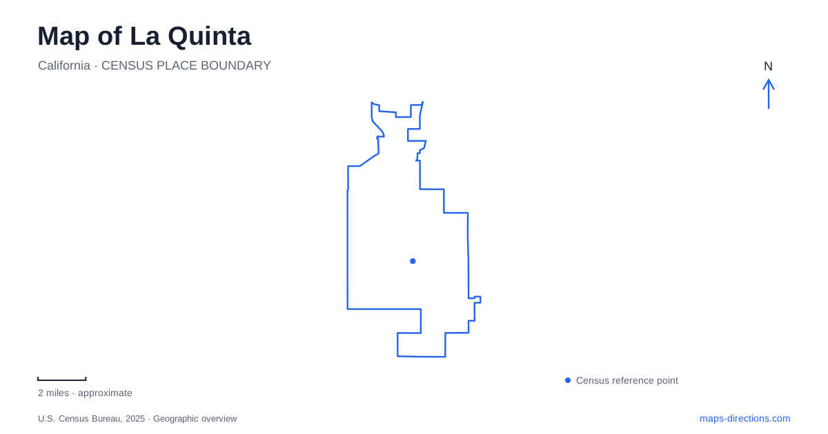
Street tiles load from OpenStreetMap when opened. The blue line shows the 2025 Census boundary.
- State
- California
- Population · July 2025
- 39,440
- Land area
- 35.3 sq mi
- Water area
- 0.4 sq mi
La Quinta's southern landscape is defined by the meeting of residential streets and the Santa Rosa Mountains. The Cove, the historic village area, resort grounds, and desert trailheads lie close enough to appear as one destination cluster on a regional map. At a closer scale, however, each has a different history and a different relationship to the surrounding terrain. Farther southeast, Lake Cahuilla introduces another kind of recreation, with managed camping and fishing beside a body of water whose name recalls a much older landscape.
The Cove and the museum
The city identifies the Cove as its first residential area. The museum stands beside the historic Village District at 77885 Avenida Montezuma, making it a useful starting point for understanding the surrounding streets. Its local-history displays connect artifacts and photographs to the development of the desert community.
The historical society supplies archival material for the museum, including Cahuilla pottery, a handwritten program from the area's first school in 1917, and adobe bricks associated with the hotel built in 1926. These objects bring together histories that a simple resort map might omit. Indigenous culture, early schooling, and tourism belong to different periods and social settings, yet all shaped the place now called La Quinta. The museum's address identifies a public cultural destination; nearby historic houses may remain private residences even when included in a heritage inventory.
A resort made from individual casitas
The historic resort began in 1926 under Walter H. Morgan, who commissioned architect Gordon Kaufmann to design twenty Spanish-style casitas. Adobe bricks and tiles were made on the property. The original arrangement of separate accommodations helps explain the resort's landscape of small buildings and outdoor spaces, rather than a single conventional hotel block.
The surviving vintage casitas are still described by the operator as original adobe rooms from the 1920s, with variations in layout and size. Their historic character comes partly from that individual construction. For La Quinta, the resort is both an operating business and an important element of the city's historical identity. Those roles coexist, but they do not make guest facilities equivalent to municipal parkland. A heritage description explains why the buildings matter; the resort determines how its spaces are used today.
Two meanings of a Bear Creek outing
The city's Bear Creek Trail description follows a route beginning at Eisenhower Drive and Calle Tampico, continuing south toward Fred Wolff Nature Preserve and the Cove Oasis Trailhead. This establishes an important connection between the developed neighborhood and its desert edge. It should not be confused with the more demanding mountain excursion associated with Bear Creek Oasis.
Cove Oasis Trailhead occupies natural open space at the southern end of the Cove, with access from Calle Tecate. The city lists picnic seating, a water fountain, public art, and access to routes including Boo Hoff and Bear Creek. These are trailhead facilities, not a description of conditions throughout the mountain routes beyond. The distinction between arriving at the trailhead and completing a particular hike is especially important here, where a short move beyond residential streets can lead into much rougher terrain.
The local hiking map separates routes toward the cave, palm oasis, and Lake Cahuilla. Their names should be treated as specific route choices rather than interchangeable labels for one loop. A plan to walk near the Cove is therefore incomplete until the intended route and turnaround point are identified.
A modern lake and an ancient shoreline
Lake Cahuilla Veterans Regional Park lies southeast of the historic center of La Quinta, at the foot of the mountains. Riverside County manages a broad recreation area with camping, picnic grounds, fishing, and equestrian facilities. The lake is a focal point, but swimming and boating in it are prohibited. Water visible on the map does not imply the same activities available at other regional lakes.
The county also distinguishes nearby hiking routes from facilities inside the park: its visitor information describes walking and cycling on park roads rather than an internal trail network. This makes the campground and the desert hiking approaches different parts of the outing.
Ancient Lake Cahuilla belongs to a much larger historical and archaeological story. The city's preservation program notes the importance of the former shoreline to local archaeological resources. That ancient lake should not be equated with the present recreation lake simply because they share a name. One helps explain the region's long human history; the other is a specific managed destination on today's map.
Reading the mountain edge carefully
The most informative map of La Quinta keeps the museum and village streets, historic resort, Cove trailhead, and county lake park distinct. Together they reveal settlement, architecture, conservation, and recreation across a relatively small part of the valley. The mountains connect these places visually, but access depends on their individual streets, entrances, and permitted uses. Recognizing those differences makes the landscape understandable without reducing it to a generic collection of desert attractions.
Map and statistics: U.S. Census Bureau, 2025 Gazetteer, January 2025 generalized place boundaries and Vintage 2025 population estimates. Local references: City of La Quinta; La Quinta Historical Society; La Quinta Resort and Club; City of La Quinta tourism; Riverside County Parks. Article prepared by Maps & Directions.