Map of La Mesa
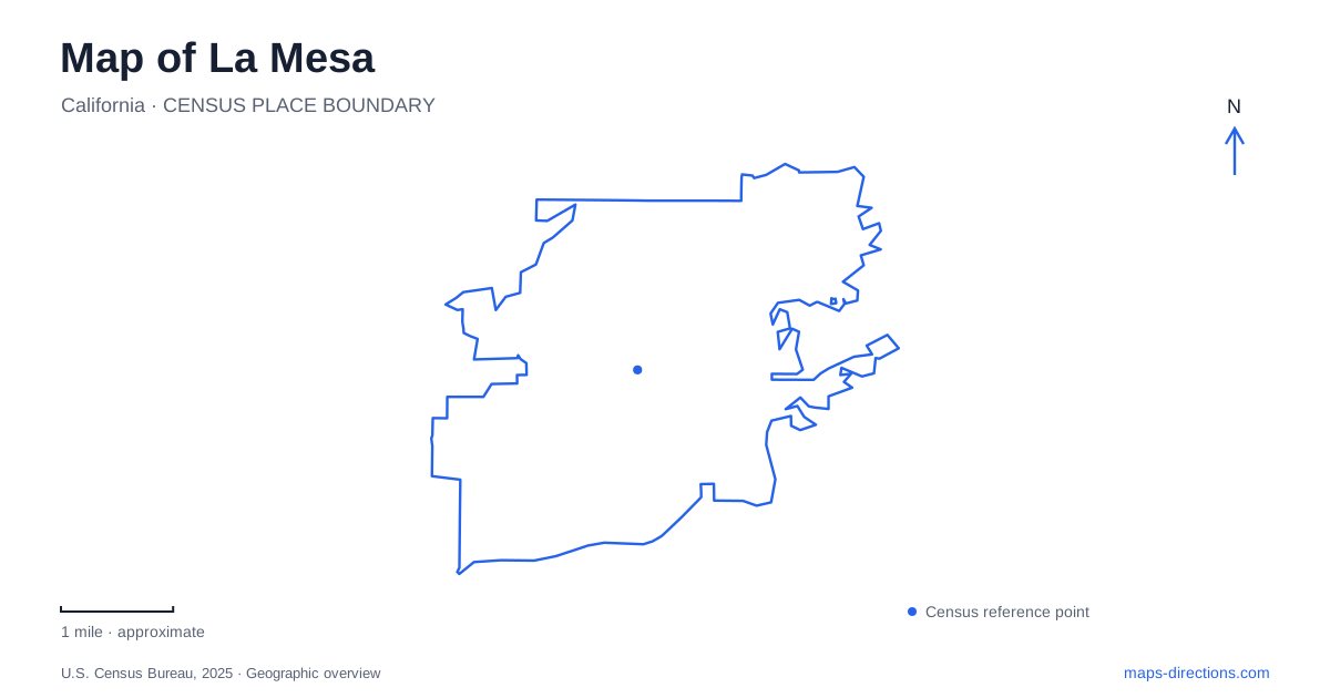
Street tiles load from OpenStreetMap when opened. The blue line shows the 2025 Census boundary.
- State
- California
- Population · July 2025
- 59,914
- Land area
- 9.1 sq mi
- Water area
- 0.0 sq mi
La Mesa offers two very different kinds of walking landscape: a downtown village organized around shops, public art and trolley access, and hillside neighborhoods where public stairways climb between residential streets. A map that shows only road distances misses that difference. The village is a useful starting point for understanding the city, but the slopes, park destinations and rail corridor give the surrounding area its particular shape.
The village at pedestrian scale
The Walkway of the Stars is a small but revealing downtown connection. It runs from the municipal parking lot on Allison Avenue to La Mesa Boulevard, linking a place of arrival with the village's commercial street. Murals and engraved stars honor local volunteers, so the passage functions both as a route and as a public space. It is the sort of feature that becomes meaningful when the map is enlarged enough to show the interiors of downtown blocks.
The village streetscape is designed around the identity of a recognizable city center. For a first visit, the boulevard and Allison Avenue provide a useful pair of references: one locates the main village experience, while the other helps explain the civic and parking side of the district. The walkway connects those roles without requiring every part of a short outing to follow a road frontage.
Public art also gives a stroll a purpose beyond moving between addresses. Rather than treating the murals as isolated attractions, read their setting as part of the pedestrian network. This makes the downtown map more useful for a compact outing involving a meal, a little browsing and a look at the volunteer memorials.
Trolley stations and distinct destinations
The Orange Line provides access to the village through La Mesa Boulevard station. Grossmont and Spring Street are additional recognizable trolley locations in the city. These names identify separate places along the transit system, and they should remain visible when comparing arrival options. A trip centered on the village has a different destination from one centered on Grossmont.
MTS identifies rider parking at Grossmont Transit Center within the first floor of an apartment building's garage, where transit spaces are marked. That arrangement is more specific than a large surface parking symbol might suggest. Spring Street station, at 4250 Spring Street, is another named point on the corridor, although construction can affect its parking arrangements. The useful lasting information is the station's position and identity; parking details belong to the particular trip.
The rail layer helps place the village within a wider San Diego journey. It also offers a way to separate the regional approach from the local walk. Once the arrival station is chosen, the next map view can focus on the streets and public spaces around that station rather than on the entire metropolitan network.
Stairways through Mount Nebo and Windsor Hills
The public stairways of La Mesa make the terrain unusually legible. In the Mount Nebo and Windsor Hills area, a stair route begins at Windsor Drive and Canterbury Drive and climbs toward Summit Drive. Another stairway descends east from Summit toward Beverly Drive. These connections were installed to help pedestrians move through the neighborhoods, and their steepness remains an essential part of their character.
A smaller stairway route begins on Fairview Avenue near Alta Lane, crosses Pasadena Avenue and continues toward Vista Drive. The street names reveal how the stairs fit into the residential layout: they connect roads at different elevations rather than forming a separate park trail. A walking route can therefore combine stairs with the surrounding streets to make a varied circuit.
This is where elevation matters more than the apparent shortness of a line on the screen. The hillside walk is an exercise outing through a lived-in neighborhood, with homes close beside the public connections. The village stroll and the stair climb can both be appealing, but they are not interchangeable versions of the same walking experience.
A regional park on Milden Street
Harry Griffen Regional Park, at 9550 Milden Street, adds a larger recreation setting. Its amphitheater, playground, picnic spaces and Canine Corners dog park create several possible destinations within one property. Someone attending an amphitheater event will use the park differently from someone seeking a picnic or an outing with a dog.
The park's scale also changes the map question. Instead of following a village block or finding a stairway between homes, the task is to understand the arrangement of facilities inside a substantial green space. Nature paths may be affected by water district work, so the existence of the park does not imply every trail is available at all times. Together, the village, trolley corridor, hillside stairs and regional recreation grounds give a map of La Mesa four clear and genuinely different ways to explore.
Map and statistics: U.S. Census Bureau, 2025 Gazetteer, January 2025 generalized place boundaries and Vintage 2025 population estimates. Local references: City of La Mesa; San Diego Metropolitan Transit System. Article prepared by Maps & Directions.