Map of La Crosse
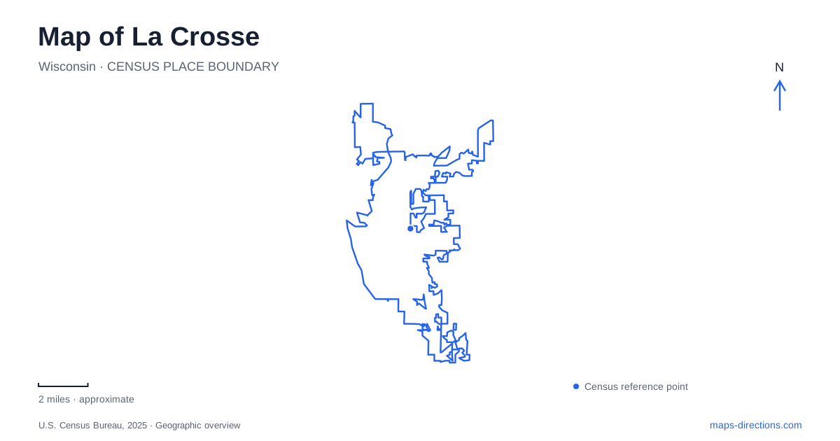
Street tiles load from OpenStreetMap when opened. The blue line shows the 2025 Census boundary.
- State
- Wisconsin
- Population · July 2025
- 50,784
- Land area
- 21.7 sq mi
- Water area
- 2.1 sq mi
La Crosse occupies a landscape where a downtown riverfront, island parks, marshland, and steep bluffs sit within the same urban view. The Mississippi establishes the broad western reference, while Grandad Bluff supplies an elevated perspective over the built-up valley. Between those extremes are places with quite different relationships to water. Riverside Park faces the main river beside downtown; Pettibone Park includes a lagoon across the channel; Myrick Park meets an extensive wetland farther inland.
The riverfront and the island opposite
Riverside Park lies between downtown and the Mississippi, with State Street providing a named street reference. Across the river, Pettibone Park offers a separate shore rather than an extension of the same promenade. Its lagoon and main-channel frontage create different water settings within one park. That distinction is visible on a detailed map and helps explain why photographs taken in the two places can show quite different surroundings.
Pettibone's history also complicates a simple reading of the state boundary. The site was once called Barron's Island and belonged to Minnesota. Albert Wells Pettibone bought the property in 1901 and gave it for public park use, but the island did not transfer to Wisconsin until 1918. City annexation followed in 1919. A map of La Crosse therefore includes a park whose public role began before its present political geography was established.
The park's built features record that long recreation history. A sandstone gazebo dates to 1902, and the standing bathhouse was designed by Otto Merman in 1926. The lagoon shelter and bridge followed in 1930 and 1931. These structures give the island more historical depth than the beach and disc golf symbols alone suggest.
Myrick Park meets the marsh
Myrick Park offers another way to understand water in the city. Its edge borders the river marsh, a wetland within the Mississippi floodplain. Trails extend from the park into this low landscape. On a local map, the green and blue areas are not vacant spaces awaiting development; the marsh stores and moves water while supporting a varied habitat.
The city purchased the park's original twenty acres in 1873. The grounds had served as a fairground and carried several names before becoming Myrick Park in 1904. Indigenous burial mounds are part of the site's history and deserve recognition alongside its later recreational uses. The location's story began long before municipal park development.
A large shelter built by the Works Progress Administration in 1941 used limestone quarried from Miller Bluff. That material creates a physical connection between the marsh-edge park and the high ground visible elsewhere in La Crosse. Reading the park and bluffs together reveals relationships that their separate map symbols can conceal.
The road to Grandad Bluff
Grandad Bluff Park opened in 1912 after a period when quarrying threatened the outcrop. Ellen Hixon helped secure support for its preservation, and a sculpture honors her contribution. The bluff is consequently both a scenic landmark and a record of civic decisions about which landscapes should remain public.
Bliss Road forms the important uphill approach, with Grandad Bluff Road identifying the park itself. The shelter was built by the WPA in 1938 using stone from the bluff's south side. During the centennial renovation, the shelter was restored and the overlook rebuilt, including work to stabilize eroding cliff faces. The viewpoint is an engineered public place within a steep natural setting.
From this height, La Crosse can be understood as a settlement shaped by the space between water and bluffs. The overlook is useful for grasping that larger pattern before returning to the individual streets and parks below.
Hixon Forest and the protected bluff network
The bluff landscape extends beyond Grandad. Hixon Forest and properties protected through Mississippi Valley Conservancy form a broader conservation network. Mathy Quarry is reached from County Road FA, while Miller Bluff is associated with Rim of the City Road. These are distinct destinations with their own terrain and access arrangements.
Miller Bluff includes oak woodland, prairie, and sandstone promontories overlooking the marsh. Parking is not permitted at its Rim of the City Road trailhead; visitors approach on foot from designated parking at County Road FA or Upper Hixon. The extra approach belongs in the route, particularly when estimating the extent of an outing.
A map of La Crosse becomes most useful when it preserves these differences in scale: the downtown waterfront for a street-level river walk, Pettibone for island recreation, Myrick for wetland access, and the bluffs for an elevated landscape. Together they explain how public spaces follow the area's water, stone, and relief.
Map and statistics: U.S. Census Bureau, 2025 Gazetteer, January 2025 generalized place boundaries and Vintage 2025 population estimates. Local references: City of La Crosse; Explore La Crosse; Mississippi Valley Conservancy. Article prepared by Maps & Directions.