Map of Kyle
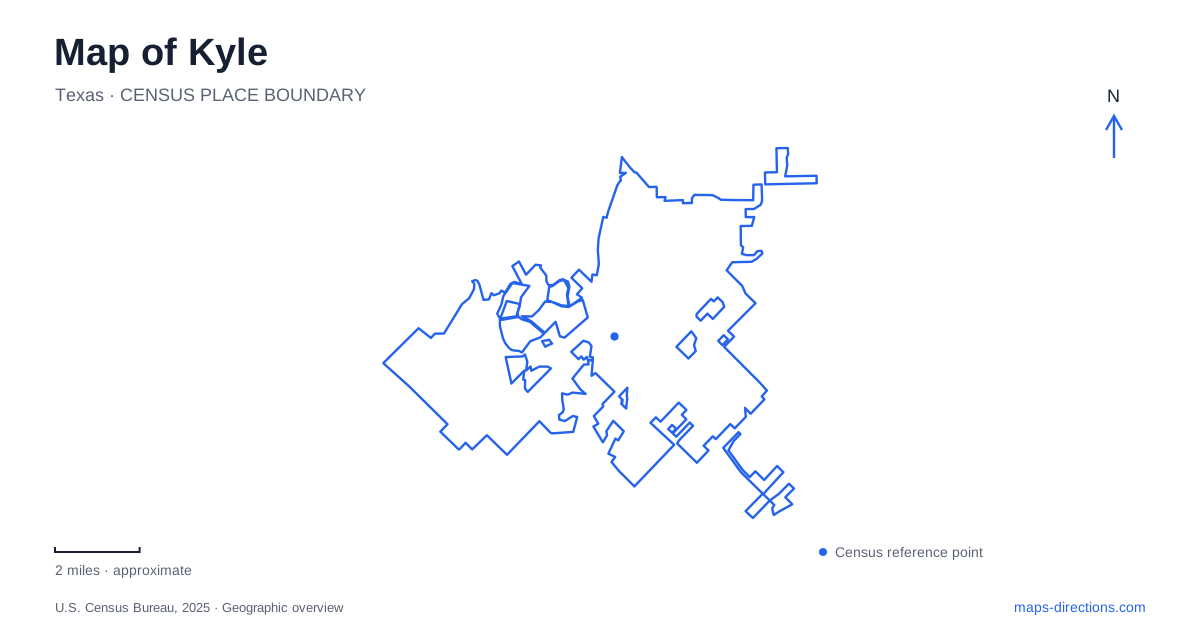
Street tiles load from OpenStreetMap when opened. The blue line shows the 2025 Census boundary.
- State
- Texas
- Population · July 2025
- 69,917
- Land area
- 32.4 sq mi
- Water area
- 0.2 sq mi
Kyle can be read through several different kinds of public space: an original town-center square, a large lake park, a creek corridor, and a newer gathering place in the Brick and Mortar District. These settings show how a growing community retains an older civic center while adding new recreation and neighborhood connections. The most useful map references are specific streets and landscapes, including Center Street, Lehman Road, Burnham Road, and Plum Creek, each of which organizes a different part of a local outing.
The square inherited from the original town plan
Mary Kyle Hartson Park occupies a compact downtown square at Main Street and West Center Street, with its visitor address at 101 South Burleson Street. The original 1880 town plat reserved a central gathering space here. In the early twentieth century, the building now called the Krug Activity Center was constructed as city hall, giving the square an enduring civic role.
The park's shade trees, benches, gazebo, and open areas continue to support gatherings. Its recognition as a Lone Star Legacy Park in 2025 acknowledges that long association with community life. On a street map, the square is more than a convenient patch of green among buildings: it is a surviving organizing feature of the town's original plan.
The nearby depot and present city hall reinforce the concentration of public history around the square. A short walk here can focus on how civic buildings and outdoor gathering space relate to one another, rather than treating the park as an isolated recreation site.
Center Street as a civic route
Center Street links the square area with Gregg-Clarke Park. The city uses this corridor for its Founders and Veterans Day parades, with routes described between the park and Front Street. These events make the street's role especially visible, but the relationship between the two public places exists throughout the year.
A map of Kyle therefore benefits from showing Center Street as a line connecting destinations, not simply as the road beside downtown. The street brings a historic gathering place into relation with a larger recreation park. That connection also helps explain why community events can occupy a route through town rather than remaining within one fenced or enclosed venue.
A lake landscape on Lehman Road
Lake Kyle Park stands at 700 Lehman Road near the Four Seasons Farm neighborhood. At about 118 acres, it is the city's largest developed park. The lake itself covers roughly twelve and a half acres, leaving much of the surrounding property available for trails, open space, and other recreation.
The park includes short walking paths, longer hiking trails, a fishing dock, a covered pavilion, and an inclusive playground. It also provides access to the Plum Creek Trail. This combination makes the lake a useful starting place for several kinds of outing: a brief walk near the developed facilities, a longer trail visit, or time beside the water.
The difference between the lake's size and the park's overall footprint is worth seeing on the map. The destination is not only a shoreline circuit. It is a larger landscape in which the water, recreation facilities, and creek connection occupy separate parts of the grounds.
Plum Creek and the evolving trail network
The city's parks master plan describes a roughly four-mile Plum Creek Trail route passing through the lake park, the preserve, undeveloped portions of Bunton Creek Park, and Waterleaf Park. The document also identifies opportunities to improve surfacing, signage, and the clarity of connections. Those recommendations should be understood as improvement needs, not as proof that every proposed feature has been completed.
The wider city vision extends the creek corridor toward Uhland in the east and the Blanco River in the west. That is a longer-term network concept. For a present outing, the developed sections and their actual park connections provide the meaningful route, while the regional line explains the direction of future ambitions.
La Verde and a newer neighborhood center
La Verde Park at 3901 Burnham Road belongs to the Brick and Mortar District, a pedestrian-oriented mixed-use development. Its performance pavilion and event lawn create a gathering focus, accompanied by water play, an all-abilities playground, a dog park, and sand volleyball.
The playground's wooden bobcat structure gives the site a distinctive form, with slides, climbing elements, and quieter enclosed spaces. The city's design description connects it with the native animal and the nearby university's identity. This is a deliberately designed neighborhood place, different in origin from the inherited downtown square.
Together, these spaces give Kyle several complementary centers. The original square preserves civic continuity, Center Street connects public destinations, the lake and creek provide a larger outdoor landscape, and La Verde brings gathering and play into a newer district. Their street and trail relationships make the city's growth easier to understand on a map.
Map and statistics: U.S. Census Bureau, 2025 Gazetteer, January 2025 generalized place boundaries and Vintage 2025 population estimates. Local references: City of Kyle. Article prepared by Maps & Directions.