Map of Knoxville
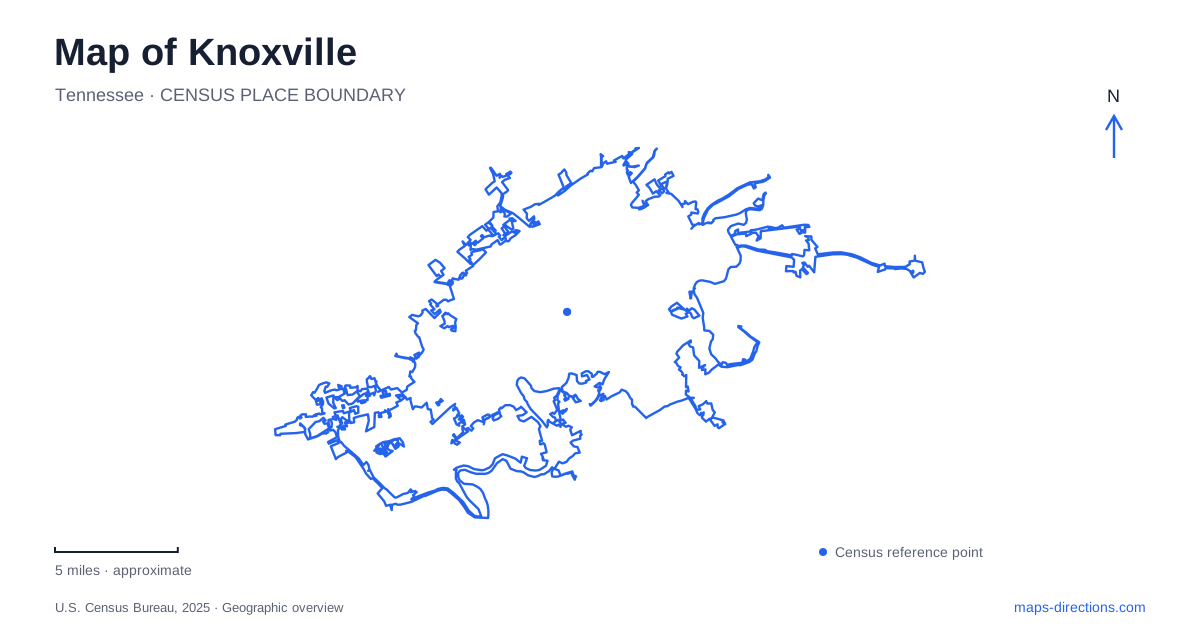
Street tiles load from OpenStreetMap when opened. The blue line shows the 2025 Census boundary.
- State
- Tennessee
- Population · July 2025
- 202,021
- Land area
- 98.7 sq mi
- Water area
- 5.5 sq mi
A map of Knoxville brings together several downtown settings within a relatively compact area, then opens into a much larger outdoor landscape across the Tennessee River. Gay Street supplies a historic commercial spine, Market Square creates an adjoining public gathering space, and the Old City preserves a different relationship with the railroad. World's Fair Park adds a twentieth-century landmark to that pattern. The river and southern trail system connect these urban stories with former quarry land and wooded recreation areas.
Gay Street and the spaces beside it
Gay Street has been central to the city since the 1790s. It hosted the 1796 constitutional convention associated with Tennessee statehood and later developed into a major commercial and entertainment corridor. The Lamar House, now the front part of the Bijou Theatre, was operating as a hotel by 1817. The Tennessee Theatre occupies the Burwell Building, part of the early twentieth-century rise of taller downtown buildings.
Those landmarks give Gay Street a sequence of recognizable places rather than a single center. Its theaters, commercial buildings and civic history make it useful for understanding how downtown Knoxville developed over time. The street also connects buildings of very different heights and ages, so the changing skyline becomes part of the historical evidence.
Market Square grew from land donated for a public market in 1854. A large enclosed Market House was later constructed there and demolished in 1960. Today's open space therefore has a different physical form from the market that once filled it. Strong Alley lies between the square and Gay Street, adding a small pedestrian connection within the larger downtown grid.
The railroad edge of downtown
The Old City occupies blocks near the railroad on the northeastern side of downtown. Jackson Avenue provides a useful reference for this district. Its history includes wholesale food businesses, flour and coffee production, meatpacking, saloons and residential communities, including African American families and European immigrants.
This was a working district with overlapping industrial, commercial and domestic uses. The name Old City can suggest that it encompasses every historic part of Knoxville, but its actual geography is more specific. Gay Street and Market Square have their own histories outside this small railroad-associated area.
Reading the districts separately makes their relationship clearer. The Old City reflects activity around freight and wholesale trade, while the central commercial streets supported a broader mix of shopping, public life and entertainment. Their proximity allows those different urban economies to be compared on foot.
The fairground that became a park
The Sunsphere and Tennessee Amphitheater survive from the 1982 World's Fair, whose theme was energy. The former fair site is now World's Fair Park, giving the city a recognizable open-space landmark beyond the older commercial blocks.
The Sunsphere's fourth level contains the observation deck. A welcome center on the third level opened in November 2024 and serves as the visitor entrance. Its elevated view takes in the park, downtown, the Tennessee River and the university area, making it especially useful for relating places that appear separately on a street map.
Within Knoxville, the fairground story is a distinct chapter of redevelopment. The surviving structures recall a temporary international event, while the park's continuing role is local and everyday. The site is therefore both a memorial to the fair and an active part of the city's public-space network.
River crossings and connected greenways
The Gay Street Bridge reopened to pedestrians and bicycles in December 2025 following repairs. Current city information describes those travel modes, so a saved route based on its older automobile use should not be assumed valid. The bridge's historical place in the street network and its present operation need to be read together.
The Neyland and Second Creek greenways provide additional routes through the central area. Their junction gives walkers and cyclists a choice between continuing along the broader river corridor and heading north along Second Creek. These greenways add a different pattern to the map from the streets used by vehicles.
Quarry landscapes south of the river
The Urban Wilderness is a connected system of recreation areas, including Ijams Nature Center, William Hastie Natural Area and Baker Creek Preserve. It is not one continuous municipal park with a single entrance. Different partners manage the places joined by its trails.
At Ijams, Mead's Quarry Lake occupies a former marble quarry, making industrial history visible in an outdoor setting. The center publishes trail maps and closure information because individual routes can be unavailable; its current notice identifies Toll Creek as closed. Other trails and quarry areas have their own alignments within the larger network.
This southern landscape gives a Knoxville map a final change of scale. Downtown can be understood through streets, squares and buildings, while the Urban Wilderness depends on connected trailheads, natural terrain and the remains of earlier land uses.
Map and statistics: U.S. Census Bureau, 2025 Gazetteer, January 2025 generalized place boundaries and Vintage 2025 population estimates. Local references: Visit Knoxville / Knoxville History Project; Visit Knoxville; Worlds Fair Park; City of Knoxville; Ijams Nature Center. Article prepared by Maps & Directions.