Map of Killeen
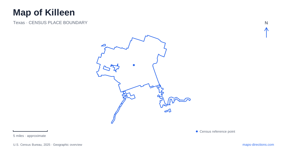
Street tiles load from OpenStreetMap when opened. The blue line shows the 2025 Census boundary.
- State
- Texas
- Population · July 2025
- 161,883
- Land area
- 54.6 sq mi
- Water area
- 0.7 sq mi
Killeen has two strongly visible historical foundations: a railway town serving the surrounding agricultural country and a community transformed by a major military installation. Its map also contains a third, everyday landscape of creekside paths, recreation grounds, and educational campuses. Understanding how these pieces fit together gives a more useful picture than defining the entire city by the fort. The old commercial blocks, military museum, and southern university each represent a different period and a different pattern of development.
A railway town before the military expansion
The Gulf, Colorado and Santa Fe Railway purchased land between the rural communities of Sugar Loaf and Palo Alto as it extended west from Belton toward Lampasas. Its town plan contained seventy blocks on a 360-acre tract. The first scheduled train arrived in 1882, beginning an era in which agricultural shipments helped sustain the settlement. Cotton, wool, and grain connected local farms to a much wider market.
The long, narrow lots surviving in the historic district are evidence of that commercial origin. They produced a different urban grain from the large institutional properties and recreation complexes found elsewhere today. On a detailed map, closely spaced storefront parcels tell part of the story that a regional highway view misses. Killeen was already a functioning trading community decades before Camp Hood opened in 1942 and changed its prospects on a much larger scale.
Avenue D and the reuse of an old school
The restored Santa Fe Depot now houses the chamber of commerce. Nearby Avenue D belongs to the early business landscape, while mid-century buildings reflect subsequent growth associated with the military community. The National Register downtown district occupies the area between Avenue B and Santa Fe Plaza, from North Fourth to North Eighth streets. Historic properties also extend beyond those bounds.
City Hall adds another layer to this geography. Its building opened as a school in 1924 after a fire destroyed the earlier school on the site. Acquired by the city in 1993, it became City Hall in 1995. The red-brick exterior and original entrance markers survive, while the former cafetorium became the council chamber. This is a useful example of civic continuity: a public building retained a community role even as its everyday purpose changed. The historic center consequently includes both commercial preservation and the reuse of educational architecture.
A museum at the edge of the installation
The National Mounted Warrior Museum introduces the military history shaping Killeen without making a museum visit equivalent to entering the operational post. It opened to the public in September 2024 on a seventeen-acre site near the main gate. Army information distinguishes its public access from installation entry: a visitor pass is not required for the museum itself.
Its subject extends from mounted soldiers on horseback to mechanized warfare, connecting individual service stories with changes in equipment and military organization. The location is significant. A museum positioned beside the installation can explain the institution's history to civilians while the surrounding post continues to function as a working military place. For routes to other facilities inside Fort Hood, access-control requirements still apply; the museum's arrangement should not be generalized to destinations elsewhere on the installation.
Two different settings for a walk
Nolan Creek supplies a recreational corridor through the developed city. The Andy K. Wells Hike and Bike Trail follows the creek and serves a group of facilities including the community center, athletic complex, amphitheater, and Rotary Children's Park. Its 2.5-mile paved route provides both exercise space and connections with adjoining neighborhoods. The concentration of these uses along water gives this part of Killeen a shared linear setting rather than a collection of isolated parks.
Lions Club Park offers another pattern at 1600 East Stan Schlueter Loop. Its trail, opened in 2011, winds around the recreation grounds. The park map shows inner and outer circuits alongside ballfields, playgrounds, a family recreation center, and an aquatic center. Those circuits allow a walk to be combined with activities elsewhere in the complex. The creek corridor emphasizes movement between places; the Lions grounds support different activities gathered within one recreation area.
The university’s campus pattern
Texas A&M University–Central Texas became a member of the university system in 2009. Its campus address is 1001 Leadership Place, with the approach from TX-201. University planning documents locate the developed core in the northwestern part of the property, parking toward its northern edge, and campus buildings south of the loop road.
This arrangement contrasts with the narrow commercial parcels of the railway town. Academic development works at the scale of a planned campus, with buildings and circulation organized within a larger site. Reading the university, downtown, creek corridor, and fort together shows why Killeen cannot be understood through a single central district: several distinct landscapes contribute to its daily geography.
Map and statistics: U.S. Census Bureau, 2025 Gazetteer, January 2025 generalized place boundaries and Vintage 2025 population estimates. Local references: City of Killeen; Visit Killeen; National Mounted Warfare Foundation; United States Army; Department of Defense; Greater Killeen Chamber of Commerce; Texas A&M AgriLife Research; Texas A&M University Central Texas. Article prepared by Maps & Directions.