Map of Kent
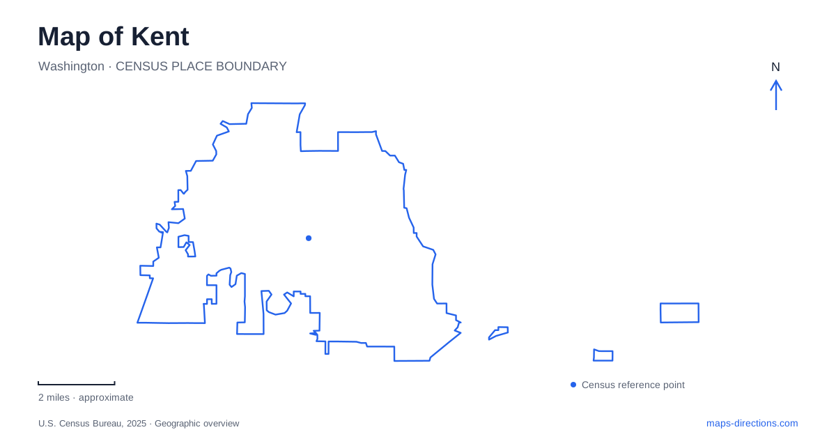
Street tiles load from OpenStreetMap when opened. The blue line shows the 2025 Census boundary.
- State
- Washington
- Population · July 2025
- 134,871
- Land area
- 33.6 sq mi
- Water area
- 0.6 sq mi
Kent is not a flat collection of interchangeable neighborhoods. Municipal geographic material divides it into East Hill, the Valley and West Hill, with downtown on the eastern side of the valley and the Green River flowing north through the lowland. That framework is the most useful starting point for a map. It explains why two addresses with similar straight-line separation can involve quite different approaches, and why the destination's position relative to the hills matters as much as its distance from downtown.
Read the valley before reading individual blocks
The lowland contains substantial warehouse and employment areas as well as the river corridor. A large roof or industrial block is therefore not unusual on a broad aerial view. Downtown occupies a different setting within that valley geography. Distinguishing those land uses helps avoid the assumption that a city-center marker represents every major destination nearby. A workplace entrance, a civic destination and a riverside park can require different local approaches even if they share the same general lowland setting.
East Hill and West Hill are geographic orientation terms rather than interchangeable names for opposite sides of one downtown street. When a route appears to climb out of the valley, the overview should retain enough surrounding terrain to make that transition clear. The article does not assign a grade to particular roads or claim a journey is suitable for every walking or cycling ability. The terrain framework instead tells a reader which details need closer inspection.
Two rail destinations must not be confused
Kent Station is the Sounder destination associated with downtown. Sound Transit identifies it with the S Line and local bus connections. A train journey should retain the service name, not merely the city's name, because another rail destination includes the same place name. The operator's station map and alerts also matter for platform and parking access; those details can change independently of the city's street pattern.
Kent Des Moines Station is a separate destination, with Sound Transit listing its address at 23525 30th Avenue South. It should not be substituted for the downtown Sounder stop. The complete station name and intended rail service are therefore essential search terms. A regional map may show both within a manageable screen area, but that visual proximity does not make their entrances, parking or onward connections equivalent.
Lake Meridian belongs to the hill-side picture
The city's park information places Lake Meridian Park at 14800 Southeast 272nd Street and identifies it with East Hill. The lake gives this side of the map a strong landmark distinct from the Green River valley. Its park includes a designated beach, fishing dock, boat access, a playground and a paved walking path. Those uses explain why different visitors may need different arrival details within the same destination.
On a Kent recreation map, select the park rather than an arbitrary point on the lake's shoreline. A waterbody outline describes extent, not public access. A person meeting at the dock should identify that feature, while someone attending a shelter gathering needs the shelter information. The shared lake name is useful at the city scale; the park's own layout becomes more useful once the general location is established.
Russell Road identifies another recreation corridor
Municipal park material places both Hogan Park and Van Doren's Landing along Russell Road. These names provide lowland references that differ from Lake Meridian's hill setting. They should remain separate saved destinations rather than being shortened to “river park.” The city's maps and facility descriptions identify particular recreation sites; the continuous road name does not imply that the sites form one uninterrupted public facility.
For a trip using the Green River Trail, consult the trail map as well as the road map. A path beside a river answers a different movement question from a road leading to a park entrance. The correct access point depends on the intended segment and direction of travel. Planning material can also contain proposed connections, so read the legend before assuming that every line represents an existing path available for use.
Match the map scale to the destination
A useful Kent overview has three layers of meaning: the valley and hills explain the terrain, the fully named stations explain transit choices, and individual parks explain recreation access. Begin by placing the destination within that framework, then zoom to its entrance or platform. For a multi-stop trip, keep the differences visible rather than grouping places only because their labels look close together. This creates a geographic plan that remains useful without pretending to know current traffic, parking availability or service disruptions.
Map and statistics: U.S. Census Bureau, 2025 Gazetteer, January 2025 generalized place boundaries and Vintage 2025 population estimates. Local references: City of Kent; Sound Transit. Article prepared by Maps & Directions.