Map of Kenosha
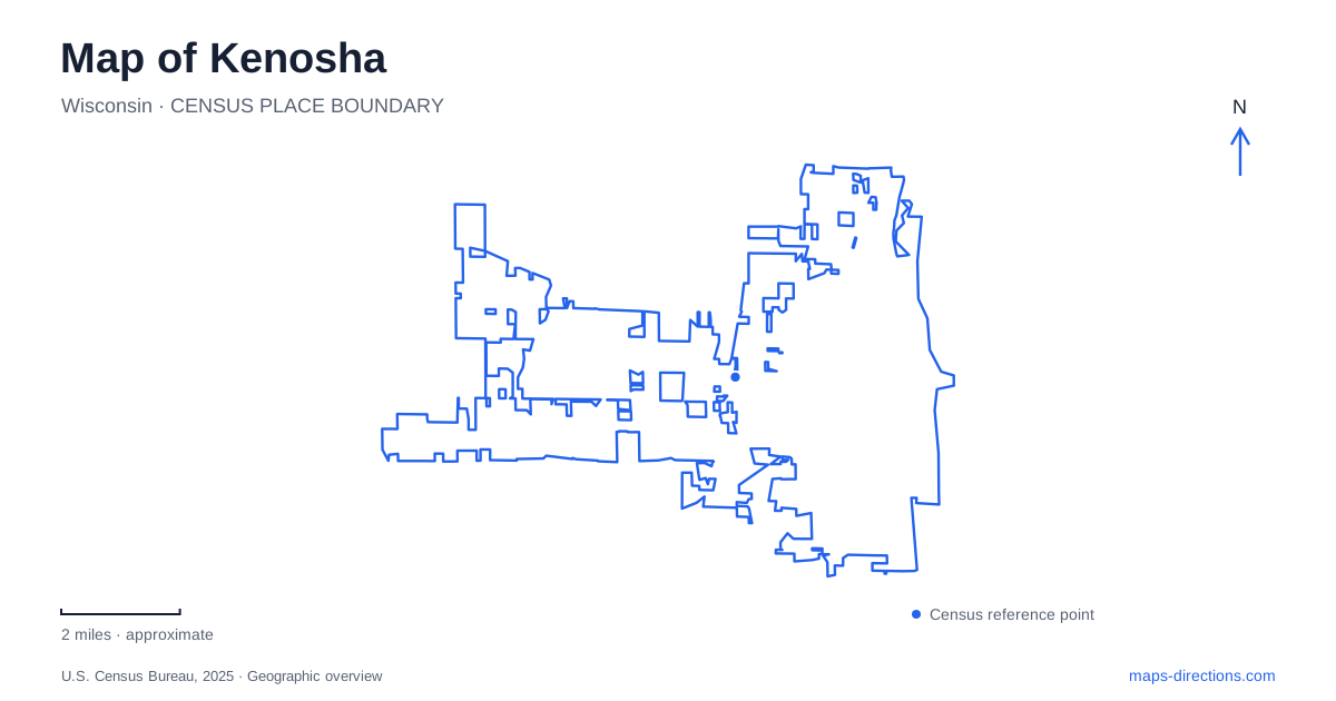
Street tiles load from OpenStreetMap when opened. The blue line shows the 2025 Census boundary.
- State
- Wisconsin
- Population · July 2025
- 99,239
- Land area
- 29.6 sq mi
- Water area
- 0.1 sq mi
Kenosha's downtown map is shaped by Lake Michigan, a harbor entrance, and a numbered street system that separates several cultural destinations. First Avenue places visitors near the lakefront museums, Tenth Avenue locates the dinosaur museum, and Thirteenth Avenue identifies the passenger rail station. Across the harbor, Simmons Island holds another historical cluster. These places are connected by the broader downtown street network, but their positions on opposite sides of the water remain important when planning a visit.
The streetcar links rail and waterfront
The restored electric streetcars follow a roughly two-mile loop through downtown and HarborPark, connecting the lakefront setting with the Metra station. The route gives a useful overview of the city's central geography because it passes commercial streets, historic districts, and the waterfront neighborhood within a compact circuit.
Metra lists the station at 5414 Thirteenth Avenue. That address places regional rail arrival inland from the museums on First Avenue. A traveler arriving by train therefore has a second, local stage to the journey, whether continuing on foot or by streetcar. The streetcar loop and the longer commuter railway serve complementary purposes rather than representing the same service.
The tourism bureau identifies the Civic Center and Pearl Street historic districts among the areas visible along the loop. It also distinguishes the museums and lighthouses across the harbor from the attractions directly along the streetcar route. For a first look at Kenosha, that combination of movement and orientation can be more informative than treating the lakefront as one uninterrupted destination.
Three museums, two principal settings
The Public Museum is at 5500 First Avenue, while the Civil War Museum is at 5400 First Avenue. Their neighboring addresses create a clear lakefront museum grouping. The former covers natural sciences and fine and decorative arts; the latter examines the war through the experiences of the Upper Middle West, including soldiers, civilians, and the home front.
The Civil War Museum's regional emphasis matters when interpreting its location. It is not presented as a battlefield site. Instead, its exhibits connect this part of the country with the people and resources involved in the conflict. This gives the waterfront institution a historical purpose different from a preserved military landscape.
The Dinosaur Discovery Museum stands at 5608 Tenth Avenue, farther inland. Its main gallery explores the relationship between theropod dinosaurs and birds, and its work connects with the Carthage Institute of Paleontology. A museum itinerary should therefore include the Tenth Avenue address explicitly rather than assuming all three institutions share the First Avenue site.
Simmons Island and two distinct lights
Across the harbor, the county historical society's campus combines the history center with the Southport Light Station Museum. The light station stands on the hill above the history-center building. Its ensemble consists of the 1866 lighthouse and an adjacent keeper's home dating to 1867; the restored home interprets a later, early-twentieth-century period in the building's use.
For a maritime map of Kenosha, the Southport tower should be distinguished from the red North Pier Lighthouse. The latter dates to 1906 and still functions as the harbor's navigational light. One structure belongs to a museum setting on Simmons Island, while the other marks the pier at the water's edge.
The tourism bureau lists the light-station museum at 5117 Fourth Avenue and the history center at 220 Fifty-first Place. Those addresses, together with the harbor outline, clarify the relationship between the hilltop historical buildings and the pier. Seeing both lights from another part of the waterfront does not make them the same destination.
Inland nature follows the Pike River
Petrifying Springs Park offers a different landscape from downtown's lakefront. Located in neighboring Somers, it contains wooded terrain and the meandering Pike River. The municipality's account describes the river basin and the higher glacial shoreline landforms around it, explaining why the park feels geographically distinct from the central harbor.
A Kenosha-area map should retain the Somers label for this outing. The park is a county recreation destination, not another stop on the downtown streetcar loop. Its paths follow a wooded river setting, whereas the central museums and piers belong to the built waterfront.
The strongest orientation comes from preserving these contrasts within the map itself: Thirteenth Avenue for regional rail, the downtown streetcar circuit, First Avenue's paired museums, Tenth Avenue's dinosaur collection, Simmons Island's historical campus, and the Pike River parkland beyond the city center. Together they explain how Kenosha's cultural and outdoor destinations are distributed around both lake and inland water landscapes.
Map and statistics: U.S. Census Bureau, 2025 Gazetteer, January 2025 generalized place boundaries and Vintage 2025 population estimates. Local references: City of Kenosha; Metra; Visit Kenosha; Kenosha Public Museums; Kenosha County Historical Society; Village and Town of Somers. Article prepared by Maps & Directions.