Map of Kenner
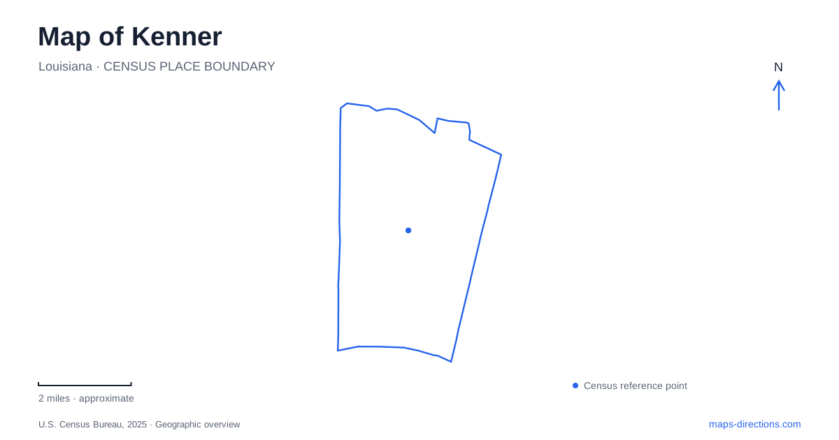
Street tiles load from OpenStreetMap when opened. The blue line shows the 2025 Census boundary.
- State
- Louisiana
- Population · July 2025
- 65,136
- Land area
- 14.9 sq mi
- Water area
- 0.2 sq mi
Kenner stretches between two very different waterfronts. Rivertown faces the Mississippi River, while Laketown occupies the Lake Pontchartrain edge. Williams Boulevard provides a useful reference between these districts, and the airport introduces another major transportation landscape. The city's history moves from river trade and railways through market gardening to aviation and suburban growth. Its map becomes clearer when those successive uses are kept distinct.
The early town joined river and railway transport
The city's historical chronology identifies March 2, 1855, as the date surveyor W. T. Thompson completed the future town's map. The settlement known as Kennerville developed on the New Orleans–Jackson railway line, close to the Mississippi River. This combination placed two important transportation systems beside one another.
Later, small market gardens supplied produce to the region. Italian and German families were among those who cultivated these plots. A streetcar line operated between the local riverfront district and New Orleans from 1915 to 1931, helping connect growers with the French Market.
These earlier routes explain why Kenner's old center lies at the river rather than beside the modern interstate. The river, railway and streetcar supported a commercial geography that preceded airport traffic and large-scale residential expansion. Present streets occupy a landscape whose organizing routes have changed over time.
Rivertown combines preservation with later interpretation
Rivertown is the historic district near the southern end of Williams Boulevard. The city targeted the original Kennerville area for renewal during the 1980s, developing the cultural identity associated with the district today. Its theaters, science attractions and public spaces occupy that renewed setting.
La Salle's Landing marks the river end of the boulevard. The city describes the association with the explorer as a believed landing location, which is more careful than treating the exact spot as conclusively established. The monument is part of the way local history is commemorated along the waterfront.
Heritage Park adds another interpretive layer. Its replica structures evoke earlier local buildings, including a hardware store. A replica can help explain a vanished streetscape, but it should not be confused with an original building surviving unchanged on its historic site. Rivertown contains both historical associations and deliberate later interpretation.
Science and theater share the historic district
The planetarium and Megadome Cinema form part of Rivertown's cultural cluster. The associated space-science complex includes an International Space Station prototype and interactive exhibits, while the performing-arts theaters provide a different kind of public program nearby.
Their presence shows how Kenner's historic district has acquired functions beyond preservation alone. Astronomy presentations and space-technology exhibits do not describe the old town's original land use; they are educational attractions introduced into its renewed civic setting. That distinction explains why a historic-district map can contain destinations concerned with subjects far beyond local history.
The cluster is best read as several venues within one district. A theater performance, a planetarium program and an outdoor event at Heritage Park have separate spaces and schedules, even when promotional material presents them under the same Rivertown name.
Laketown faces a different body of water
At the northern end of Williams Boulevard, Laketown meets Lake Pontchartrain. The lakefront park provides boating, fishing and picnic facilities, with paths and open space along the water. The Pontchartrain Center adds an event venue in the same broader lakefront area.
This is Kenner's second waterfront identity. The broad lake edge differs from the riverfront landing and its historic trade connections. Both can appear under a general waterfront search, but they occupy opposite ends of the city's organizing boulevard and serve different settings.
The distinction also helps separate the park from neighboring commercial and event properties. Laketown names an area and its public recreation landscape; it is not a single building with one entrance. The individual destination remains important within that wider district.
The airport terminal changed the arrival geography
Louis Armstrong New Orleans International Airport opened its replacement terminal on November 6, 2019. The passenger terminal's address is 1 Terminal Drive. This replaced the earlier passenger facility associated with Airline Drive, changing the location travelers needed to reach within the airport property.
Later roadway improvements integrated the Interstate 10 flyover project with airport access roads. The airport's completed-project description records the widening and connection work, making clear that the road layout continued to evolve after the terminal opened.
The airport serves the wider metropolitan region, but its physical setting is in Kenner. That distinction between the name of the region served and the location of the facility is central to reading the map. Rivertown, Laketown and the terminal each represent a different kind of arrival: the historic river-and-rail center, the recreational lake edge, and a modern aviation complex whose entrance changed substantially in 2019.
Map and statistics: U.S. Census Bureau, 2025 Gazetteer, January 2025 generalized place boundaries and Vintage 2025 population estimates. Local references: City of Kenner; Visit Jefferson Parish; Louis Armstrong New Orleans International Airport; Southwest Airlines. Article prepared by Maps & Directions.