Map of Keizer
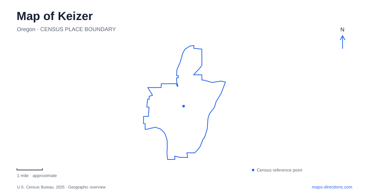
Street tiles load from OpenStreetMap when opened. The blue line shows the 2025 Census boundary.
- State
- Oregon
- Population · July 2025
- 39,140
- Land area
- 7.2 sq mi
- Water area
- 0.1 sq mi
Keizer's street map is easier to understand when the Willamette River and Claggett Creek are treated as active influences on settlement, not simply blue features beside residential blocks. Flooding shaped where people built, a school changed locations as the community expanded, and public parks developed from several kinds of land. Chemawa Road links important civic and recreational destinations, while the riverfront provides a wider setting for understanding the city's relationship to the valley.
Higher ground and the modern community
The municipal history describes the destructive Willamette Valley flood of 1861 and later settlement on higher ground. It also records repeated twentieth-century floods before river regulation helped encourage more substantial development in the 1950s. Even then, the flooding of 1964–65 showed that the river remained a major influence. The landscape's history is therefore more complicated than a straightforward progression from farms to houses.
Keizer became a city in 1982, joining with the Clear Lake community to the north. That northern area had its own agricultural identity around Wheatland and Clear Lake roads, with orchards, hop yards and berry fields. Incorporation brought together places that already had established patterns of land use. The river landscape, road alignments and farming communities had shaped the area before the municipal boundary was established.
A school building that no longer marks its original site
The historic 1916 school began at River and Chemawa roads, replacing an earlier one-room building. It originally had four classrooms and a basement, and later additions reflected the area's growth. As newer schools took over and the old complex became unsuitable, residents organized to preserve the original portion rather than lose the whole building to redevelopment.
The surviving school was moved away from its first site and ultimately placed beside the civic complex. It now houses the Keizer Heritage Museum within the cultural center at 980 Chemawa Road NE. A visitor looking for the historic building should therefore use its present address rather than assume it remains at the old school corner. This is a case where architectural survival depended on relocation, so the building and its original geographic setting have different histories.
The museum opened in 1999 and preserves material from the school and wider community. Its location beside City Hall brings local memory and present government into the same small civic area. The building is not a reconstructed schoolroom erected for display; it is a surviving structure adapted to cultural use after decades of education and community activity.
The rapids name is older than the park
Keizer Rapids Park occupies riverfront land reached from 1900 Chemawa Road N. The rapids themselves were a recognized river feature long before the city incorporated or the present park was created. The city traces the name to the Keizur family, whose surname appears with different spellings in historic records. An old reference to the rapids should consequently not be read as evidence that today's park facilities already existed.
The 148-acre park combines former private parcels with state-owned land historically called Beardsley Bar. A regional task force formed in 2003 to help bring the project together, and community contributions supported later amenities. This assembled ownership history explains why the park is more than a single former municipal lot. River access, recreation and conservation were brought together across land with several earlier identities.
Riverfront recreation has several distinct zones
The park's contemporary landscape includes forest, more open recreation spaces, a boat ramp, an amphitheater, a dog park and the Big Toy playground. The city's parks inventory identifies a conservation easement in the forest near the ramp. That protected setting has a different purpose from the developed play areas, even though both appear inside the same park outline.
The amphitheater and playground are recognizable fixed destinations, whereas the paths allow movement through a broader river landscape. A gathering at one of those facilities should not be reduced to an undifferentiated riverfront pin. The different spaces reflect the park's combined roles as an outdoor venue, neighborhood recreation destination and corridor beside the Willamette.
Claggett Creek offers another kind of green space
Claggett Creek Park lies between the Chemawa and Dearborn approaches, with parking at both ends. The city acquired the park through a transfer in 1983 after an earlier purchase from the Hardman family in 1963. Its playing fields, picnic spaces and playground create an established community park, while the creek and adjoining wetlands retain the importance of water within the neighborhood landscape.
In Keizer, the smaller creek park and the larger riverfront park should be understood alongside the historic school and Clear Lake's agricultural past. Each expresses a different part of the community's development. The resulting map is a record of movement and adaptation: settlement shifted toward higher ground, a school moved to survive, and public recreation took shape around waterways that long predate the streets surrounding them.
Map and statistics: U.S. Census Bureau, 2025 Gazetteer, January 2025 generalized place boundaries and Vintage 2025 population estimates. Local references: City of Keizer; Keizer Heritage Museum. Article prepared by Maps & Directions.