Map of Kearny
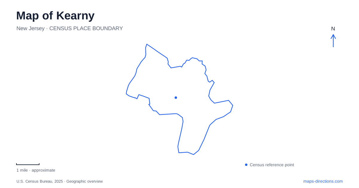
Street tiles load from OpenStreetMap when opened. The blue line shows the 2025 Census boundary.
- State
- New Jersey
- Population · July 2025
- 40,862
- Land area
- 8.8 sq mi
- Water area
- 1.4 sq mi
Kearny occupies a landscape between two rivers, but its developed areas have very different characters. The Passaic side contains residential neighborhoods and a long waterfront recreation corridor. Farther east, the Meadowlands and industrial districts occupy a much larger landscape of marshes, infrastructure, and employment sites. The Passaic and Hackensack rivers converge near the southern tip and flow into Newark Bay, giving the town a shape that cannot be understood from its central shopping streets alone.
A town between the rivers
Municipal planning documents divide the territory into a predominantly residential western section, an eastern section within the Meadowlands District, and a primarily industrial southern tip. Interstate 280 and the New Jersey Turnpike pass through the southeastern area. A highway view of warehouses and interchanges therefore presents only one part of the municipality; the residential streets and riverbank parks occupy a different setting.
This distinction is particularly useful when comparing addresses on Passaic Avenue with industrial destinations toward the Hackensack side. Both belong within the same municipal outline, yet they serve different patterns of movement. The map contains a neighborhood-scale street network as well as regional freight and highway infrastructure.
Kearny was established on March 14, 1867, and named for the Civil War major general who had lived at the Belle Grove estate. Today's Belgrove Drive preserves a connection to that estate's name and location. The general died at the Battle of Chantilly; the riverbank's Chantilly Park recalls that same historical association in a public landscape.
Passaic Avenue and the riverbank
Riverbank Park follows the western side of town along Passaic Avenue between Bergen Avenue and Belleville Turnpike. Its named sections include Centennial Orchard, Keating Cove, and veterans' memorial space. These smaller names describe places within the longer waterfront corridor rather than separate regional parks scattered around the municipality.
Near Bergen Avenue, the Frank A. Vincent Marina provides a boat-launching location. The Michael Branin Memorial Soccer Facility occupies the stretch between Bergen Avenue and Afton Street, while the roller-hockey facility is near Afton. The riverfront thus combines access to the water with playing facilities on land. A map showing only a continuous green strip can conceal those different uses.
The boathouse dock received a completed reconstruction documented by the town in October 2025. The project included a 240-foot dock, composite decking, native pollinator plantings, a steel bulkhead, and bank stabilization. It supports rowing crews from Kearny and neighboring Nutley and Belleville. That shared use gives this section of waterfront a regional sporting role while keeping it physically tied to the Passaic shore.
Schuyler Avenue's sports grounds
Gunnell Oval, at 490 Schuyler Avenue, forms another major recreation concentration. The municipal directory lists baseball, softball, soccer, basketball, tennis, volleyball, a playground, and a skate park. Harvey Field, at 280 Schuyler Avenue, provides a separate soccer complex and children's playground farther along the same avenue.
The Oval's reconstruction project began in 2019 with more than playing surfaces in mind. Its published design addressed frequent flooding associated with the nearby marsh through drainage, detention, and discharge improvements. This history explains why a sports complex here also appears in discussions of stormwater infrastructure: recreational land and wetland geography are closely related in this part of town.
For a map of Kearny, Schuyler Avenue consequently serves as a useful organizing line. It connects major field destinations while bringing the residential side of the municipality toward the broader eastern landscape. The grounds are substantial destinations in their own right, rather than extensions of the Passaic riverbank facilities.
West Hudson Park's shared landscape
West Hudson Park spans the boundary with Harrison. The county describes a 46-acre landscape centered on two-acre Fairy Lake, with scenic bridges and paths through tree groves. Its early history reaches back to 1888, although the county's land-purchase bond approval came in 1902 and further construction began in 1910.
This is a different park form from the elongated riverbank corridor or the concentrated sports fields at Gunnell Oval. The lake and its surrounding paths establish an interior landscape, while the municipal boundary passes through the larger setting. Searching under either adjoining town can therefore lead to references to the same county park.
Together, the Passaic shore, Belgrove Drive's historical association, Schuyler Avenue's grounds, and the eastern industrial landscape provide a coherent reading of Kearny. They show how river access, local neighborhoods, public recreation, and regional infrastructure occupy distinct but connected parts of the town.
Map and statistics: U.S. Census Bureau, 2025 Gazetteer, January 2025 generalized place boundaries and Vintage 2025 population estimates. Local references: Town of Kearny; Hudson County. Article prepared by Maps & Directions.