Map of Kalamazoo
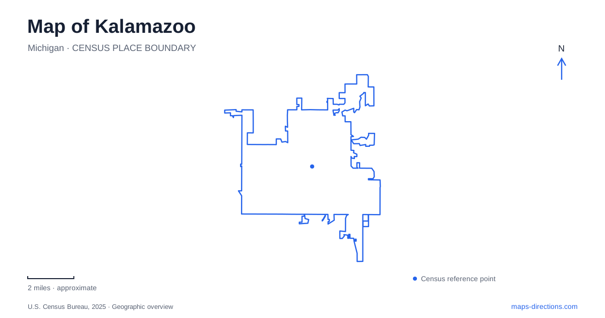
Street tiles load from OpenStreetMap when opened. The blue line shows the 2025 Census boundary.
- State
- Michigan
- Population · July 2025
- 72,683
- Land area
- 24.6 sq mi
- Water area
- 0.4 sq mi
Kalamazoo is easiest to understand through three different landscapes: the compact downtown, the riverfront around Mills Street, and the university-associated lands toward Parkview Avenue. Downtown contains museums, public gathering places, and a shopping street with an important pedestrian-design history. The riverfront adds sports and trails, while Asylum Lake connects outdoor recreation with education and conservation. Each setting contributes something different to the city's identity and requires a different scale of map reading.
Downtown's outdoor shopping landmark
The Kalamazoo Mall opened in 1959 as the country's first outdoor pedestrian mall. Its historical importance lies in treating a downtown shopping street as a place for people to linger, rather than simply as a route for vehicles passing through. Today, its businesses occupy a setting that includes restored Art Deco buildings, shops, cafes, and restaurants.
The word mall can be misleading for someone expecting one enclosed building beside a large parking field. Here it describes a downtown street environment woven into surrounding blocks. That distinction makes nearby intersections and individual business addresses more useful than searching for a single shopping-center doorway. It also helps explain why the area works naturally with visits to other downtown cultural destinations.
Rose Street, Park Street, and public culture
Bronson Park occupies one of the city's original blocks at 200 South Rose Street. Named for founder Titus Bronson, it is the oldest municipal park and has long served as a gathering place. Shaded benches, paved paths, sculptures, and memorials make it a recognizable civic space even when no event is taking place.
The Institute of Arts stands at 314 South Park Street, with access from South and Lovell streets. Its focus on visual art supplies a different kind of public experience from the outdoor park. Farther along the Rose Street axis, the Valley Museum occupies 230 North Rose Street and includes a planetarium. Together, these institutions create several possible downtown visits without requiring every outing to revolve around shopping or a scheduled performance.
Kalamazoo also has an important festival landscape at Arcadia Creek Festival Place. Event admission, ordinary park access and use of the pedestrian bridge are separate questions within that site. Redevelopment drawings describe ideas for changing the grounds, rather than guaranteeing the availability of each feature. Consult the city's park and event information for the visit you intend to make, especially when an itinerary depends on crossing the creek or entering the festival enclosure.
Mills Street and the riverfront
Mayors' Riverfront Park is at 251 Mills Street. Its recreational uses include a canoe and kayak launch, paved paths, picnic space, a playground, and basketball facilities. The Growlers' baseball field and Soisson-Rapacz-Clason Field give the area a strong sporting identity as well.
The park connects with the Kalamazoo River Valley Trail, extending the possibilities beyond a visit contained inside the grounds. This is a different outdoor setting from Bronson Park: the river and trail provide a linear connection through the landscape, while sports fields and gathering spaces occupy larger parcels alongside it. A ballgame, a trail outing, and a paddling trip can share the same general district while using quite different portions of the site.
Parkview Avenue and the watershed
Asylum Lake Preserve occupies approximately 274 acres at Drake Road and Parkview Avenue. Western Michigan University's ecological description identifies two lakes and a mixture of prairie, oak savanna, forest, wet meadow, and marsh. The preserve is consequently more varied than a simple loop around one body of water.
The water system helps explain its geography. Asylum Lake drains into Little Asylum Lake and then toward the West Fork of Portage Creek. Parkview Avenue forms the preserve's southern boundary, with the university's engineering and research development on the other side. This juxtaposition places academic facilities beside land used for passive recreation, research, and environmental education.
The preserve's name also recalls its institutional history. Land here was acquired for a state hospital colony-farm experiment in the nineteenth century. The former complex was eventually abandoned, and most structures were removed in the early 1970s. The present open landscape therefore carries a history of medical use and later conservation, rather than representing untouched land outside the city.
Reading these settings together gives Kalamazoo a clearer shape. The downtown mall and civic park emphasize public urban life, the Mills Street district brings recreation to the river, and the Parkview landscape connects the university with a protected watershed. Their differences are part of what makes the city's geography useful to explore.
Map and statistics: U.S. Census Bureau, 2025 Gazetteer, January 2025 generalized place boundaries and Vintage 2025 population estimates. Local references: Discover Kalamazoo; Kalamazoo Institute of Arts; Kalamazoo Valley Museum; City of Kalamazoo; Kzoo Parks; Western Michigan University. Article prepared by Maps & Directions.