Map of Jurupa Valley
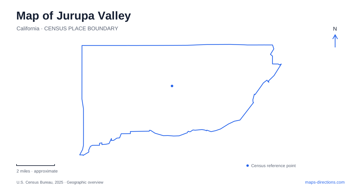
Street tiles load from OpenStreetMap when opened. The blue line shows the 2025 Census boundary.
- State
- California
- Population · July 2025
- 107,311
- Land area
- 42.9 sq mi
- Water area
- 0.7 sq mi
Jurupa Valley is easier to understand as a group of established communities than as a city organized around one traditional downtown. Municipal housing documents describe nine distinct communities, including older neighborhoods such as Rubidoux, Mira Loma, Belltown, and Glen Avon. Those names remain useful geographic references alongside the city name. Limonite Avenue identifies the municipal offices, Granite Hill Drive leads into a hillside educational landscape, and Crestmore Road serves regional recreation near the Santa Ana River. Together, these places reveal a map shaped by settlement, agriculture, rocky terrain, and the river corridor.
Community names and the civic address
City Hall stands at 8930 Limonite Avenue. This provides a definite civic destination, but it should not erase the older community identities that appear in local addresses and descriptions. A reference to Rubidoux or Glen Avon supplies neighborhood context within Jurupa Valley, while the municipal address identifies a particular administrative building. The two kinds of label operate at different scales.
The city's own planning documents recognize variations among these communities in housing and physical setting. That is a useful reminder that the municipal outline contains several development patterns rather than a single uniform subdivision. For an initial map reading, retain the community name, the road, and the street number together. Limonite, Granite Hill, Briggs, and Crestmore then become anchors for different parts of a larger place, each associated with a specific local institution or landscape.
Granite Hill's educational grounds
The Jurupa Mountains Discovery Center is located at 7621 Granite Hill Drive, north of the 60 freeway. Its visitor directions use Pyrite Road from the freeway and then Granite Hill Drive toward Camino Real. This places the center in a hillside setting distinct from the river parks. The street approach itself helps explain why a science and nature destination appears among rocky terrain rather than in a conventional downtown museum block.
Established in 1964 by Sam and Ruth Kirkby, the center occupies an approximately 82-acre property. It became part of the Jurupa Area Recreation and Park District in July 2025. Its collections and programs focus on earth and life sciences, with fossils, minerals, gardens, and large dinosaur sculptures providing several ways to explore the site.
For Jurupa Valley, the center's detailed grounds map is especially revealing. It distinguishes the Museum of Discoveries, cactus and aloe gardens, the nursery, Dino Trail, and the Dino Mesa expedition area. These are separate components of one educational property. Public areas coexist with service roads and areas marked against public entry, so the site is more structured than an unrestricted hillside ramble. A map of its gardens and activity zones explains that organization far better than a single museum symbol.
A ranch shaped by river history
Jensen-Alvarado Historic Ranch at 4307 Briggs Street preserves another kind of landscape. Cornelius Jensen and Mercedes Alvarado established their ranch house around 1870 after moving downstream from the Agua Mansa area following destructive flooding. The surviving brick house, outbuildings, and former winery connect the property to agricultural life before the later suburban landscape developed around it.
Riverside County acquired the property from descendants in the late 1970s and restored its buildings. The preserved grounds occupy about 30 acres, a remnant of the larger ranch. The winery now serves an interpretive role, making the buildings themselves part of the explanation of how the land was used. County visitor information specifies appointments for visits, so the ranch is a managed historic site rather than an ordinary neighborhood park with continuously available interior access.
This history gives Jurupa Valley's river setting depth. Water supported settlement and farming, but flooding also redirected where families established homes and businesses. The ranch's location and surviving structures make that relationship visible at a specific Briggs Street address.
Crestmore Road and the wider river corridor
Rancho Jurupa Regional Park uses 4800 Crestmore Road. Its county map separates campgrounds, cabins, day-use areas, lakes, picnic shelters, and recreation facilities. The park name therefore covers a substantial internal layout, with overnight and daytime uses occupying different areas. This is a different public landscape from the historical ranch or the Discovery Center's hillside grounds.
The wider Santa Ana River corridor also includes Hidden Valley Wildlife Area, whose official approach is at 11401 Arlington Avenue in Riverside. That address matters when comparing nearby river destinations across municipal boundaries. Its nature center and trail areas belong to the same broader watershed but use a different road approach; county notices also identify limited access during fire recovery. Reading these named sites together gives Jurupa Valley a clear geographic structure: community neighborhoods and civic streets, educational hillsides, preserved farmland, and a river landscape shared with neighboring cities.
Map and statistics: U.S. Census Bureau, 2025 Gazetteer, January 2025 generalized place boundaries and Vintage 2025 population estimates. Local references: City of Jurupa Valley; Jurupa Area Recreation and Park District; Riverside County Parks. Article prepared by Maps & Directions.