Map of Joplin
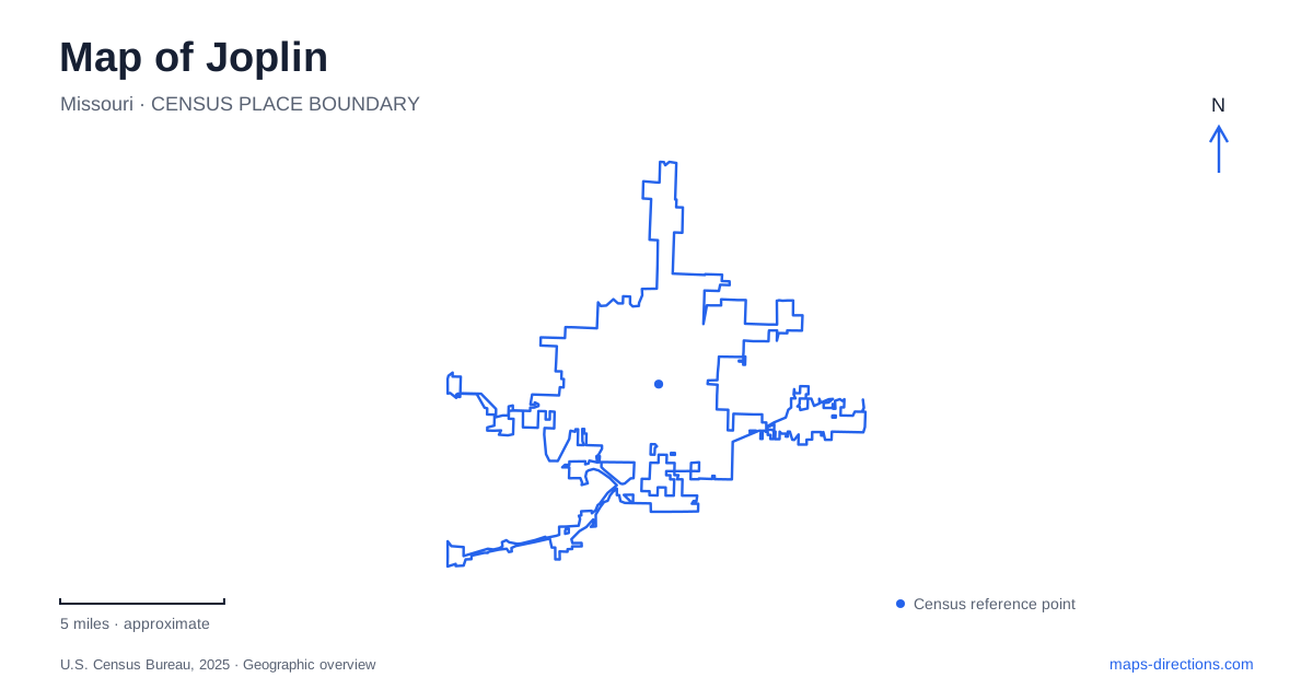
Street tiles load from OpenStreetMap when opened. The blue line shows the 2025 Census boundary.
- State
- Missouri
- Population · July 2025
- 53,930
- Land area
- 38.1 sq mi
- Water area
- 0.1 sq mi
Joplin's urban streets and creek landscapes tell related but different stories. Downtown and nearby Murphysburg preserve evidence of prosperity associated with mining, while Shoal Creek exposes distinctive rock formations south of the central city. Historic Route 66 adds another layer through the commercial street network. The most useful orientation connects Main Street, the residential blocks west of downtown, and the southern creek corridor, rather than assuming that every well-known local attraction belongs to the same walkable district.
Main Street introduces the city's public history
The Route 66 Visitor Center occupies the former Newman's Department Store at 602 South Main Street, within the historic City Hall building. That reuse gives a downtown address several functions: municipal government, visitor orientation, and historical interpretation. The building is a strong starting point for understanding the commercial center because its own history reflects the changing purposes of a prominent urban property.
Inside is Thomas Hart Benton's mural depicting local life around the turn of the twentieth century. Dedicated in 1973, it portrays the social world of the mining boom rather than offering a simple celebratory panorama. An accompanying exhibit explores the work's creation through preparatory material. The mural lets a visitor approach Joplin's built environment with some context for the wealth, labor, and social contrasts that shaped it.
Murphysburg turns from commerce to houses
West of downtown, Murphysburg is a residential historic district extending from First to Seventh streets around Moffett and Sergeant avenues, with portions of Pearl and Byers avenues also included. Its houses display several architectural traditions, including Queen Anne, Craftsman, and American Foursquare. The difference from Main Street is immediately useful on a map: this is an adjoining neighborhood of homes, not another line of downtown storefronts.
The district takes its name from Patrick Murphy, who acquired land here in 1871. Two years later the settlement merged with its neighboring community to form the city. Historical markers identify individual properties, helping connect the larger district with particular buildings. Seventh Street along its southern edge is associated with historic Route 66, so the neighborhood also provides an architectural context for a road trip through the area.
Cunningham Park and the history of storm recovery
Cunningham Park is at 26th Street and Maiden Lane. Its origins reach back to land donated by Mayor Thomas Cunningham in the late nineteenth century, but its present meaning also reflects the devastating May 22, 2011 tornado. The storm destroyed the park, which was subsequently rebuilt as a place for both recreation and remembrance.
For Joplin, the park is therefore more than an ordinary green rectangle on a street map. Its reflective ponds and walking areas accompany familiar amenities such as playgrounds and picnic spaces. The location helps explain the city's recovery and transformation without treating recovery simply as new construction. A visit here has a different purpose and tone from a downtown architectural walk or a stop at a scenic waterfall.
Shoal Creek exposes an unusual rock landscape
Wildcat Park occupies the southern creek corridor near South Main Street and 55th Street. The Shoal Creek Conservation Education Center, at 201 West Riviera Drive, provides exhibits, native plant landscaping, and trail access. The center's trails connect with the municipal trail system, while the park also supports fishing and boating access along the creek.
The chert glades are a particularly distinctive feature of Joplin's surroundings. These open rocky habitats form on resistant beds of chert, with shallow soils and specialized plant and animal communities. The Missouri Department of Conservation identifies the local glades as exceptionally rare. Reading them as habitat, rather than merely as exposed rocks beside a path, gives the creek landscape much more meaning. The building's opening schedule and the outdoor area's access hours are separate, so a trail outing need not have the same timing as an indoor program.
Grand Falls lies downstream
Grand Falls is downstream from Wildcat Park on Shoal Creek, at 5685 Riverside Drive. Water drops about twelve feet across a broad chert ledge, creating a natural feature that connects visibly with the geology interpreted farther upstream. The falls are reached by local roads, not by following the urban Main Street corridor to its end.
The official visitor information distinguishes approaches for taller vehicles because one route includes a low-clearance restriction. It also notes that there are no facilities at the falls. Those are useful, specific considerations when combining the waterfall with another stop rather than treating it as a fully equipped park complex.
A wider itinerary from Joplin may include George Washington Carver National Monument, but that site is near Diamond at 5646 Carver Road. Keeping that separate regional destination distinct from the downtown, memorial park, and Shoal Creek sites preserves a clear sense of the distances and different landscapes involved.
Map and statistics: U.S. Census Bureau, 2025 Gazetteer, January 2025 generalized place boundaries and Vintage 2025 population estimates. Local references: Visit Joplin; City of Joplin; Missouri Department of Conservation; National Park Service. Article prepared by Maps & Directions.