Map of Johnson City
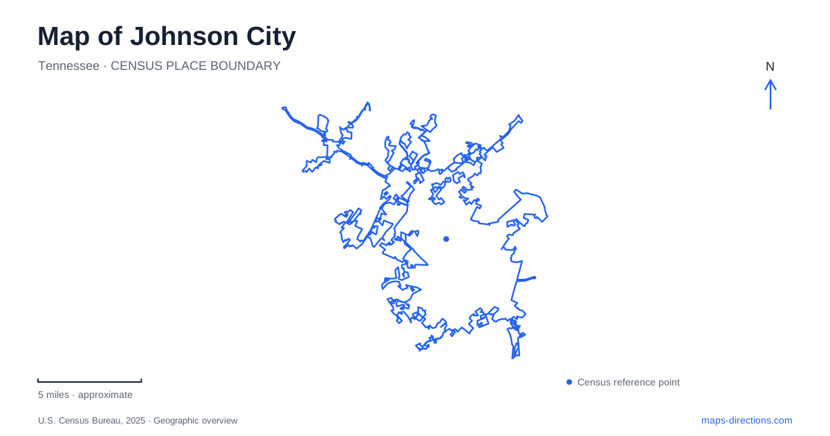
Street tiles load from OpenStreetMap when opened. The blue line shows the 2025 Census boundary.
- State
- Tennessee
- Population · July 2025
- 74,943
- Land area
- 43.8 sq mi
- Water area
- 0.3 sq mi
Johnson City, Tennessee, brings several landscapes into one urban map: a downtown shaped by railroads and creeks, a university with public arts institutions, mountain terrain, and the recreation shoreline of Boone Lake. These places support very different journeys. A level rail trail toward Elizabethton, a wooded climb, and a museum visit may all begin within the same community, but their geography and purpose are distinct. Reading the map through those relationships provides a more useful introduction than treating every green space as interchangeable.
A downtown park with an infrastructure story
Founders Park, at 225 Commerce Street, occupies about five acres downtown. Its creek, amphitheater, and gathering spaces reflect a project that combined flood mitigation with a public amenity. The open space is therefore part of the city's water-management geography as well as its cultural life. This explains why the park has a linear, creek-centered character rather than simply filling a vacant rectangular block.
Around downtown Johnson City, green space and public art belong within the street network rather than outside it. Founders provides an identifiable setting for concerts and community gatherings, while its original stormwater purpose connects present-day recreation to the practical work of adapting the built environment. Looking at both the creek and adjacent streets makes the park's position easier to understand than focusing solely on an event marker.
The university's two arts settings
East Tennessee State University's Reece Museum stands at 363 Stout Drive on campus. Its collections grew from a history classroom project in the late 1920s and now address Appalachian history, contemporary art, and culture. This is a regional museum within an active university, so the campus setting forms part of the visit rather than merely supplying a mailing address.
A separate university arts destination now occupies downtown's historic Ashe Street Courthouse. The Tipton-Ashe Gallery is at 401 Ashe Street; the university announced the move and new gallery name for fall 2026. Older references to Tipton Gallery on Spring Street describe the previous location. That change is a particularly useful map detail for Johnson City because searching an established cultural name can otherwise produce two plausible downtown addresses. Reece and Tipton-Ashe also illustrate how the university's public arts presence extends beyond its main campus.
Following the former railroad toward Elizabethton
The Tweetsie Trail follows the former East Tennessee and Western North Carolina railroad corridor. Its local trailhead is listed at 107 Alabama Street, and the route continues toward Elizabethton. Compacted stone, a comparatively level railroad grade, and a sequence of bridges distinguish it from the mountain paths nearby. The old transport alignment now supports walking, running, and cycling while retaining the long, continuous form of a railway.
That eastward connection gives Johnson City an outdoor route that can be understood as a corridor between communities. It differs from a park circuit that returns immediately to its starting point. The full trail extends well beyond a short downtown outing, so selecting an intended turnaround gives the line on the map a useful scale. The railroad origin also explains why the route can offer a relatively gentle journey in a region otherwise associated with steep terrain.
Wooded riding terrain and a mountain slope
Tannery Knobs at 18 Tannery Knob concentrates off-road cycling on more than forty wooded acres close to downtown. A paved pump track and mountain-bike trails provide a skills-focused setting. Its compact hill landscape offers a different experience from the extended Tweetsie corridor, even though both may appear under the same broad cycling category in a search.
Buffalo Mountain Park, by contrast, occupies the mountain's north slope and covers roughly 725 acres. Forest, rugged ground, and overlooks make hiking the defining activity. The difference is visible in the shape of an outing: the rail trail follows an inherited transport grade, the bike park concentrates purpose-built riding features, and the mountain park follows natural relief. Recognizing those distinctions helps visitors choose a landscape that matches the trip they actually intend.
Boone Lake and the northern recreation area
Winged Deer Park introduces a lakeshore setting at the northern edge of the city. Carroll Creek Road leads toward the park from the highway approach near the Devault Bridge over Boone Lake. Athletic fields, woodland paths, disc golf, and waterfront recreation share the broader park area. The local cycling organization also maintains a network of interconnected singletrack trails developed through a partnership with the city.
The Boone Lake edge completes a broad reading of Johnson City: downtown creek improvements, campus and courthouse galleries, an eastward rail corridor, wooded hills, and lakeside recreation all occupy different parts of the map. Their named streets and landscape features provide enough structure to organize a visit around a particular interest without reducing the entire community to either a college town or a mountain-trail starting point.
Map and statistics: U.S. Census Bureau, 2025 Gazetteer, January 2025 generalized place boundaries and Vintage 2025 population estimates. Local references: City of Johnson City; Johnson City Convention and Visitor Bureau; East Tennessee State University; Tennessee Watchable Wildlife; SORBA Tri-Cities. Article prepared by Maps & Directions.