Map of Johns Creek
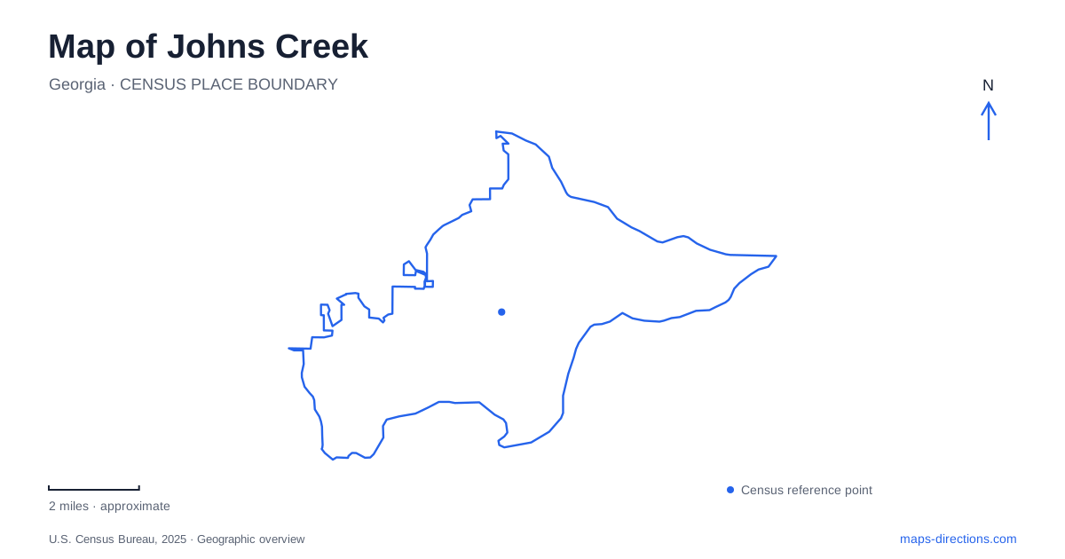
Street tiles load from OpenStreetMap when opened. The blue line shows the 2025 Census boundary.
- State
- Georgia
- Population · July 2025
- 80,401
- Land area
- 30.8 sq mi
- Water area
- 0.6 sq mi
Johns Creek has several distinct outdoor landscapes: wooded ravines around Autrey Mill, the recreation grounds along Old Alabama Road, and broad riverfront parkland beside the Chattahoochee. Following these landscapes provides a useful introduction to the city. The river is especially important because it separates places that can appear close together on a regional map. Rogers Bridge supplies a pedestrian connection to Duluth, while the nationally managed river units have their own access points and trail systems.
Old Alabama Road and the Newtown grounds
Newtown Park occupies 3150 Old Alabama Road. Its combination of recreation facilities and commemorative space makes it a particularly useful landmark along this corridor. The fenced dog park is near the front entrance, with separate enclosures for large and small dogs. Farther within the park, the Veterans Memorial Walk occupies five acres, combining paved paths, granite monuments, a fountain, and a gathering plaza.
The Wall That Heals is part of this memorial landscape. The 250-foot replica of the Vietnam Veterans Memorial was previously a traveling exhibit before finding a permanent home here. A visit focused on the memorial therefore has a different rhythm from an outing centered on the dog enclosure or athletic grounds. On a detailed park map, the walking paths explain how these activities fit within the same public property.
This part of Johns Creek also illustrates how a familiar road can organize several kinds of trips. Old Alabama Road serves recreation and access to the wooded preserve described below, while nearby local streets lead into quieter residential surroundings. The corridor is a useful reference when comparing destinations without assuming that all of them belong to one continuous park.
Autrey Mill preserves a rural landscape
Autrey Mill Nature Preserve and Heritage Center is at 9770 Autrey Mill Road, reached from Old Alabama Road. Its 46 acres include ravine forest and a heritage village. The property's history runs from woodland through farming and back to a predominantly wooded setting, a sequence that gives the preserve a different character from the city's athletic parks.
The heritage village concentrates several buildings in one corner of the grounds. Summerour House, the Green Store, and Warsaw Church appear on its walking map alongside a tenant farmhouse and the visitor center. These names preserve traces of the area's rural communities. They also give a walk a series of identifiable stopping places instead of making the historic portion feel like an undifferentiated patch of open space.
Beyond the buildings, named routes include the River, Warsaw, Forest, and Wildflower trails. The village paths and nature trails represent two complementary ways to explore the property: one follows buildings and exhibits, while the other follows woodland and creek terrain. Autrey Mill gives Johns Creek a place where the built history and the shape of the land can be read together.
Cauley Creek and the crossing to Duluth
Cauley Creek Park occupies 203 acres at 7255 Bell Road beside the Chattahoochee. Opened in 2023, it combines athletic fields and courts with a rubberized 5K trail and river overlooks. Its scale allows a substantial walk within the park itself, with sports areas and the river forming distinct reference points along the route.
Rogers Bridge adds a different possibility: continuing across the water to Rogers Bridge Park in Duluth. The pedestrian crossing opened in 2023 as a reconstruction in the location of the earlier steel bridge. For walkers, it changes the river from an edge into a connection between two communities. It is a particularly useful feature to identify when comparing a local walking route with a driving route through the broader road network.
The surrounding trail network also extends beyond the park boundary. The city completed the Rogers Bridge Road trail project between Bell Road and Kemper Drive in September 2025. This is a concrete example of Johns Creek linking neighborhood approaches to its larger recreation grounds, rather than relying entirely on journeys that begin at a park parking lot.
Separate river units and smaller parks
The National Park Service maintains distinct Chattahoochee River units at Abbotts Bridge, Medlock Bridge, and Jones Bridge. Their trail networks differ substantially: the agency lists about 0.4 mile at Abbotts Bridge, 1.5 miles at Medlock Bridge, and 4.6 miles at Jones Bridge. These figures describe walking trails within the units, not distances along the water between them. Keeping the two measurements separate helps when choosing between a riverside walk and a longer river outing.
Away from the river, Ocee Park at 10900 Buice Road offers another recreation anchor. Bell-Boles Park is much smaller, occupying the roundabout area where Bell and Boles roads meet, while Shakerag Park lies at the city's northeastern tip. These smaller and larger grounds distribute public space across Johns Creek. Together with Newtown, Autrey Mill, and Cauley Creek, they reveal a city organized around several local centers, with wooded terrain and the Chattahoochee giving each a distinctive setting.
Map and statistics: U.S. Census Bureau, 2025 Gazetteer, January 2025 generalized place boundaries and Vintage 2025 population estimates. Local references: City of Johns Creek; Autrey Mill Nature Preserve and Heritage Center; Autrey Mill; National Park Service. Article prepared by Maps & Directions.