Map of Jefferson City
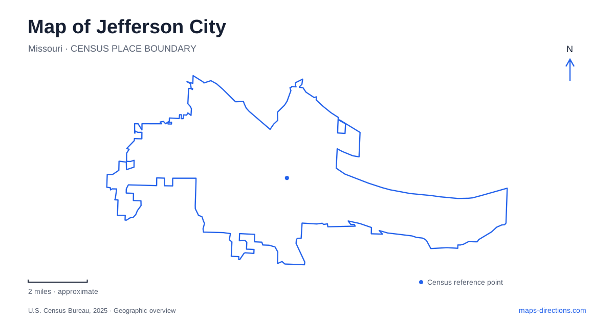
Street tiles load from OpenStreetMap when opened. The blue line shows the 2025 Census boundary.
- State
- Missouri
- Population · July 2025
- 42,489
- Land area
- 36.1 sq mi
- Water area
- 1.6 sq mi
Jefferson City faces the Missouri River with a landscape shaped by state government, river commerce and rail transportation. The Capitol is the obvious landmark, but the lower end of Jefferson Street explains how people and goods once entered the capital. Across the river, the North Jefferson trail network belongs to a different geography of levees, former settlements and regional recreation. Understanding these settings together produces a more useful map than simply collecting the major historic buildings.
The Capitol as a landmark and a collection
The present Missouri State Capitol followed the destruction of its predecessor by a lightning-caused fire in 1911. Built between 1913 and 1917, it overlooks the river and uses Missouri stone, including Burlington limestone from Carthage. Ceres, the goddess of agriculture, crowns the dome. That figure ties the government's most prominent architectural symbol to the state's agricultural identity.
The building also contains the Missouri State Museum. Its origins lie in separate early twentieth-century collections: a Soldiers and Sailors Memorial Hall in the east wing and a resources museum in the west wing. They combined in 1923. Thomas Hart Benton's 1936 mural in the House Lounge adds another interpretation of Missouri's past. A visit to this part of Jefferson City therefore brings government, historical collections and public art into one building, though each has its own subject and location inside.
The landing below Jefferson Street
Jefferson Landing developed at the lower end of Jefferson Street after the seat of government moved here in 1826. The Lohman Building began in 1839 as a stone structure serving several commercial uses, including warehousing, a store and a hotel. Its combination of spaces suited a place where river travelers, legislators and merchants came together. The arrival of the Pacific Railroad reinforced the landing's commercial importance during the 1850s.
Later, rail transport helped draw business away from the river trade. The surviving buildings eventually served other purposes, including the Tweedie Shoe Company. Preservation advocates prevented their replacement by a parking lot after state acquisition in the 1960s. Today the Lohman Building interprets an 1850s store and warehouse, while the Union Hotel contains the Elizabeth Rozier Gallery and the Amtrak station. That ongoing transportation use makes the landing more than an architectural remnant: the site still connects travelers with Jefferson City.
A riverside park beside the government district
The Bicentennial Bridge links the Capitol area with Deborah Cooper Park on Adrian's Island. The city's transportation plan describes both a greenway trail and a soft-surface nature trail in the park. This adds an outdoor setting to the government district and a place from which to see the Capitol across the riverfront landscape.
The park is especially useful for understanding the relationship between the monumental building and its setting. From within the Capitol, attention naturally goes to rooms, paintings and political history. Beside the river, the broader arrangement of land, water and infrastructure becomes easier to appreciate. The bridge-and-park connection lets those two perspectives form part of the same downtown outing without treating the river simply as distant scenery.
The prison as an institution in the landscape
The Missouri State Penitentiary opened in 1836 and operated until 2004. Its history belongs to the establishment of the capital as well as to the history of incarceration. The site's own timeline explains that Governor John Miller supported building the prison when the young capital's status still seemed uncertain. A major state institution could help anchor government activity here.
The former prison thus adds a different dimension to a map of Jefferson City. Its enclosed grounds represent a long-lasting state presence with a very different purpose from the public halls of the Capitol. The visitor bureau operates guided tours, allowing the institution's history to be interpreted within the surviving site rather than inferred only from its exterior walls.
North-bank trails and inland habitats
North Jefferson Trailhead is at mile 143.2 of the Katy Trail. A city-maintained spur runs south for about a mile to a pavilion near Highways 63/54 and Route W in the former town of Cedar City. Another connection, the John Sweet Trail Spur, runs approximately three-quarters of a mile north and provides a road-route connection toward Holts Summit. These named links explain how local trails connect with a much larger regional route.
Runge Conservation Nature Center offers a contrasting outdoor destination at 330 Commerce Drive. Its five trails total 2.4 miles and pass through woodland, prairie and glade environments beside ponds and a wet-weather stream. Three trails have hard surfaces and two use wood chips. Adding Runge to a map of Jefferson City reveals another layer beyond government and transport: a compact collection of Missouri habitats that can be compared with the river corridor's very different setting.
Map and statistics: U.S. Census Bureau, 2025 Gazetteer, January 2025 generalized place boundaries and Vintage 2025 population estimates. Local references: Missouri Secretary of State; Missouri State Parks; Visit Jefferson City; City of Jefferson; Jefferson City Convention and Visitors Bureau; Missouri Department of Conservation. Article prepared by Maps & Directions.