Map of Jackson
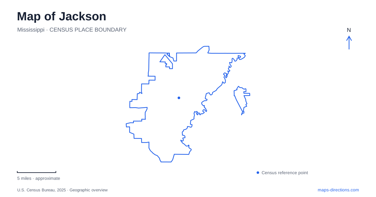
Street tiles load from OpenStreetMap when opened. The blue line shows the 2025 Census boundary.
- State
- Mississippi
- Population · July 2025
- 141,196
- Land area
- 111.7 sq mi
- Water area
- 2.1 sq mi
Jackson's map connects state government, civil rights history and the landscape of the Pearl River. Downtown contains two capitol buildings from different eras and a major museum complex. The Evers family home belongs to a residential neighborhood beyond that central cluster, while LeFleur's Bluff brings museums and outdoor habitats together in another setting. These places offer several ways to understand Mississippi's capital: through public institutions, household experience and the terrain that preceded the modern city. Their locations matter because each history belongs to a particular kind of urban space.
Two capitols record different periods
The Old Capitol stands at 100 South State Street. Legislators first convened in the building in 1839, and it remained the statehouse until 1903. Its Greek Revival architecture, dome and substantial interior spaces expressed the importance of government in the young capital. Today, the museum interprets both the building and the political events that occurred there.
Those events include secession in 1861 and the creation of the 1868 and 1890 state constitutions. The site is therefore a place to examine consequential and contested decisions, not simply an architectural landmark. Its later restoration also forms part of the story of how the state chose to preserve and interpret its governmental past.
The current Capitol is at 400 High Street, between President and West streets. The legislature's visitor information identifies High Street as the rear side and Mississippi Street as the front. In downtown Jackson, the two buildings provide distinct geographical anchors: the older statehouse on State Street and the working legislative complex farther within the central street grid. Their separate addresses correspond to separate roles in the capital's history.
Statewide history and civil rights share one complex
The Two Mississippi Museums opened in 2017 at 222 North Street. The Museum of Mississippi History and Mississippi Civil Rights Museum are interconnected, but their exhibitions have different organizing subjects. One follows a broad history from Indigenous societies through later settlement, slavery, industry and cultural change. The other examines the struggle against racial oppression and for civil rights.
The Civil Rights Museum includes the stories of Freedom Riders and activists such as Fannie Lou Hamer, Vernon Dahmer and Medgar Evers. Its central gallery uses light and music as part of the interpretive experience, while other galleries address violence, organizing and resistance. Together, the museums connect institutional history with the experiences of people who challenged institutions.
For a visit to Jackson, this complex provides context for other historical sites around the city. The wider narrative can then be connected with a particular building or neighborhood, while keeping the distinction between a museum's statewide subject and the local setting of an individual event.
The Evers home remains within a neighborhood
Medgar and Myrlie Evers purchased their house in 1956 in the Elraine subdivision, described by the National Park Service as Mississippi's first modern subdivision designed for middle-class Black residents. The modest ranch-style house places their civil rights work within the domestic setting of a postwar neighborhood.
The home is at 2332 Margaret W. Alexander Drive, a street previously known as Guynes Street. That change of name is useful when comparing historical documents with a present map. The house and the nearby Myrlie's Garden form the visitor setting, with the garden providing interpretation and a small gathering space.
The National Park Service emphasizes that people still live around the monument. The neighborhood is part of the site's meaning: public activism was carried out by a family whose daily life continued within these residential streets. Seeing the home after the civil rights galleries brings the statewide story to a much smaller physical scale, without detaching it from the community around it.
LeFleur's Bluff joins science and outdoor habitat
LeFleur's Bluff offers a different view of Jackson. The Mississippi Museum of Natural Science sits within the state park, where large windows overlook a natural landscape and outdoor trails. Inside, aquariums and exhibits interpret habitats, fossils and species from across the state. Outside, paths pass through wooded bluffs, river-bottom environments and wetter ground.
The museum shares a campus setting near I-55 and Lakeland Drive with the Mississippi Children's Museum and the LeFleur's Bluff Playground. Spotter's Adventure Trail links those facilities, creating a specific pedestrian connection among the educational and play spaces. This cluster has its own internal geography beyond the broader park name.
The natural-science setting complements the capital's historical institutions. Instead of explaining political decisions or civil rights organizing, it reveals the ecological variety associated with the surrounding landscape. A map of Jackson becomes richer when all three scales remain visible: the downtown institutions, the lived residential neighborhood and the wooded bluff and river environments. Each supplies evidence about the place that the others cannot fully represent.
Map and statistics: U.S. Census Bureau, 2025 Gazetteer, January 2025 generalized place boundaries and Vintage 2025 population estimates. Local references: Mississippi Department of Archives and History; Mississippi Legislature; National Park Service; Mississippi Department of Wildlife, Fisheries and Parks. Article prepared by Maps & Directions.