Map of Issaquah
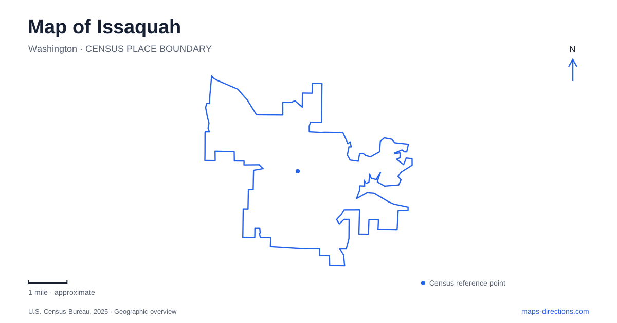
Street tiles load from OpenStreetMap when opened. The blue line shows the 2025 Census boundary.
- State
- Washington
- Population · July 2025
- 39,423
- Land area
- 12.1 sq mi
- Water area
- 1.1 sq mi
Issaquah sits between a lake landscape and forested hills, with an older town center that preserves evidence of railways, farming, and resource industries. The map therefore changes character quickly: compact streets around historic buildings give way to creekside parks, a broad lakeshore recreation area, and trailheads serving extensive mountain terrain. These settings are connected by local history and water, but they are not interchangeable starting points for the same outing.
Two buildings from 1889
The depot at 78 First Avenue Northeast was built in 1889 and remained in railway operation until 1958. It now presents local history through exhibitions that connect industries such as coal mining, logging, hop growing, and dairy farming with the later protection of nearby mountain landscapes. The building's former transport role gives its location meaning beyond its current use as a museum.
Gilman Town Hall, also built in 1889, stands separately at 165 Southeast Andrews Street. Today it houses a research center and museum administration, with research visits arranged by appointment. Behind it is a two-cell concrete jail used from 1914 to 1930, while the grounds include native plants and seasonally growing hops. These features preserve different aspects of community life from the depot's railway story.
The two sites make old Issaquah legible at a small scale: public assembly and local government in one building, transport and commerce in another. Their shared date does not mean they have identical visitor arrangements or functions today.
Where the creek branches meet
Confluence Park occupies the meeting of the main stem and East Fork of Issaquah Creek. Its creation brought together three adjoining park areas, including Tollë Anderson and Cybil-Madeline. The combined landscape opened in 2013 with connected paths, meadow, play areas, and a picnic structure designed to recall the property's agricultural history as the Anderson Farm.
The confluence itself explains the park's shape and identity. This is a place organized around watercourses and former farmland rather than a rectangular recreation block imposed on the street grid. The current facility listing places the park at 595 Rainier Boulevard North and includes natural open space, a playground, picnic shelter, and a pedestrian and bicycle bridge. Older project documents describe additional phases, so a historical master plan should not be treated as an inventory of everything now built. The existing creekside setting is substantial in its own right.
A lakeshore assembled from former farms
Lake Sammamish State Park occupies floodplain ground at the southern end of the lake. Its public history includes the purchase of former Anderson farmland beginning in 1950 and an opening in July 1952. A later bequest from dairy farmer Hans Jensen added another important property. The recreation landscape therefore developed partly through the conversion of agricultural land to public use.
Today, Sunset and Tibbetts beaches provide distinct lakeshore areas, with picnic facilities and other recreation space. Wetlands and creek corridors are equally important parts of the park, even if the beaches dominate a visitor's first impression. In 2025, restoration added large wood to the creek, reopened historic side channels, and planted native vegetation to improve habitat for young salmon. The work reconnects flowing water with its floodplain instead of treating the creek simply as a channel carrying water through the park.
Bridges can change the lakeside route
The park's current notices identify the Issaquah Creek bridge and Tibbetts Creek bridge as closed because of erosion following high winter water levels. This affects the continuity of a walk even when the broader park remains available. A map showing a bridge establishes where a crossing exists physically; it does not establish whether that crossing can be used today.
That distinction is especially relevant in a floodplain park, where water conditions shape both habitat and infrastructure. Beach access, a particular walking loop, and travel between different sections of the park are separate questions. The lake's open shoreline should not be interpreted as proof that every inland connector is open as well.
Tiger Mountain has several approaches
High Point Trailhead is the primary access to the West Tiger Mountain Natural Resources Conservation Area. The state identifies an accessible interpretive loop there alongside access to a much larger hiking network. Its approach from Interstate 90 differs from the Poo Poo Point trailhead south of town and Tiger Summit Trailhead off State Route 18.
Tiger Summit's parking and accessibility improvements reopened fully in June 2026, a separate milestone from the development of other mountain entrances. That improvement belongs to one specific trailhead, not to every entrance around the mountain. The separate approaches demonstrate why a broad search for Tiger Mountain is insufficient for choosing a starting point. Viewed together, the historic center, creek junction, lakeshore, and mountain gateways show Issaquah as a meeting place of several landscapes, each requiring its own level of map detail.
Map and statistics: U.S. Census Bureau, 2025 Gazetteer, January 2025 generalized place boundaries and Vintage 2025 population estimates. Local references: Issaquah History Museums; City of Issaquah; Washington State Parks; Washington DNR. Article prepared by Maps & Directions.