Map of Irving
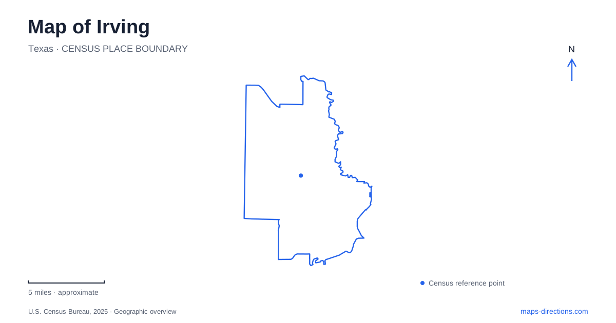
Street tiles load from OpenStreetMap when opened. The blue line shows the 2025 Census boundary.
- State
- Texas
- Population · July 2025
- 257,076
- Land area
- 67.0 sq mi
- Water area
- 1.0 sq mi
Irving contains an early railroad town and a later master-planned urban center, each with its own streets, landmarks and rail connections. The Heritage District looks back to the community laid out in 1903, while Las Colinas organizes much of its central activity around Lake Carolyn, canals and larger commercial developments. The contrast is useful when reading the map: the older Main Street setting and the lake-centered district tell different stories about how the city grew within the Dallas–Fort Worth region.
Main Street and the railroad town
J.O. Schulze and Otis Brown laid out the original town on 80 acres in 1903. The Heritage District retains that early-town identity through its Main Street, historic buildings and commemorative parks. Heritage Park, at Main and Second streets, brings together several objects associated with the community's beginnings, including the 1887 Caster Cabin and a replica of the early Rock Island depot.
The park is also used for contemporary events. Its redevelopment added an amphitheater and other public gathering facilities, with a reopening celebration in December 2021. That mix of historic interpretation and active civic use is central to the district's character. On a map, the park belongs to the same small street network as shops and restaurants rather than standing apart as an isolated historical site.
The Heritage House on O'Connor Road dates to 1912. Built by C.P. Schulze, brother of the co-founder, it preserves a domestic chapter of early Irving alongside the railroad and commercial history. Nearby Centennial Park commemorates the city's first hundred years and follows Delaware Creek. The creekside space adds a softer landscape to the older center, with founder statues and a walking route complementing the Main Street blocks.
A different center around Lake Carolyn
Las Colinas developed around a much broader planning vision. Lake Carolyn and the Mandalay Canal are engineered water features tied to floodplain reclamation, but they also provide the district with its recognizable public landscape. The canal connects with the lake and passes among offices, residences, hotels and restaurants. Bridges, waterfalls and waterside paths make its edges an important pedestrian setting within the larger commercial area.
The difference between canal and lake is visible at close scale. The canal is a narrow, winding space framed by buildings, while the lake opens the view toward a wider skyline. A walk can combine these settings, but the route follows the water's outline rather than a simple street rectangle. The tourism bureau describes a full lake circuit of about 2.8 miles; that distance is useful for distinguishing a complete loop from a short stroll along one section.
Williams Square and the mustangs
The Mustangs of Las Colinas sculpture, by Robert Glen, occupies Williams Square at 5221 North O'Connor Boulevard. The bronze horses provide a landmark within a district whose office buildings and broad roads can otherwise look similar on a small map. The square is part of the urban center's designed public realm, with the sculpture as its focus.
O'Connor's appearance in both the historic-house address and this northern landmark also illustrates the scale of the city. A familiar road name can connect very different settings. The house belongs to the early residential story, while Williams Square represents the planned business district. Plotting both makes the distance between those chapters of development visible.
Two rail systems, two local geographies
Downtown Irving/Heritage Crossing Station is on the Trinity Railway Express at 201 Rock Island Road, east of O'Connor Road. Its location ties today's commuter rail to the older town's railroad corridor. The TRE continues between Dallas and Fort Worth, with another local stop farther west on Jackson Street near Esters Road.
Las Colinas uses DART's Orange Line. That corridor opened in phases from 2012 to 2014, after the city assembled land for the right of way and stations. The line was deliberately routed through the planned urban center, where it supports offices, residences and visitor destinations.
Irving Convention Center Station stands at 480 West Northwest Highway. DART's station map shows pedestrian connections toward the convention center and Las Colinas Boulevard, while Las Colinas Urban Center is a separate stop along the same line. The station names describe different arrival areas within the district. Choosing between them depends on the destination's position around the lake and surrounding blocks, not just the general Las Colinas label.
These two rail corridors preserve the distinction between Irving's older center and its later development. The TRE follows the historic cross-region axis, and the Orange Line serves the planned northern urban landscape. Together with Main Street, O'Connor Road and the waterways, they supply the main reference points for understanding the city's arrangement.
Map and statistics: U.S. Census Bureau, 2025 Gazetteer, January 2025 generalized place boundaries and Vintage 2025 population estimates. Local references: Visit Irving; Trinity Railway Express; DART. Article prepared by Maps & Directions.