Map of Inglewood
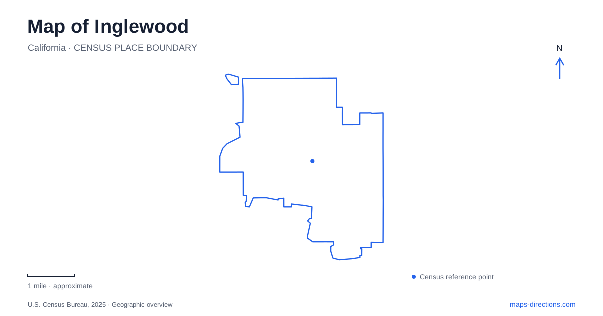
Street tiles load from OpenStreetMap when opened. The blue line shows the 2025 Census boundary.
- State
- California
- Population · July 2025
- 101,662
- Land area
- 9.1 sq mi
- Water area
- 0.0 sq mi
Inglewood's map works at two noticeably different scales. Market Street and the civic center belong to an established downtown street network, while the sports and entertainment venues occupy much larger properties around Prairie Avenue, Manchester Boulevard, and Century Boulevard. North of these areas, Edward Vincent Jr. Park supplies a substantial community recreation setting. The Centinela Adobe adds an older regional story whose location does not fit neatly inside the modern city's best-known visitor districts.
Market Street and the civic center
Market Street is a downtown gathering corridor, used by the city for cultural events as well as everyday commercial activity. The K Line's downtown station gives the area a rail connection, and Metro identifies the station as an access point for the street. This makes the downtown grid a distinct arrival area, separate from the stadium properties farther along the local road network.
The civic center introduced another scale of development when it was dedicated in 1973. The city and county jointly developed the complex, which brought municipal and county functions together with the main library. City Hall's address, One Manchester Boulevard, provides a clear civic reference near the downtown district.
Reading Market Street and the civic buildings together gives Inglewood a center beyond its event venues. The smaller commercial blocks and public institutions explain daily city life, while the railway connects that setting with the broader metropolitan network.
Prairie Avenue organizes the major venues
The Kia Forum occupies the southeast corner of Manchester Boulevard and Prairie Avenue, using 3900 West Manchester Boulevard. Its large parcel and surrounding parking create a different street relationship from the downtown storefronts. SoFi Stadium, farther south within Hollywood Park, lists 1001 South Stadium Drive as its contact address. Its grounds include multiple guest entrances distributed around the stadium.
Prairie Avenue and Century Boulevard help orient this larger entertainment area, but individual destinations have separate access arrangements. Intuit Dome's transportation guidance identifies a mobility hub in its Standard Parking East Lot at 3665 West 102nd Street. The hub combines designated rideshare, family pickup, taxi, and shuttle functions.
These details are useful because the venue name and the arrival location are different kinds of information. A concert ticket identifies the building; a parking or shuttle reservation identifies the approach through the surrounding campus. The large properties make that distinction more consequential than it would be for a shop facing an ordinary sidewalk.
Rail service and event transfers
The K Line serves the downtown area and connects with the regional rail network. Metro's current SoFi guidance directs event passengers using its stadium express service to the LAX/Metro Transit Center, reached by the C or K line. That transfer point is separate from the downtown station, illustrating why the best rail arrival can vary with the event transportation being used.
Inglewood's event geography therefore needs both a city map and the specific venue's arrival information. The city map explains the relationship between Market Street, Manchester, Prairie, and Century. The event plan explains the final movement from a station, parking area, or pickup zone. Keeping those two scales together helps avoid confusing the nearby rail corridor with a direct platform at every arena.
Edward Vincent Jr. Park's community facilities
Edward Vincent Jr. Park uses 700 Warren Lane. Its facilities include an amphitheater, swimming-pool complex, sports courts, playing fields, a walking path, and the Willie Agee Playhouse. The Veterans Memorial Building adds indoor community space within the park.
This mixture makes the park more than a single sports destination. A theater program, swimming visit, and neighborhood walk can occur within the same grounds, each using a different part of the site. The park's location near the northern street network also broadens an Inglewood itinerary beyond the commercial center and the entertainment properties to the south.
Centinela Adobe and the earlier valley
The Centinela Adobe complex stands on Midfield Avenue and carries a Los Angeles postal address in the city's facility directory. It is maintained through cooperation between the city and the Historical Society of the Centinela Valley. The restored adobe and Daniel Freeman office building preserve elements of the area's ranch-era history.
The city developed from land associated with the Centinela Ranch after a railway station was established in the area. That older landholding history crosses the boundaries and district names used by today's visitor maps. The adobe is therefore a regional historical reference rather than another attraction within the stadium campus.
Together, these places show Inglewood through distinct but connected settings: a downtown commercial and civic core, large event properties, a community park, and a surviving piece of the earlier valley landscape. The named streets and rail connections explain how those settings relate without reducing the city to its most prominent arenas.
Map and statistics: U.S. Census Bureau, 2025 Gazetteer, January 2025 generalized place boundaries and Vintage 2025 population estimates. Local references: City of Inglewood; LA Metro; City of Inglewood / California CEQAnet; SoFi Stadium; Intuit Dome. Article prepared by Maps & Directions.