Map of Indio
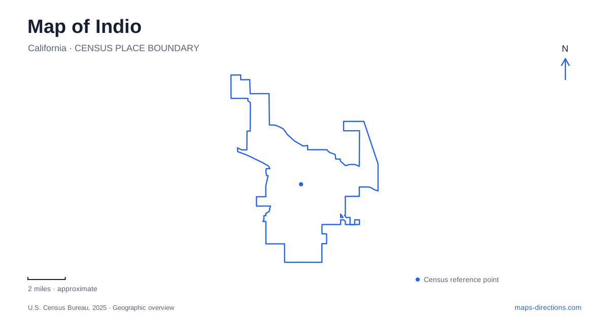
Street tiles load from OpenStreetMap when opened. The blue line shows the 2025 Census boundary.
- State
- California
- Population · July 2025
- 94,269
- Land area
- 33.2 sq mi
- Water area
- 0.0 sq mi
Indio’s downtown began around a railroad stopping point, and that origin still helps explain its street pattern. Miles Avenue, Fargo Street, and the rail corridor formed an early center of activity before regional road travel shifted toward newer highways. Today the same general area contains civic buildings, a history museum, gathering spaces, and public art. Farther away, the Badlands trailhead presents a desert landscape quite different from the planted grounds and older blocks near Miles Avenue.
The railroad crossroads and the streets around it
The Southern Pacific established a halfway station between Los Angeles and Yuma. Development concentrated around the depot and the point where Miles Avenue and Fargo Street met the regional corridor. The city’s downtown plan uses that historic crossroads to explain the location of the original commercial core.
Indio Boulevard, once State Route 99, later lost some of its regional role when Interstate 10 bypassed it. Jackson Street carried traffic toward the freeway, and an overpass changed its relationship with the older boulevard. These successive transportation decisions help explain why the historic street network and the larger roads do not always meet in a simple grid.
Miles Avenue remains a useful local reference across this older area. Towne, Smurr, Oasis, and Fargo streets identify different parts of the downtown framework, while Highway 111 defines a major corridor to the south. Looking at these named streets together makes the area easier to understand than following only the interstate exits.
A museum campus on Miles Avenue
The Coachella Valley History Museum stands at 82616 Miles Avenue. Its grounds bring several historical settings together: the Smiley-Tyler Adobe House, the 1909 Schoolhouse, and the California Date History Museum. The adobe house dates to 1926. It was once the residence of Dr. Smiley and Dr. Tyler before becoming an exhibition setting.
Inside the house, subjects include the Desert Cahuilla people, water and agriculture, railroads, firefighting, and domestic life during the 1930s and 1940s. This range matters when interpreting the surrounding city. The railroad was important, but it was only one part of a landscape also shaped by Indigenous communities, irrigation, farming, and households.
The campus format gives those subjects physical separation. A schoolhouse, a residence, and an agricultural-history exhibition each frame the past differently. Moving among them creates a more layered understanding than treating the entire property as one house museum.
Date palms as an agricultural landscape
The date exhibition follows the crop’s movement from the Middle East and North Africa to the Coachella Valley. Imported offshoots, irrigation methods, growers, and workers are all part of that story. Date palms therefore represent cultivated agriculture and human labor, rather than simply a decorative feature of the desert skyline.
The Memorial Date Garden occupies the northwest corner of the museum grounds beside the schoolhouse. Its planted setting makes a useful counterpart to the indoor interpretation. Together, exhibit and garden connect the crop’s larger history with the visible form of a palm grove. This is one of the clearest places in Indio to understand why water infrastructure and agriculture belong in any account of the local landscape.
Festival art beyond the festival grounds
Miles Avenue Park, at 82540 Miles Avenue, stands beside the museum. Its dog park contains the colorful Mutts sculptures originally shown at the 2022 Coachella Valley Music and Arts Festival. The museum’s historical campus and the contemporary sculpture therefore occupy neighboring public destinations along the same street.
At Dr. Carreon Park, 82200 Dr. Carreon Boulevard, Francis Kéré’s Sarbalé Ke installation brings another festival work into everyday public space. First displayed at the 2019 festival, its nine tall, colored structures create a distinctive landmark. North Jackson Park at 43200 Towne Street offers a third setting, beside the CV Link and Andrew Jackson Elementary School, with Peter Hazel’s mosaic Desert Tortoise sculpture.
These locations show how Indio’s festival identity extends beyond temporary events. Art moves into neighborhood parks, where it becomes part of ordinary walking routes and local orientation. The different addresses also show that these works form a dispersed collection across the city, not a single sculpture garden.
The trailhead at Golf Center Parkway
The Badlands trailhead is at 42000 Golf Center Parkway. Improvements celebrated in April 2026 added more than 30 parking spaces, new trees, solar-powered lighting, landscaping, and a walking path into the trail area. This is a developed arrival point for a desert outing, distinct from the downtown parks’ cultural and neighborhood uses.
The contrast is part of Indio’s geographic character. The railroad crossroads, irrigated museum garden, and open desert trailhead reveal different ways people have occupied the same valley. Their roads and paths tell those stories at different scales, from a single planted campus to a much broader desert view.
Map and statistics: U.S. Census Bureau, 2025 Gazetteer, January 2025 generalized place boundaries and Vintage 2025 population estimates. Local references: City of Indio; Coachella Valley History Museum. Article prepared by Maps & Directions.