Map of Indian Trail
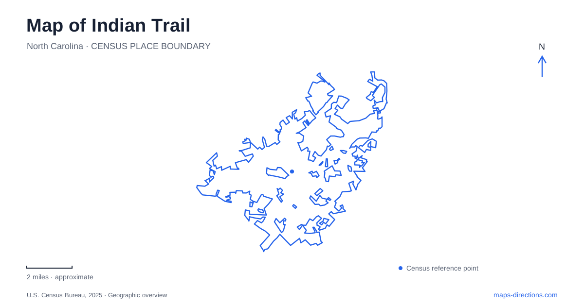
Street tiles load from OpenStreetMap when opened. The blue line shows the 2025 Census boundary.
- State
- North Carolina
- Population · July 2025
- 44,303
- Land area
- 22.9 sq mi
- Water area
- 0.2 sq mi
Indian Trail's public spaces reveal several layers of movement: an older trade route, the railroad, the commercial highway, and a developing network of walking connections. The town's parks are especially useful geographical anchors because each occupies a different setting. Crossing Paths Park belongs to the historic core, Chestnut Square combines sports with a prominent road junction, and Crooked Creek Park sits behind Sardis Elementary School on Oakwood Lane. Their differences help explain the town's layout more clearly than treating them as interchangeable recreation stops.
The crossing at the town's origins
Crossing Paths Park occupies a small site at 120 Blythe Drive, close to where the railroad meets Indian Trail Road. The town's parks master plan identifies this as near the geographical center of the original settlement. Interpretive signs and monuments refer to an earlier trade route between Petersburg, Virginia, and Waxhaw, giving the park's name a specific historical meaning.
The railroad introduced another layer of regional movement in 1874. Agricultural roots and access to goods and services helped shape the settlement, while today's roads carry a different scale of traffic. At the park, these successive transport systems can be understood together: the place mattered because routes met here, rather than because a modern recreation facility happened to be built on an available parcel.
Opened in May 2011 as the first municipal park, Crossing Paths contains an amphitheater, sloping event lawn, playground, and walking path. Its compact design suits gatherings and short neighborhood visits. The open lawn is central to the arrangement, allowing an event to organize the whole space around a performance.
The commercial highway and the regional bypass
US 74 serves the commercial corridor through this part of Union County. The state transportation department describes its role in providing direct access to retail, business, and employment centers. That function differs from the Monroe Expressway, an all-electronic toll road opened in November 2018 to carry regional travel along an approximately eighteen-mile route.
The expressway begins near I-485 and reconnects with US 74 between Wingate and Marshville. Its purpose is to separate some longer-distance movement from the property access needs of the existing highway. For a map of Indian Trail, the distinction is practical: similar route associations do not mean the roads serve the same destinations or offer the same kind of access.
A local business address along the older corridor belongs to a road lined with destinations, whereas a toll-road journey depends on interchanges and connecting streets. The relationship between the two roads explains much of the area's transportation geography without relying on estimates of traffic or travel time.
Chestnut Square's active recreation setting
Chestnut Square Park stands at Chestnut Parkway and Matthews-Indian Trail Road, with its listed address at 320 Chestnut Parkway. The park contains an artificial-turf field, sand volleyball courts, tennis courts, shelters, a playground, an outdoor fitness court, and a paved walking track. This is a concentrated setting for several kinds of active recreation.
The field and courts give the park a different spatial character from Crossing Paths. Activity is divided among defined playing areas, with shelters and walking space supporting people using them. Its road-junction setting also makes the park a useful reference point when comparing the central streets with the larger highway corridor.
Crooked Creek's broader mix of spaces
Crooked Creek Park at 5900 Oakwood Lane lies behind Sardis Elementary School. Its facilities include ball fields, pickleball courts, an eighteen-hole disc golf course, a nature playground with a zipline, an accessible playground, a splash pad, and a dog park. A paved walking track and outdoor fitness equipment add activities beyond organized field sports.
The range of facilities creates several distinct destinations within the park. A family using the play areas, a group on the ball fields, and disc golfers moving through their course experience different parts of the same property. The school relationship and Oakwood Lane address explain its local setting better than the broad park name alone.
Connecting parks across the highway
The Southfork Crooked Creek Greenway plans describe a connection between Chestnut Square and Crooked Creek Park across the US 74 corridor. That road crossing is the important geographic challenge. Project drawings can explain the intended link, but a walking itinerary should use the town's trail-access information to establish which sections and crossings are available.
That project identifies a real gap in Indian Trail's public-space network. The parks already serve different recreation needs, while the proposed path aims to connect those existing destinations across a major transportation corridor. Showing both the current parks and the planned link makes the direction of local change clear without confusing future access with what is available now.
Map and statistics: U.S. Census Bureau, 2025 Gazetteer, January 2025 generalized place boundaries and Vintage 2025 population estimates. Local references: Town of Indian Trail; North Carolina Department of Transportation. Article prepared by Maps & Directions.