Map of Idaho Falls
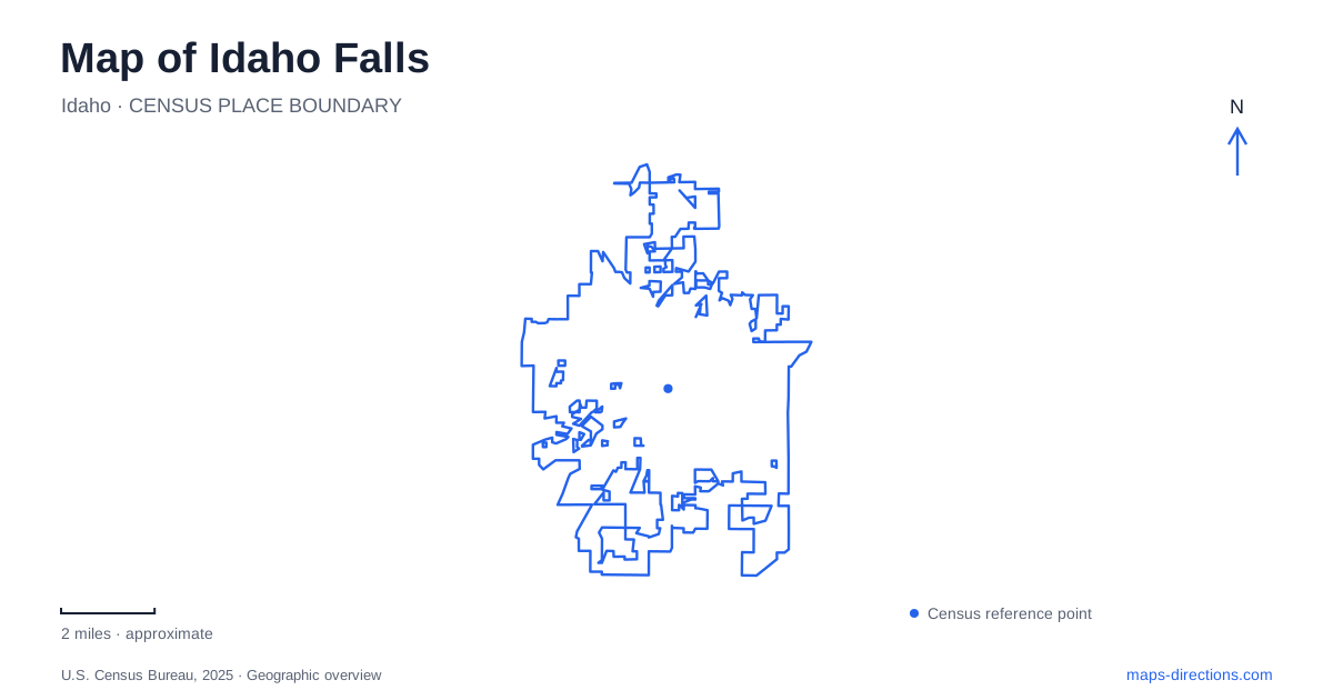
Street tiles load from OpenStreetMap when opened. The blue line shows the 2025 Census boundary.
- State
- Idaho
- Population · July 2025
- 71,785
- Land area
- 27.2 sq mi
- Water area
- 0.6 sq mi
Idaho Falls has a particularly clear organizing feature: the Snake River and the public spaces along its banks. The River Walk, an island garden, and several crossings bring the water into everyday navigation. Farther from the river, the Museum of Idaho and Tautphaus Park provide two other strong reference points. Reading these places together reveals a city with several useful scales: an intimate garden, a downtown museum district, a long waterfront corridor, and a substantial park containing multiple recreational facilities.
The river as a sequence of walking loops
The municipal River Walk description covers five miles on both sides of the Snake River. Broadway is a useful reference for comparing its sections. The city lists the Broadway-to-Pancheri return walk as 1.4 miles, while Broadway to John's Hole and around is 2.3 miles. Around Freeman Park, another listed circuit measures one mile. These are separate named walks, which makes them more useful for planning than treating the entire riverfront as one fixed-length loop.
On an Idaho Falls map, the river's two banks should be read with the crossings that connect them. The floating bridge is seasonal, with typical operation from early June into early November. A route that relies on that crossing therefore needs a different interpretation outside its operating season. The waterfront can still provide an outing, but the available circuit may change. Broadway, Pancheri, John's Hole, and Freeman Park offer recognizable reference names for choosing the portion that suits a particular walk.
An island with two kinds of history
The Japanese Friendship Garden occupies a rocky island in the river. Its location has historical significance because the island was the site of the first bridge across the Snake River in eastern Idaho. The garden adds a later story: it was developed to commemorate thirty years of the sister-city relationship with Tokai-Mura in Japan.
Those histories meet in a small, carefully arranged landscape. A traditional gate, water features, a viewing platform, and a path across a pond organize the space, while a large Japanese lantern was a gift from Tokai-Mura. Volunteers built and maintained many of the features. Rather than serving only as a scenic interruption along the water, the garden connects the city's crossing history with its international civic relationships.
This island gives an Idaho Falls walking route a natural change of pace. The broader river corridor is about distance and movement; the garden invites attention to individual structures and the way water is used within a much smaller space. Its designated paths are part of that composition and help protect the planted setting.
A museum rooted in a former library
The Museum of Idaho stands at 200 North Eastern Avenue in downtown. Its location has a history that extends beyond the museum itself. The Village Improvement Society secured Carnegie funding for a library completed in 1916, and the library remained there until 1977. After the building faced demolition, preservation work allowed the historical society to establish a museum in it.
Subsequent expansions created the larger history and science institution present today. The Eagle Rock street scene and the Way Out West exhibit connect the building's own survival with interpretation of the wider region. This makes the museum a useful indoor counterpart to the river landscape: one presents stories through collections and reconstructed settings, while the other exposes the physical corridor around which the community developed.
For regional arrivals, the museum identifies Interstate 15 Exit 118 as the Broadway approach. It also gives a US 20 approach through Riverside Drive, Memorial Drive, and Broadway, and a US 26 approach using Yellowstone Avenue and Elm Street. These named corridors help place downtown within a wider Idaho Falls journey without reducing the museum to an isolated point.
Tautphaus Park beyond the waterfront
Tautphaus Park is a separate concentration of recreation at 2800 South Boulevard. The city lists roughly eighty-four acres containing ballfields, tennis courts, picnic areas, a skate park, playground equipment, an ice arena, Funland, and the zoo. That variety explains the park's large footprint: a game, a picnic, and an animal visit use different portions of the grounds.
The zoo gives its own address as 2925 Rollandet Avenue and occupies about ten developed acres inside the larger park. This relationship is useful when comparing the park boundary with the zoo footprint. A destination label for the whole park does not communicate the smaller enclosure's scale or its position along Rollandet Avenue.
A day in Idaho Falls can be organized around these distinct landscapes without trying to combine every attraction into one continuous walk. The river loops and island garden form one coherent outdoor experience. Downtown adds the museum and its preserved library building, while Tautphaus Park offers a broader recreation outing. Together they provide a practical framework for understanding where the city's principal visitor spaces sit and why each deserves a different map scale.
Map and statistics: U.S. Census Bureau, 2025 Gazetteer, January 2025 generalized place boundaries and Vintage 2025 population estimates. Local references: City of Idaho Falls; Museum of Idaho. Article prepared by Maps & Directions.