Map of Hutchinson
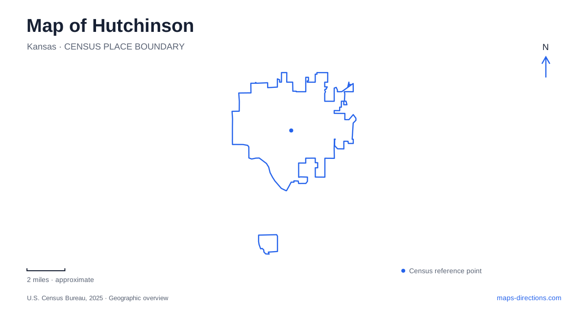
Street tiles load from OpenStreetMap when opened. The blue line shows the 2025 Census boundary.
- State
- Kansas
- Population · July 2025
- 39,595
- Land area
- 25.4 sq mi
- Water area
- 0.1 sq mi
Hutchinson brings together an unusual set of places: a space museum beside a college campus, an underground museum within a working salt-mining landscape, and downtown buildings devoted to county history. Their subjects reach far beyond the street grid, but their locations are quite specific. Reading the map by these separate destination groups reveals a city whose cultural geography extends upward to spacecraft and downward into geological formations, with quieter outdoor landscapes on its northeastern side.
A planetarium that outgrew the fairgrounds
The Cosmosphere stands at 11th and Plum streets, but its story began elsewhere in Hutchinson. In 1962, Patty Carey opened a small planetarium inside the poultry building at the Kansas State Fairgrounds. A used projector and rented folding chairs formed the beginnings of an institution that later moved onto the junior college campus in 1966.
That earlier campus planetarium space remains part of the present complex as Dr. Goddard's Lab. The institution expanded as its collection grew, and its current identity includes space-history galleries as well as educational demonstrations. The 1997 expansion incorporated an SR-71 Blackbird into the lobby, while SpaceWorks, the museum's preservation division, restored the Apollo 13 command module Odyssey. These details explain why the building is more than a planetarium with a new name. The fairgrounds origin and present Plum Street address belong to successive stages of the same institution, not two operating branches.
Salt mining beneath the surface
Strataca is at 3650 East Avenue G, a separate destination from the Cosmosphere and downtown museum. It opened in 2007 within a salt mine that has operated since the 1920s. Visitors descend 650 feet below the surface to encounter the mining landscape and its interpretation. That vertical journey is the feature a normal street map cannot display.
For Hutchinson, the underground museum connects industrial history with the physical geology that supported it. The surface arrival point is only the beginning; the exhibition environment occupies worked underground space. The operation uses scheduled tours, and reservations are recommended because walk-in admission is not assured. That arrangement differs fundamentally from walking into a public park. A route ending at the surface building establishes where to arrive, while the museum's own tour system determines access below ground. The active mining setting also should not be read as permission to explore the surrounding industrial property independently.
County history in two joined buildings
At Walnut Street and Avenue A, the Reno County Museum occupies two historic structures joined into a single facility. Exhibitions are housed in the former Great American Life Insurance Building, while the Rosemont Building contains the archive and offices. The historical society has occupied this downtown location since 1986, although the organization itself began in 1961.
The distinction between a museum's founding date and its building history is especially visible here. Older commercial architecture now serves a public historical purpose, and two originally separate structures work together behind one museum identity. This is a different kind of adaptation from the underground spaces at Strataca. Both institutions belong to the county historical society, but their locations and subject matter are separate. A search for the organization should therefore be refined to the actual museum intended, rather than assuming that its downtown address also identifies the salt-mine entrance.
Woodland and prairie at Dillon Nature Center
Northeast Hutchinson has another landscape at 3002 East 30th Avenue. Dillon Nature Center developed from land once used by grocery-store employees for swimming and picnics. The original property was donated to the city in 1970, changing a private recreation ground into a place for public outdoor education.
Its trail names describe genuinely different walking experiences. The Woodard Interpretive Trail passes ponds, marsh, a small stream, prairie, thickets, and woodland on mixed surfaces that include steps and slopes. The Upper Pond route follows concrete paths through gardens and toward the visitor center, while other routes use grass or dirt. The nature center also includes access to adjoining prairie through partnerships, so the public landscape is broader than the original wooded tract. Trails are intended for people on foot and wheelchair users rather than bicycles. Even the paved route has slopes that may be challenging for some visitors.
Reading the city in layers
These places make Hutchinson especially suited to a map that separates address, institution, and physical setting. The Cosmosphere's fairgrounds beginnings explain a move across town; the county museum explains the reuse of downtown buildings; Strataca introduces a substantial underground dimension; and Dillon Nature Center combines woodland with neighboring prairie. Each destination occupies a different part of the city and preserves a different relationship between people and place. Following those relationships gives the map a narrative that a list of attraction names alone cannot provide.
Map and statistics: U.S. Census Bureau, 2025 Gazetteer, January 2025 generalized place boundaries and Vintage 2025 population estimates. Local references: Cosmosphere; Strataca; Reno County Historical Society; Hutch Rec; Visit Hutch. Article prepared by Maps & Directions.