Map of Huntsville
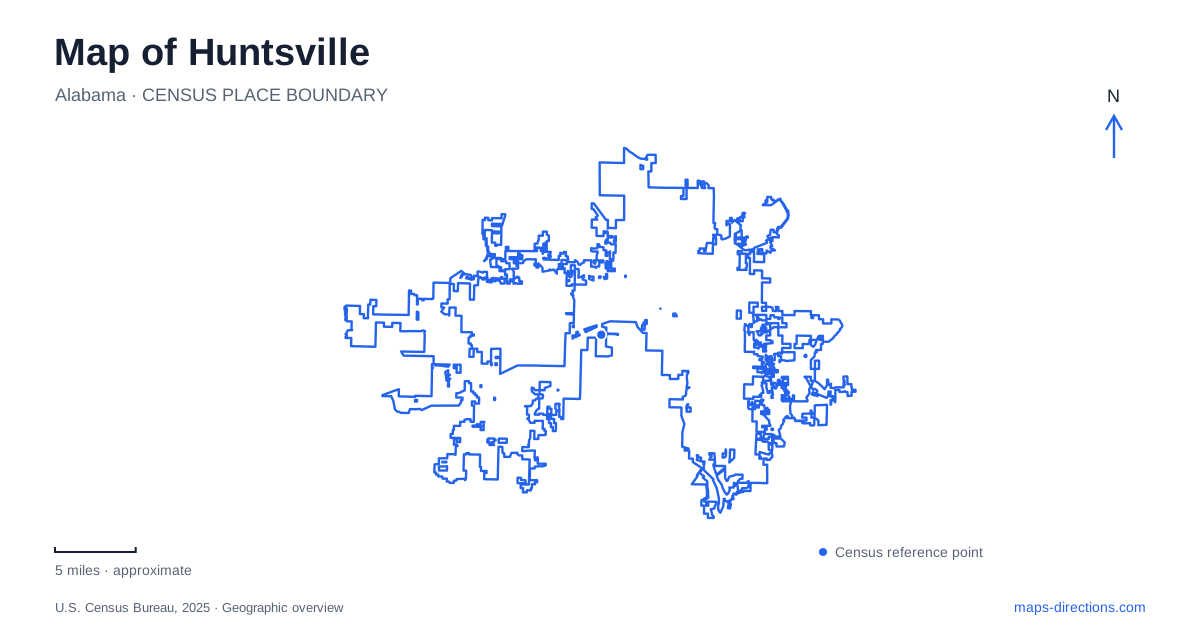
Street tiles load from OpenStreetMap when opened. The blue line shows the 2025 Census boundary.
- State
- Alabama
- Population · July 2025
- 233,627
- Land area
- 225.3 sq mi
- Water area
- 1.5 sq mi
Huntsville brings together a spring-centered town, industrial neighborhoods, a space-research legacy and wooded mountain slopes. These layers do not occupy one compact visitor district. Big Spring provides a downtown reference, historic residential streets extend the older town pattern, and Monte Sano introduces real changes in elevation. The rocket museum and surviving textile buildings add another geography, shaped by large workplaces and their changing uses. Understanding those relationships makes the map more informative than a simple collection of attraction markers.
The spring beneath the downtown story
John Hunt occupied a cabin beside the spring in 1805, according to the municipal history. The water source that helped establish the settlement remains visible in Big Spring Park, emerging beneath a rock bluff and flowing into the landscaped park's lake. Its continued presence connects the modern public space to the physical reason an early settlement developed here.
The nearby courthouse square and Constitution Village give the center a civic dimension. The village recreates the setting associated with Alabama's 1819 statehood proceedings. Around the park, the art museum and Von Braun Center add cultural and event uses to the older civic landscape. A downtown walk consequently moves through several periods without needing to treat the spring as an isolated scenic stop: water, government and public gathering have all helped organize this small area.
Three residential histories
Twickenham became Huntsville's first locally designated historic preservation district in 1972. Its name recalls the town's early official name, and its homes include Federal, Greek Revival and later architectural styles. The district contains a substantial collection of buildings dating from before the Civil War, reflecting the wealth accumulated by merchants and professionals during the cotton-trading era.
Old Town offers a different architectural emphasis. Most of its houses date from 1880 through 1929, and its growth was connected with proximity to downtown, the railroad depot and cotton mills. Five Points, meanwhile, preserves the street pattern of an 1892 addition made practical by streetcar transportation. Its broad parallel streets, narrow lots and rear alleys help explain how households could live farther from their workplaces before widespread car ownership. These districts record different stages of expansion rather than three interchangeable collections of old houses.
A textile mill becomes an arts destination
Lowe Mill began textile production in 1901. Its original work involved spinning local cotton, followed by adjacent weaving operations. The surviving brick complex therefore belongs to the industrial history that also influenced nearby housing and the older commercial economy. Its size and connected buildings reflect production needs quite unlike the smaller structures around a traditional courthouse square.
Today the arts complex at 2211 Seminole Drive SW contains working studios, galleries and performance spaces. This reuse gives an industrial landmark an active cultural role in Huntsville. It also broadens the meaning of an arts destination: the building itself documents manufacturing history, while its present occupants use the large interior spaces for a different kind of work. The contrast is visible in the factory architecture rather than dependent on a reconstruction of a vanished site.
Rockets at Tranquility Base
The U.S. Space & Rocket Center occupies its own museum campus at One Tranquility Base. Inside the Davidson Center for Space Exploration is an authentic Saturn V rocket, displayed horizontally. The tall outdoor Saturn V is a replica. Distinguishing these two objects makes the site's layout clearer and prevents the most conspicuous skyline feature from being confused with the historic artifact inside.
The museum identifies itself as the official visitor center for NASA's Marshall Space Flight Center. Its collections explain the space-program connection that transformed Huntsville during the twentieth century. The campus map includes the main ticketing area, outdoor exhibits, the Davidson Center and Space Camp facilities, reflecting a destination with multiple buildings and purposes rather than a single exhibition room.
Mountain roads and old transportation routes
Monte Sano State Park covers 2,140 acres, with woodland trails and cabins, including eleven built by the Civilian Conservation Corps in the 1930s. Its official address is on Nolen Avenue. The park specifically cautions travelers towing campers or driving RVs against using Bankhead Highway, an important route distinction on this elevated terrain.
The adjoining Land Trust nature preserve has a separate network connecting with the state park and Burritt on the Mountain. Old Railroad Bed Trail follows the former mountain railway and passes surviving stone bridge supports. Three Caves is a former limestone quarry, with an exterior loop; the underground openings are closed because of falling rock. The paved Tollgate Greenway follows part of the historic Toll Gate Road along Bankhead Parkway. These features show how earlier roads, rail construction and quarrying still shape recreation on the slopes above Huntsville.
Map and statistics: U.S. Census Bureau, 2025 Gazetteer, January 2025 generalized place boundaries and Vintage 2025 population estimates. Local references: City of Huntsville; Lowe Mill Arts and Entertainment; U.S. Space and Rocket Center; Rocket Center Foundation; Alabama State Parks; Land Trust of North Alabama. Article prepared by Maps & Directions.